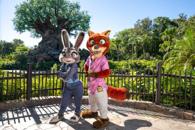
Man Disney Travel Agents Near Me
We recognize that Disney vacations are not just an investment, but often the highlights of our lives, and we take that responsibility seriously. We want to ensure you have the best vacation experience.
Interested in a job in travel? Click here to learn: How to Become a Disney Travel Agent
Jump to section:
A B C D E F G H I J K L M N O P Q R S T U V W X Y Z
See our Disney travel agents near me.
Categories: Caribbean > Cayman Islands
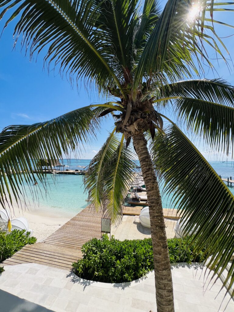
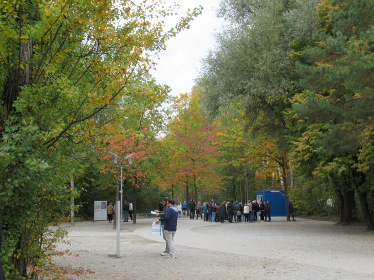
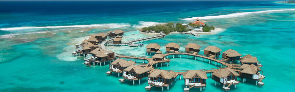
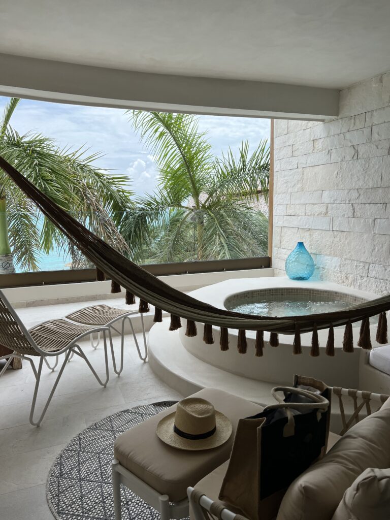
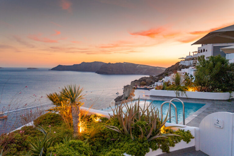
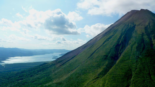
The Cayman Islands offer that postcard-perfect appeal travelers expect from a tropical island getaway. Boasting crystal blue waters, white sandy beaches and a laid-back attitude, travelers are pretty much guaranteed that the lingering concerns carried over as excess baggage will stay on the plane and go back where they came from. Whether for a honeymoon, a family escape, a solo diving adventure, or just one of those rare weekend getaways, the Cayman Islands are a versatile paradise that allows travelers to choose their own adventure.
Free Cayman Islands Vacation Package Quote
The Cayman Islands' economy greatly depends on tourism, so its pristine beaches and staggeringly clear ocean are considered valuable resources and are protected (if often crowded). For all of the Westernized modernization of George Town, its capital, the whole of the Cayman Islands (including Cayman Brac and Little Cayman) is home to some 50,000 residents, and lush green areas are plentiful within just a few minutes′ drive from the town centers. Divers will delight in the natural lagoons and reef walls that populate various points around the island. Hikers will enjoy exploring the nooks and crannies of the Mastic Trail, an old trading route from the early 19th century. And those looking to laze on the soft sands of Seven Mile Beach (or innumerable other equally lovely stretches of coastline) will have no trouble staking their temporary claim.
Travelers with a little more time on their itineraries will want to trek east to Cayman Brac and/or Little Cayman. Both smaller islands offer less touristy and less developed areas to visit. While most popular with divers and nature enthusiasts, they have strong appeal for any kind of traveler willing to commit to a day trip. On Cayman Brac, the Bluff offers world-renowned scuba diving and snorkeling, while on Little Cayman, the 22 diving sites of Bloody Bay Marine Park are impressive as well. Bird watchers will be enthralled by the Booby Pond Nature Reserve, home to a large colony of red-footed booby birds and swooping frigates.
The versatility of any Cayman vacation is perhaps the greatest appeal. The beautiful natural surroundings can be the heart and soul of a vacation, but equally so can a week of retail therapy amidst the boutiques of downtown George Town. This abundance of things to do makes the traveler's job easy, and if the Caribbean can teach us anything, it is that life is best taken easy. The world back home, and the stresses it holds, can wait.
The Compass
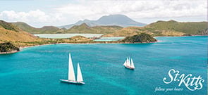
The St. Kitts Tourism Authority is confident that 2023 will bring ongoing growth in arrivals, as strategic programming, product development and positioning aligned with the new Venture Deeper brand campaign will continue to differentiate St. Kitts and drive continued success.
Featured Articles
See all articles
Free Cayman Islands Vacation Package Quote
Categories: Caribbean > Cayman Islands
Categories: Caribbean >
Dominican Republic > La Romana
La Romana is a city on the Domincan Republic's Caribbean coast with a population of about 130,000. It is the Dominican Republic’s youngest and wealthiest city and has a well-developed tourism infrastructure. It was founded in 1897 as an oil town and later turned to sugar production, but now its main industry is tourism, as its beautiful beaches and large collection of hotels and resorts attract travelers from around the world.
Free La Romana Vacation Package Quote
Many travelers come to La Romana to relax, and many hotels are located right on the ocean so they have their own beaches. But travelers looking to be more active have many options as well.
La Romana is home to the Teeth of the Dog golf course, the Caribbean’s highest-rated golf course. The city has other world-class golf courses that make La Romana a paradise for golf lovers. Diving is also a popular outdoor activity and La Romana has many dive sites where divers can explore colorful and exciting marine life like coral formations, dolphins, nurse sharks and manatees.
The National Park of the East, established in 1975, is the most visited natural attraction in the Dominican Republic. There, travelers can see the rare bayahibe rose, a cactus-shrub that serves as the country’s national flower. The most popular area of the park is Saona Island, which has a settlement of about 500 people and is also home to a turtle sanctuary. Throughout the nesting season, which lasts from March to November, green turtles, leatherback turtles and the endangered hawksbill turtles lay their eggs on Saona Island’s beaches, making it the most important area for marine turtles in the Dominican Republic.
There is also an exciting dining scene in La Romana. Bakeries, cafes, Italian restaurants and restaurants with classic Dominican cuisine can keep any foodie busy. Travelers looking for arts and culture can visit Altos de Chavon, an artists' village with many galleries and shops that are very welcoming to tourists.
The Compass
It’s an important update for travel agents regarding the Dominican Republic.
Featured Articles
See all articles
Free La Romana Vacation Package Quote
Categories: Caribbean >
Dominican Republic > La Romana
Categories: Caribbean >
Dominican Republic > Samana
A cultural oddity in a country usually associated with Columbus and Spanish domination, the town of Samana, 65 miles northeast of Santo Domingo, was founded in the 1750s and later settled by English-speaking U.S. slaves in the 1820s. This came about through the efforts of U.S. abolitionists and a Haitian general who worked to relocate thousands of slaves who had escaped Southern plantations via the Underground Railroad. Descendants of the original settlers — called Americanos — still live around the town, which is on the south coast of the Samana Peninsula. They continue to have a noticeable impact on the area's food, churches and architecture and some residents speak English as their first language.
Free Samana Vacation Package Quote
Samana was developed relatively recently as a tourist destination — the first road to the town was built only a few decades ago. A highway now allows travel from Santo Domingo in as little as two hours, and the recent opening of Sanchez El Catey International Airport has further boosted the peninsula's fortunes. With its low-key atmosphere and many budget-type accommodations, Samana is a popular spot with Europeans and whale-watchers.
Humpback whales inhabit Samana Bay from December through early March before heading north for the summer, and the bay is a protected wildlife refuge. The World Wildlife Fund has named Samana Bay as one of the best spots in the world for whale-watching. It lives up to the title, as the views are second to none, made easier by the opening of a whale-viewing platform at Punta Balandra. Boat excursions give travelers a close-up look at the huge mammals.
On the north side of the peninsula is Las Terrenas, perhaps the Dominican Republic's most pleasant resort village. Its idyllic palm-fringed beaches are lined with some of the most pleasing boutique-hotels in the country (many, along with cosmopolitan but laid-back restaurants, run by European entrepreneurs), and the mood remains relaxed, despite the proliferation of noisy motorbikes, burgeoning development and the arrival of the first all-inclusive hotels. The drive over the mountains to reach Las Terrenas is one of the most breathtaking in the country. Travelers should be sure to stop at the Salto de Limon waterfalls when driving between Las Terrenas and Samana—horseback treks are offered from the village of Limon.
An even more laid-back spot on the Samana Peninsula is the seaside town of Las Galeras, 16 miles northeast of Samana. Las Galeras has several small hotels and an all-inclusive resort. Also nearby is Playa Rincon, a lovely secluded beach that can best be reached by four-wheel-drive vehicle or hired boat from Las Galeras.
Los Haitises National Park, on the south side of Samana Bay, is known for its mangrove and swamp areas, and caves with pre-Columbian Native American rock paintings. The park has varied plant life and fabulous birdlife (including frigatebird and boobie rookeries), but is best known for its spectacular karst formations rising sheer from the bay. Guided tours of the park leave from Samana, Sanchez and Sabana de la Mar.
The Compass
It’s an important update for travel agents regarding the Dominican Republic.
Featured Articles
See all articles
Free Samana Vacation Package Quote
Categories: Caribbean >
Dominican Republic > Samana
Overview
Introduction
Named after the first European to sight New Zealand, Abel Tasman National Park is 170 mi/280 km northwest of Christchurch. Its location on the South Island has a beautiful rocky coastline edged by rain forest and offers many opportunities for hiking, sea kayaking, boating and simply relaxing on the beach. Inland are caves and Maori rock carvings. Nelson is a good base for visiting the park.
Local companies offer day trips in the park and on the water, as well as shuttle service to Marahau, where the Abel Tasman Coast Track begins. Marahau is also a good place to rent sea kayaks. All kinds of birds (including penguins), dolphins and seals can usually be seen in and around Tasman Bay. You can also visit Tonga Island's marine reserve and seal colony.
Overview
Introduction
Ajman, 100 mi/160 km east of Abu Dhabi, is the smallest emirate in land area. It is mostly residential—sort of a suburban emirate. Many people who work in neighboring Sharjah and Dubai live there. Interesting activities include watching dhows being built at the shipyard and visiting the Ajman Museum (the country's best, it has a reconstructed traditional souk and Umm Al-Nar tomb). Ajman also has two small mountain enclaves, Manama and Masfut, which merit a half-day visit each.
Lower prices and the presence of several luxury hotels have helped to attract more business and leisure travelers to the area.
Overview
Introduction
Located near Iowa City, the seven villages of the Amana Colonies were founded in 1855 by members of the Amana Society from Germany (a utopian offshoot of the Lutheran church). They operated as a successful, communal enterprise until 1932, when they voted to abandon the communal approach to their business activities and instead form a profit-sharing business. Today, they function as an employee-owned corporation that operates several businesses, including Amana Refrigeration, the manufacturer of Amana kitchen appliances. A visit to the colonies allows visitors a look at the Amana community's interesting past and their ongoing enterprises. (Be aware that many of the attractions in Amana are open only in the warm-weather months, usually from April or May through October or November.)
A good place to start your visit is at the Amana Colonies Convention and Visitors Bureau, where you can pick up a map for a self-guided tour. If you see nothing else, you should at least stop at one of the great German restaurants in the villages (including Colony Inn, the Ronneburg, Ox Yoke Inn and others). If you have more time, two good places to include in your visit are the Amana Heritage Museum in Amana, which gives a thorough introduction to the colony, and the Communal Kitchen and Cooper Shop Museum in Middle Amana, where you can see cooking facilities and utensils used in the 1800s, as well as a barrel-making shop. We also enjoyed the Barn Museum in South Amana, which contains a collection of miniature buildings depicting 19th-century Iowa farms and villages. You can see local industry at work at the Amana Woolen Mill and the Amana Furniture and Clock Shop. There are also several wineries in the area that offer tours and tastings, as well as the Millstream Brewing Company that makes beers in the German tradition. 90 mi/145 km east of Des Moines.
Overview
Introduction
The naming of Amanzimtoti is generally attributed to Shaka Zulu. He was passing through the area with his army on one of his campaigns and stopped to rest. He was brought a calabash filled with water from the river. He sipped the water and said: Kanti Amanz'amtoti—"so the water is sweet." Amanzimtoti has sweeping beaches, and many of them are quiet stretches with dunes and rock pools. There are also designated launching areas for ski boats and areas set aside for surfers. Overview
Introduction
Known as Philadelphia when it was part of the Decapolis (a group of 10 cities on the eastern border of the Roman Empire), Amman, Jordan's capital and largest city, lies just a short drive from the country's borders with Syria and Israel.
The area has been continuously inhabited since 6,000 BC, though few ancient buildings remain. This relatively drab, modern and sprawling city was not much more than a village when it became the seat of government in the 1920s—since then it has grown dramatically. Its population swelled with the arrival of succeeding waves of displaced Palestinians, who today make up a majority of the city's residents.
Nowadays, Amman has little of the atmosphere or medieval architecture one might describe as typically Middle Eastern. If you're trying to get away from Western life, you'll have a particularly hard time in the Amman West section of the city, which is lined with upscale shopping malls.
Must See or Do
Sights—The ancient ruins of the Citadel for the spectacular views; the brilliantly restored Roman Theatre.
Museums—The Jordan Archaeological Museum for its scenic vistas and illuminating exhibits artifacts; the Jordan Museum to see the Dead Sea Scrolls.
Memorable Meals—Sufra for traditional Jordanian dishes; the locally popular Hashem Restaurant; pastries at Al-Quds.
Walks—Strolling through the trendy neighborhood of Jabal Weibdeh; a walk down lively Rainbow Street.
Potpourri
Amman is one of the oldest inhabited areas in the world.
When it was ruled by the Macedonians, Amman was called Philadelphia.
The landscape of Amman comprises 19 hills.
Location
The port of Aqaba is the nearest dock, about 217 mi/350 km from the city. Both passenger as well as cargo vessels dock at this port.
Tourists visiting Amman by sea should carry all the necessary documents with them. Verification of the documents will be done before you get off the ship.
Overview
Introduction
India's Andaman and Nicobar Islands are located in the Bay of Bengal, more than 750 mi/1,200 km southeast of Kolkata. These 300-plus islands are really off the beaten path.
The Andamans, once famous for being home to Kalaa Pani, a jail for political prisoners during colonial rule, now offer nice beaches, palm trees, dense forests, farms, swampy land and a wide variety of ethnic people. Mud volcanoes can be seen boiling on some. A volcano at Barren Island, 87 mi/140 km from Port Blair, exploded in 2005, after laying dormant for 107 years, and is still erupting.
The Nicobar Islands, 10 mi/16 km south of the Andamans, are still primitive, offering few tourist facilities.
The Andamans are reached by air from Kolkata, Chennai or Delhi, or by a three-day boat ride to Port Blair in the Andamans. Travel between the islands is by boat. Only a few islands are open to visitors, and even those require special permits for a limited stay. Some cruise lines also dock at Port Blair as a port of call. Port Blair is a 45-minute flight away from Phuket.
Overview
Introduction
Basse Casamance National Park, located 160 mi/260 km southeast of Dakar, is one of the natural highlights of Senegal, but it remains off-limits to tourists because of the risk of unexploded mines as a result of former rebel activity.
The park is a preserve of forest, savanna and mangrove swamps. The diverse terrain provides homes for more than 50 mammal species, including several types of monkey and antelope, as well as the secretive aardvark. The animals are often difficult to find, but the park's fascinating flora makes up for it. So does the varied birdlife, which includes several very localized species associated with Senegal's last remaining patch of Guinea-Congo rainforest.
The park, located on the Guinean border to the south of the Casamance River, can be viewed by boat or car.
Overview
Introduction
The home of Montana State University, 140 mi/225 km west of Billings, Bozeman has a reputation for being the state's hip town as well as a major agricultural center. The city's historic downtown area offers more than 100 shops and restaurants.
Bozeman is also well-situated between two of the state's popular ski areas, Bridger Bowl and Big Sky. Nearby Hyalite Canyon, part of the Gallatin National Forest, is popular for camping and hiking.
Overview
Introduction

Cayman Brac, a small island 90 mi/145 km northeast of Grand Cayman, offers excellent hiking, spelunking, diving, snorkeling and deep-sea fishing (marlin, wahoo, bluefin and barracuda).
It's also the only part of the Cayman Islands with any notable above-water topography: A spinelike wedge of limestone rock runs the length of the island, rising to a height of 140 ft/43 m at the east end, where it drops straight into the sea. (Brac is Gaelic for "bluff.")
"The Brac" has fewer than 1,500 residents and is still unspoiled by development. It's a great place to read, swim, bicycle, explore, bird-watch or simply relax.
If there's a drawback, it's that the Brac has little beach compared with the other islands, though most hotels maintain a small stretch of sand for their guests. Still, it's the best place in the Caymans to experience the relaxed lifestyle of the Caribbean: Most island residents are happy to sit and chat.
A good place to catch the local gossip is at La Esperanza, an open-air bar and restaurant in Stake Bay, on the north side of the island. A stop at the small Cayman Brac Museum, which depicts early island life, is also worthwhile.
Overview
Introduction

You'll enjoy the Cayman Islands if you've ever had the urge to see beneath the sea. The underwater scenery is among the best in the Caribbean, full of exotic fish, coral reefs and even the occasional stingray. The water is warm, clear and often calm—and there are plenty of places to dive or snorkel.
Be aware, however, that the Cayman Islands do not offer much in the way of geographic diversity, and just about everything costs more than it does at home. Of the three islands that make up the Caymans, Grand Cayman is the largest and the center of both the tourism and offshore banking industries. Most visitors spend at least some time there, if not their entire vacation. The heavy influx of visitors to Grand Cayman has had a homogenizing effect on that island. With its traffic, chain restaurants and T-shirt shops, you could, on occasion, mistake crowded stretches of Seven Mile Beach for parts of Florida. The other islands, Cayman Brac and Little Cayman, get fewer visitors.
Geography
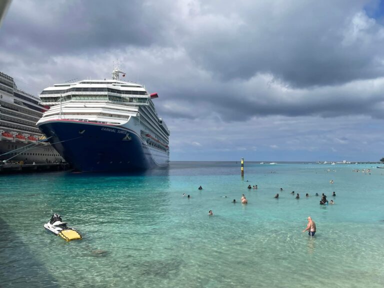
A trio of low-lying islands surrounded by vibrant coral reefs, the Cayman Islands are limestone outcroppings—the tops of a submarine mountain range called the Cayman Ridge, which extends southwest from the Sierra Maestra range off the southeastern edge of Cuba. The islands lack rivers or streams because of the porous nature of the limestone rock. This lack of runoff gives the surrounding Caribbean Sea exceptional clarity with visibility depths of more than 120 ft/37 m. The islands are located 480 mi/770 km south of Miami, Florida, and 180 mi/290 km northwest of Jamaica.
George Town, the capital, serves as the center of business and commerce and lies on Grand Cayman, the largest of the three islands (76 sq mi/197 sq km). Cayman Brac is smaller (14 sq mi/36 sq km), but with a bluff that rises 140 ft/43 m above sea level, it has the most dramatic topography of all three islands. Little Cayman is the smallest of the islands (10 sq mi/26 sq km), and with its 203-acre/82-hectare Booby Pond Nature Reserve, it's home to the Caribbean's largest population of red-footed boobies. Little Cayman and Cayman Brac, known as the "sister islands," lie 89 mi/143 km northeast of Grand Cayman and are separated by a channel about 7 mi/11 km wide.
History
Columbus came upon the islands in 1503, naming them Las Tortugas because their only inhabitants were vast numbers of turtles. By the mid-1500s, they were known as the Caymanas, the Carib word for crocodile.
Ships—including pirate ships—frequently visited in the 1500s and 1600s, but the first settlers didn't arrive until 1655, when deserters from the English army that was then capturing Jamaica made their way to Grand Cayman. Later arrivals also came from the British Isles—England, Ireland, Scotland and Wales. Slaves of African descent played a role in the islands' development, too, although the Caymans never became lucrative plantation isles like others in the Caribbean. The slaves were emancipated in 1834, and thereafter some escaped slaves from other parts of the New World settled on the island.
Today, tourism is a large part of the economy. More than half a million people visit each year—80% are from the U.S. and Canada, but more Europeans are discovering the islands. The other big business is finance: The Caymans rank among the favorite offshore banking locales in the world. There are some 500 banks based there, holding more than US$450 billion in assets. On paper, there are more than 68,000 registered companies that take advantage of the favorable tax status offered by the islands. The government opened a stock exchange in 1996.
The Cayman Islands are an Overseas Territory of the U.K., with a governor appointed by The Foreign and Commonwealth Office, though the islands retain a largely autonomous legislature.
Snapshot
The main attractions of the Cayman Islands include scuba diving, snorkeling, deep-sea fishing, beaches, shopping, good food, relaxation and investing.
If you are interested primarily in watersports, beautiful beaches and exploring duty-free stores, you'll enjoy the Caymans. Fine dining is big in the Caymans, with a diverse nightlife that can go until 3 am. The people are friendly, the communities are safe and clean, and you won't be harassed by roadside vendors.
Potpourri
During the Hurricane of 1932, residents of Cayman Brac sought shelter in the many caves on the island. The caves saved many lives then, as they did during Hurricane Ivan in September 2004. Ivan ranks second in the islands' most devastating hurricanes.
The national flower is the wild banana orchid. These small, scented flowers with purple tips bloom after May and June rains. More than two dozen varieties of orchids grow in the Cayman Islands, including five found nowhere else in the world. Some are reportedly so small they can't be seen without a magnifying glass.
Most visitors pronounce the name Cayman with the accent on the first syllable. Though they won't tell you it's wrong, most islanders pronounce it Cay-MAN. Also, Caymanians usually refer to their homeland simply as Cayman, rather than "the Cayman Islands" or "the Caymans."
Residents from the sister islands Cayman Brac and Little Cayman find it offensive when visitors or the international media refer to the islands as "The Grand Cayman Islands."
More than 140 different nationalities are represented in Cayman. The majority of the population is Caymanian, Jamaican, British, American, Canadian, Philippine and various South American nationalities.
Caymanian Tanya Streeter was the first human to free dive to the amazing depth of 525 ft/163 m.
Dolphin is the local name for mahimahi. Don't be alarmed when you see it on a menu—it's not the mammal.
In the spring, hundreds of thousands of red bay crabs invade the three islands, filling streets and homes. The migration ritual typically lasts for a month.
Location
Of the three islands, Grand Cayman is the only one with the capacity to host cruise ships. A US$17.5 million port facility—just 1,315 ft/400 m north of the old Port Authority dock—with a 200-ft/60-m pier can dock one or two cruise ships.
Most passengers filter through Royal Watler, a self-contained facility with immigration, tourist information, shops, restaurants, restrooms and a taxi dispatch center in the center of George Town. Some passengers arrive at the town's less-equipped South or North terminals one block from the Royal Watler.
George Town is awash with shops and restaurants all within short walking distances of the terminals. Discussions about building another pier are under way, since on any given day there can be up to six cruise ships in the harbor and some passengers still need to be tendered to the terminal. There is also talk of augmenting the cruise terminal so that the new super-sized cruise ships can berth.
In rough weather, ships may anchor off the island's southern coast and tender passengers to Spotts, which lies about 4 mi/6 km from George Town. (Cruise ships are banned from anchoring in Spotts Bay.) Taxis or buses then transport passengers to George Town for shopping and to the various attractions.
There is a tourist information booth at the airport and at Royal Watler terminal when a cruise ship is in port. Phone 345-949-0623. http://www.caymanislands.ky.
Shore Excursions
Most trips take you offshore to explore the spectacular coral and fish (in a submersible vessel or glass-bottomed boat or, for certified divers, with scuba gear). There's also the option of a party cruise. Other popular options include a visit to Boatswain Beach—home of the Cayman Turtle Farm, the Cayman Motor Museum and Hell, all located in the West Bay. A party cruise and a historical and cultural tour are also options. Shoppers will be delighted with the countless duty-free shops, especially around George Town. Check with your travel agent for additional information.
Several local tour operators await passengers at the Royal Watler terminal and offer an array of activities.
Overview
Introduction
The mountainous Chapada Diamantina National Park 725 mi/1,165 km north of Rio de Janeiro, where diamonds were discovered nearly 200 years ago, is dotted with abandoned mining towns. The lush mountains are laced with hiking trails that pass roaring waterfalls (including the fascinating Cachoeira da Fumaca), rivers, mysterious caves and dozens of varieties of wild (often rare) orchids. Be sure to hire a guide—trails are not always marked. Rock hounds will enjoy the opportunity to collect unusual specimens—those with a keen eye may even spot a diamond.
The charming town of Lencois was the center of the diamond activity, and it has retained much of the flavor of its diamond-rush days. Visit the old French vice-consulate (the French bought industrial diamonds for use in drills in the construction of the Panama Canal) and the Mining Museum (Museu do Garimpo). Other interesting old towns include Mucuge and Palmeiras.
Overview
Introduction
On New Zealand's North Island, across the Firth of Thames and 70 mi/115 km east of Auckland, the rugged Coromandel Peninsula offers spectacular scenery. The drive along the coast winds past bays, beaches and green fields edged with cliffs that plunge into the sea. Trips into the interior bush let visitors get a look at gold-mine ruins, waterfalls, ancient kauri trees, and plenty of tree ferns and birds. This is a popular destination in summer.
Whitianga, on the northeast coast, makes a good base for exploring the area. Don't miss beautiful Cathedral Cove and Hot Water Beach (where you can dig a hole in the sand at low tide and sit in it while hot water bubbles to the surface), both near Hahei. Be aware that Hot Water Beach isn't safe for swimming because of dangerous undertows.
Take the unpaved 309 Road between Whitianga and the town of Coromandel (it's about an hour's drive) to see the peninsula's interior, complete with waterfalls and a grove of kauri trees. Pauanui is a favorite holiday town among Auckland's wealthy set. When driving around, keep in mind that though distances may appear short on a map, it takes more time than you expect to travel the peninsula's small, winding roads.
Overview
Introduction
Residents of Cumana boast that it was the first city built by Europeans on the South American continent (1521), although that honor actually goes to Colombia's Santa Maria le Antigua del Darien, founded in 1510. Still, Cumana is South America's oldest continuously inhabited city founded by Europeans, and is the birthplace of many Venezuelan generals and poets. Though located on the mainland, 250 mi/400 km east of Caracas. Cumana is often visited by those vacationing on Margarita Island. A ferry operates somewhat irregularly between the main island and Cumana.
Cumana's main tourist attraction is its historic zone. Despite the fact that major earthquakes in 1684, 1853 and 1929 destroyed much of the original town, the historic zone still charms visitors primarily because of its impressive Castillo de San Antonio de la Eminencia fort. And don't miss the modern-art museum next to it. Calle Sucre is lined with colonial buildings as well as another smaller, less-appealing fort (Castillo de Santa Maria de la Cabeza) and the Convent of San Francisco (the first school in South America; currently being restored). The inviting, tree-filled Parque Guaiqueri parallels the Manzanares River.
An express ferry links Cumana with Araya, on the Araya Peninsula, where you can visit the ruins of a picturesque colonial fort (it was the most expensive construction project in Venezuela at the time) and the adjacent beach. If you have time, take the hour-long drive along the Route of the Sun, the peninsula's coastal highway.
Another frequent side trip is to Caripe, located in the mountains about 90 minutes southeast of Cumana. Its biggest attraction is La Cueva del Guacharo, the largest cave in Venezuela at 33,455 ft/10,200 m (about a third of which is open to the public—guided tours are offered daily). The cave's name comes from the thousands of guacharo birds that inhabit one of its pitch-black galleries.
Overview
Introduction
This rugged, sparsely populated island in southern Vanuatu is only for the adventurous, as accommodations are basic and the hikes are demanding (the island has several areas of low inland mountains). North of Dillons Bay there's a good coral reef, with some nearby cave burial sites. Erromango is 90 mi/150 km southeast of Efate. Overview
Introduction
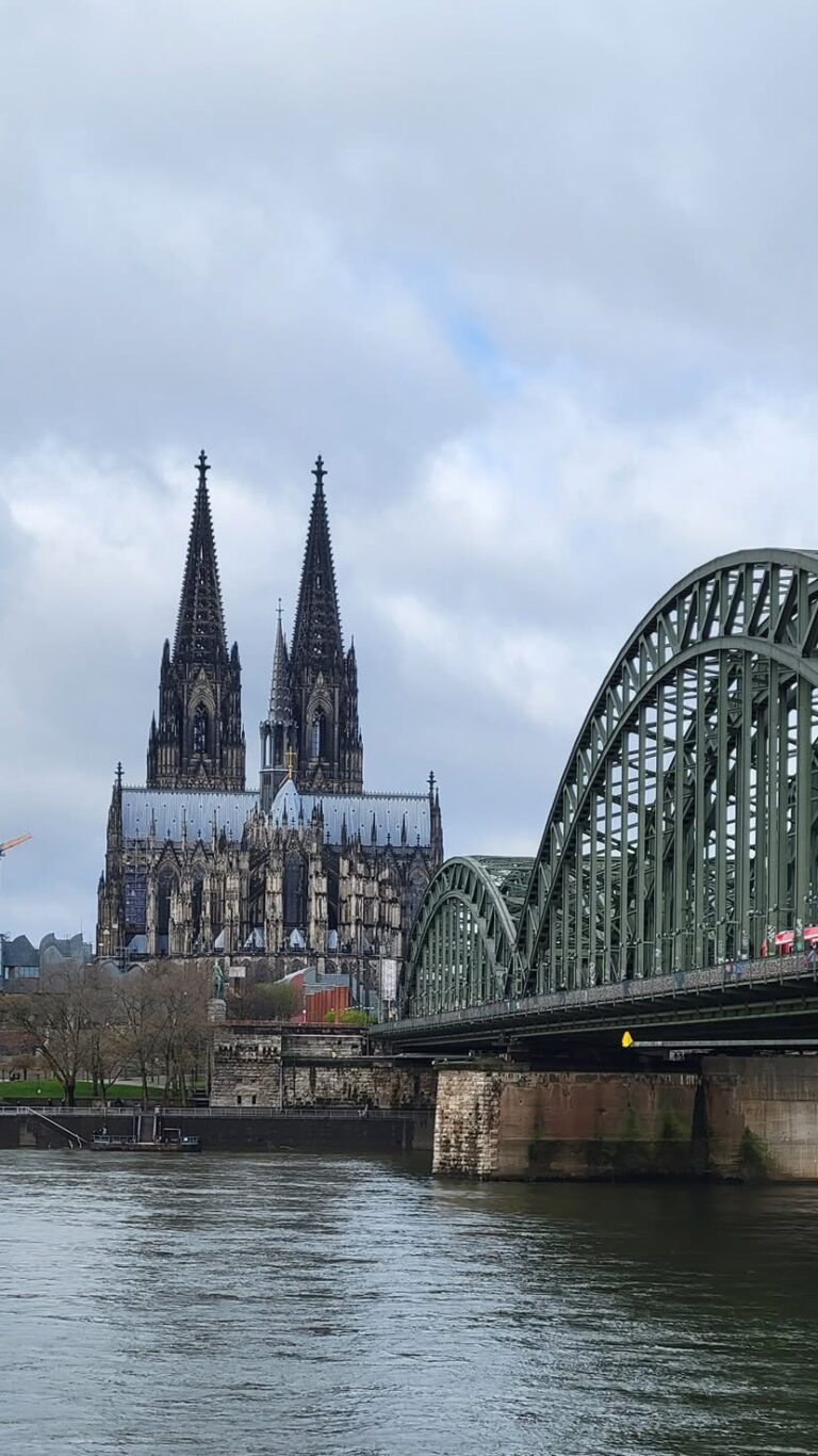
Though Germany is weathering the world financial difficulties better than most countries, the impact of unification at the end of the Cold War means there are still significant disparities between east and west. Nevertheless, continued significant investment in public services, research and development, and infrastructure projects has ensured that Germany has one of the highest standards of living in the world.
In real terms, this means that travelers are likely to move around the country faster, dine better and experience newer attractions, such as the Reichstag's glass dome or the spectacular Elbphilharmonie in Hamburg. A lot has changed, yet chances are that repeat visitors will still find the things they always liked: the restaurant serving huge helpings of sauerbraten or the biergarten with liter upon liter of lager and wheat beer.
Germany is a relatively new nation, created in 1871, and it has retained a very strong federal element. Rather, therefore, than looking at the country in terms of east and west, Germany is best seen as a host of regions sharply defined by dialect, food, traditions and history. For the best perspective, sample as many regions as possible.
Culturally, Berlin is booming, and it is now the country's No. 1 tourist magnet. Visitors to the cultural centers of Dresden, Leipzig and Weimar in eastern Germany will find much improved amenities there as well. The north has the delightful old seafaring cities of Hamburg and Bremen.
Along the Rhine and Moselle rivers are picturesque castles and steep, terraced vineyards. The Grimm Brothers collected the tales they heard in a trail of villages from Hanau to Bremen. In the south are snowcapped Alps, the alluring Black Forest, Munich, and Bavaria's boisterous beer halls and rococo palaces and churches.
Although it has plenty of fairy-tale sights and picturesque scenery that is reminiscent of medieval times, Germany is without a doubt a postindustrial, multicultural country with all the inherent advantages and conflicts. Reunification was a huge social and economic undertaking, and it came on top of an already heavy and, at times, troubled history. Broadly speaking, it has been a remarkable success, though travelers shouldn't expect all parts of the country, at all times, to be an Oktoberfest.
Geography
Germany shares a border with nine countries, more than any other European nation. Internally, it's divided into 16 bundeslander (provinces or states). Its only coastlines are in the north, along the North and Baltic seas. In the south are mostly foothills and mountains: the Alps in the far south and the Erzgebirge in the southeast. The central part of the country is also spotted with several smaller mountain ranges. The northern third of the country is mostly a plain.
Rivers are also distinctive features. The main ones are the Rhine, which flows northward in the western part of the country; the Danube, which begins as a trickle in the southwest and becomes a real river farther east; the Elbe, which flows through Dresden in the southeast and into the North Sea near Hamburg; and the Oder and Neisse, which together form the eastern border with Poland.
If the country were a clockface, Berlin would be at 2, Dresden 3, Munich 6, Frankfurt 9, Cologne 10 and Hamburg 12.
History
The 1945 division of Germany and its 1990 reunification fit the pattern of the nation's history: Germany has constantly gone through periods of conquest, occupation and reorganization.
The Danube River and the Rhine River divided the Germanic tribes from the Romans in the first century AD, but 500 years later Christianity began to take hold over the entire region. On Christmas Day in the year 800, the pope crowned the king of the Franks, Charlemagne, emperor of the Romans. It was the birth of the Holy Roman Empire (the First Reich), which lasted until the Napoleonic wars in the 19th century.
In 1517, Martin Luther set the Reformation in motion. Eventually, tensions between Protestants and Catholics resulted in the Thirty Years War, which ended in 1648.
The strong authority of local princes kept Germany from truly uniting as a nation until the rise of Prussian power and the formation of the German empire in 1871 (the Second Reich), under the chancellorship of Otto von Bismarck and the first kaiser, Wilhelm I. Just two kaisers later, the monarchy was dissolved when Wilhelm II abdicated his throne at the end of World War I.
Crushing inflation and social unrest after World War I caused political instability in the Weimar Republic. Those conditions were exploited by the Nazi party, under Adolf Hitler, who came to power in 1933, the beginning of the Third Reich. Germany invaded Poland in 1939, which started World War II.
When Germany was defeated, it was split again, with the eastern sector under the control of the Soviet Union and the three western sectors under the control of France, Britain and the U.S. During the Cold War, East Germany enjoyed the highest standard of living among Warsaw Pact countries, though that prosperity was relative: West Germany forged ahead with the economic miracle spurred on by the Marshall Plan.
The Berlin Wall fell in November 1989, and less than a year later, the two Germanys were reunited.
Today, Germany is the economic powerhouse of Europe and one of the biggest advocates of the European Union. Its leading position in the EU also offers its citizens, and the world, a positive and progressive outlook for the country's future.
Snapshot
Germany's main attractions are history; Berlin; mountains and forests; river cruises; Christmas markets; lakes and beaches; art, architecture and performing arts; wine and beer; soccer, skiing, fishing and hiking; health spas and casinos; castles and churches; Alpine scenery; farmland; shopping; and Munich.
The country will appeal to travelers who are interested in European history, old-world architecture, lovely landscapes and cultural attractions as well as the flavor of German life. Travelers who are particularly interested in warm-water beaches and consistently nice weather may be happier in other European destinations.
Potpourri
The first Green Party was organized in Germany, and Germany is one of the leading European countries in terms of recycling and the generation of solar and wind-based power.
The Neanderthal Man got his name from the Neanderthal Valley near Duesseldorf where the first skeleton was unearthed in 1865. The last Neanderthals vanished around 30,000 years ago, though they were actually much more intelligent than usually portrayed.
The Russian writer Leo Tolstoy often lost all his possessions at the casino Baden Baden. It is also the setting of Fyodor Dostoevsky's novels The Double and The Gambler.
Bremerhaven was Germany's most important port for people emigrating into the New World. About 7 million people left Old Europe from there. Only 4 million were Germans. German ships were popular because they were safer and more comfortable than those leaving from Britain or France.
The 6 million visitors to Munich's annual Oktoberfest drink a total of around 1.8 million gal/7 million l of beer, and eat around 520,000 half-chickens, 140,000 pairs of sausages and 100 oxen.
In the 19th century, the Brothers Grimm collected fairy tales in many towns and regions in Germany and committed them to paper: Snow White and Rose Red took place in Muhldorf, Puss-in-Boots near Berlin, Snow White and the Seven Dwarfs in Alfeld, Sleeping Beauty in Sababurg, Little Red Riding Hood in Hesse, Hansel and Gretel near Marburg, and Cinderella in Budingen.
There are about 40 castles on the Rhine River between Koblenz and Mainz.
In addition to visiting the Bauhaus-Archiv in Berlin, enthusiasts of the Bauhaus style of architecture will want to visit Dessau, where the movement was important from 1925 to 1932.
Schloss Herrenchiemsee is a Bavarian castle with a difference: Built by King Ludwig II on an island in Lake Chiemsee, it's a miniature copy of Versailles. It was never finished; Ludwig ran out of money.
Overview
Introduction

When visitors first set eyes on Grand Cayman Island, they see a flat stretch of land that barely rises out of the water. But despite what its appearance may suggest, Grand Cayman is not lacking in awe-inspiring geographical features. To see them, visitors just have to look down.
Just offshore, coral reefs and walls plunge dramatically into the abyss, creating superb conditions for diving and snorkeling.
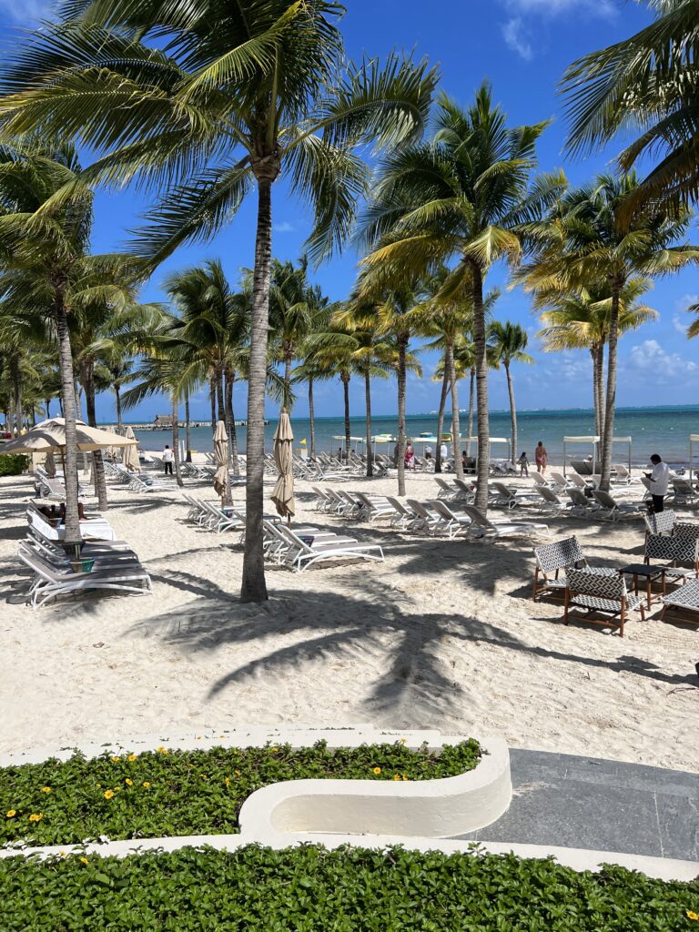
Grand Cayman is a largely stress-free place to vacation. Beaches are wide, sandy and fringed with palm trees, so beach-lovers have no shortage of coastline to enjoy. Crime is relatively rare; islanders are friendly, speak English and enjoy the highest standard of living in the Caribbean. Duty-free shopping in George Town is also a big attraction.
Grand Cayman serves as the base of operations for most visitors heading to the islands. Even those traveling to Little Cayman or Cayman Brac—which are even more laid-back and minimalist than the "big island"—will find that time on Grand Cayman is well-spent and a welcome break from the almost imperceptible pace of life elsewhere. For diversity in restaurants and shopping, and for sailing and diving options, it’s also by far the best place to start. And in many cases it also serves a valuable utilitarian purpose: A visitor to the other islands will need to go there to get anything beyond essential supplies.
Must See or Do
Sights—Dive down to see the Oro Verde; snorkel Eden Rock; explore the underwater reefs in a submarine; send someone back home a postcard from the unique attraction Hell; lounge by the clear waters at Rum Point.
Museums—The Cayman Motor Museum; the Cayman Islands National Museum.
Memorable Meals—Shrimp and lobster over a bed of fresh pasta at Agua; conch ceviche at The Cracked Conch; conch fritters and mudslides at the Rum Point Club Restaurant.
Late Night—Sip cocktails beachside while listening to a DJ at the Royal Palms Beach Club; the Full Moon Party at Calico Jack's; dancing the night away at The O Bar; live music with the Barefoot Man at The Reef.
Walks—Shop, eat and shell-scavenge along Seven Mile Beach; hike and nature-watch along the Mastic Trail; take a walking tour of George Town; stroll through the Queen Elizabeth II Botanic Park.
Especially for Kids—Visit Black Pearl Skate Park; view sea turtles at Cayman Turtle Farm; swim and snorkel with the stingrays at Stingray City; wander through the Pirate Caves at Bodden Town.
Geography
Situated in the western Caribbean Sea, Grand Cayman is the largest of the three coral islands that compose the Caymans. Mainly flat, it stretches 76 sq mi/197 sq km with a maximum elevation of 60 ft/19 m at East End. Almost half of the island is wetland.
Separated from its easterly sister islands, Little Cayman and Cayman Brac, by an 80-mi-/129-km-wide channel, Grand Cayman is 480 mi/773 km south of Miami and 180 mi/290 km northwest of Jamaica.
Cayman Trough is a massive subterranean ridge that rises 8,000 ft/2,400 m from the sea floor and is the deepest part of the Caribbean. To the south lies Bartlett Deep, where depths of more than 18,000 ft/5,580 m have been recorded. Submerged during the Ice Age, this trench is an extension of the Cuban Sierra Maestra range. Abundant coral reefs create ideal conditions for diving and sportfishing.
Another interesting geographical point is the shallow, 35-sq-mi/91-sq-km reef-protected lagoon called the North Sound.
History
In 1503, during his fourth voyage to the New World, Christopher Columbus discovered Grand Cayman's two sister islands, Cayman Brac and Little Cayman. He baptized the islets "Las Tortugas" because of their dense population of sea turtles. Sir Francis Drake changed the islands' names to "Caymanas" in 1586, after the Carib term caiman for the resident crocodiles.
Spain ceded the islands to the British under the Treaty of Madrid in 1670. The crown-appointed governor resided in Jamaica, watching over the affairs of both colonies.
During the 1730s, pirates, shipwrecked sailors and deserters from Oliver Cromwell's army in nearby Jamaica began to permanently settle the island. This small population of European settlers was augmented by the influx of African slaves who were used for farming until the British outlawed slavery in 1834.
In 1832, the citizenry gathered at St. James Castle—now known as Pedro St. James, the birthplace of democracy in Cayman—and voted to create a legislature of representatives. Eight Justices of the Peace were appointed by the governor of Jamaica. The islands were formally annexed to Jamaica in 1863. However, upon realizing the difficulty of ruling over two colonies, Jamaica appointed a commissioner in the Cayman Islands to oversee the affairs of the country.
The Cayman Islands got their first constitution in 1959, which provided for 12 elected members, along with a couple of nominated members and official members. There was also an Executive Council. The Commissioner was replaced by an Administrator who oversaw the Legislature and Executive Council.
The Cayman Islands and Jamaica were governed as a single colony until 1962, when Jamaica declared its independence from Britain. The Cayman Islands remained a British Overseas Territory. The islands pride themselves on their own constitution and government. The Cayman Islands Order, also known as the Constitution, was created in 1972 and was revised in 1994.
Potpourri
Visitors to Grand Cayman can choose to explore some 160 unique dive sites.
Although this may change soon, currently, with no direct taxation, the Cayman Islands are a mecca for banking, with about 500 registered banks and trust companies, including more than 40 of the world's largest banks.
The famous Seven Mile Beach has experienced significant hurricane damage, and as a result, it's now only 6 miles long.
Unspoiled beaches, duty-free shopping, scuba diving, deep-sea fishing and a virtually nonexistent crime rate lure nearly a million visitors each year.
The Turtle Farm is the world's only commercial green sea-turtle farm, housing more than 16,000 endangered sea turtles.
In 2004, Hurricane Ivan devastated the Caymans more than any other island group in the Caribbean, destroying some 85% of all structures. Fortunately, the majority have since been rebuilt.
Although the islands are a British Overseas Territory, Spanish is widely spoken in the Caymans because of their proximity to Columbia, Venezuela and Central America.
Location
Of the three islands that make up the Caymans, Grand Cayman is the only one with the capacity to host cruise ships. Some ships still anchor outside the harbor west of George Town, but a CI$14.2 million port facility—just 1,312 ft/400 m north of the old Port Authority dock—with a 200-ft/60-m pier, has the capacity to dock one or two cruise ships.
Most passengers filter through Royal Watler, a self-contained facility with immigration, tourist information, shops, restaurants and a taxi dispatch center in the center of George Town. Some passengers arrive at the town's less-equipped South or North terminals one block from the Royal Watler.
George Town is awash with shops and restaurants, all within short walking distances of the terminals. Discussions about building another pier are under way, because on any given day there can be up to six cruise ships in the harbor, and some passengers still need to be tendered to the terminal. There is also talk of augmenting the cruise terminal so that the super-sized cruise ships can berth.
In rough weather, ships may anchor off the island's southern coast and tender passengers to Spotts, which lies about 4 mi/6 km from George Town. Taxis or buses then transport passengers to George Town for shopping and to the various attractions.
There is a tourist information booth at the Royal Watler terminal. Phone 345-949-0623. http://www.caymanislands.ky.
Shore Excursions
Most trips take you offshore to explore the spectacular coral and fish (in a submersible vessel or glass-bottomed boat or, for certified divers, with scuba gear). Other popular options include a visit to Boatswain Beach—home of the Cayman Turtle Farm, the Cayman Motor Museum and Hell, all located in the West Bay. A party cruise and a historical and cultural tour are also options. Shoppers will be delighted with the countless duty-free shops, especially around George Town. Check with your ship's shore-excursion staff or your travel agent for additional information.
Several local tour operators await passengers at the Royal Watler terminal and offer an array of activities.
Overview
Introduction
The evocatively named Whale Coast in South Africa lives up to its title from July to November, when large numbers of southern right whales seek out the sheltered bays along the South African southern coast for breeding.
Whales can be seen from False Bay at Cape Town all the way east to Mossel Bay on the Garden Route, but by far the best place for whale spotting is Hermanus. The cliff tops in the town are popular with binocular-clutching visitors to see the whales breeching and blowing in the ocean below. There's a Whale Festival in September that is popular with day-trippers from Cape Town, and sandy beaches and vineyards provide further distractions.
Overview
Introduction
The vast UNESCO World Heritage site of iSimangaliso Wetland Park, South Africa, lies 150 mi/250 km from Durban, along the humid stretch of coast running northward from the St. Lucia Estuary to Kosi Bay on the border with Mozambique.
The park comprises eight interlinking ecosystems that house ancient coastal dunes, swamp forests, coral reefs, South Africa's largest freshwater lake and the pristine estuarine system of St. Lucia. It forms the centerpiece of a mosaic of small, provincially managed conservancies known informally as the Zululand Reserves.
St. Lucia itself is best known for its lush, subtropical mood and teeming populations of hippos, crocs and waterbirds. The nearby Hluhluwe-Imfolozi Game Reserve protects all of the Big Five, including a dense population of the endangered black rhino and the white rhino; other worthwhile goals include Mkhuze Game Reserve (good photography), Ndumo Game Reserve (rated by some as the country's finest bird-watching location) and Zulu cultural lodges such as Shakaland and Simunye.
Overview
Introduction
Isle of Man, an island in the Irish Sea 80 mi/130 km northwest of Liverpool, is a stark, rugged and fascinating land. It is not part of England (or the United Kingdom, for that matter). Instead, it's a crown dependency (and a tax haven for the rich), with its own postage stamps, laws, currency and parliament (more than 1,000 years old).
Most first-time visitors to England will probably not want to slow down long enough to appreciate Isle of Man's subtleties. About 30 mi/48 km long and 10 mi/16 km wide, the island has a shoreline of huge cliffs and a 2,000-ft/610-m mountain (Mount Snaefel) at its center. It is populated by farmers, fishermen and cats with no tails (manx).
The isle's capital, Douglas, makes a good base for exploration. Visitors will want to spend at least two nights absorbing the Gaelic atmosphere, visiting castles, watching birds (especially at The Chasms), scuba diving, golfing, trekking on ponies, sailing, fishing and hiking in the many lush glens.
There's an interesting narrow-gauge steam train that runs between Douglas and Port Erin. Inns and hotels are scattered throughout the island, which is accessible via air or ferry. In June, the island is packed with motorcycle fans, who congregate to watch the famous Tourist Trophy (TT) races.
Overview
Introduction
Located 420 mi/675 km northeast of Jakarta, Kalimantan is Indonesia's portion of the island of Borneo, which it shares with Brunei and the Malaysian states of Sarawak and Sabah. Clashes between ethnic groups have taken place in Kalimantan, especially in the central and western portions of the territory, and prospective visitors should be sure to keep abreast of security developments.
The area does not offer much in the way of comfortable tourist accommodations, in sharp contrast to the Malaysian side of the island. Much of the place seems more geared for the logging, mining and oil industries than for travelers. Local ground operators lead group tours along the Mahakam River with stays at tribal longhouses that are up to 600 ft/183 m long and house up to 50 families. The island has 200 Indonesian Dayak ethnic groups living in thatched houses on stilts. Its two national parks, Gunung Palung and Tanjung Puting, are good places to see the rain forest.
We know from experience that Kalimantan is not a good place to run out of insect repellent—be sure to take along plenty. Also, beware of the heat—the air can get steamy and oppressive. As tourism is still fairly new to Kalimantan, English is not widely spoken. Transportation arrangements can also be more difficult than in other areas of Indonesia.
One of the key attractions of Kalimantan is river boat expeditions upriver to visit the orangutan rehabilitation centers near Camp Leakey. These range from single-night visits to weeklong expeditions where you sleep on the boat each night. Besides the orangutans, these trips feature jungle trekking, firefly-lit evening dinners and visits to the Camp Leakey interpretive center. You'll spy hornbills, macaques and proboscis monkeys from the boat, along with crocodiles in the river and the occasional wild boar. Book tours with local guides via email, and be sure to shop around. Prices are not standardized, and getting three offers could mean three very different bids for essentially the same experience.
Overview
Introduction
This village in Turkish Cyprus is a picturesque reminder of what the island used to be. A trail leads from the village to St. Hilarion Castle, a huge ruined fortification dating from the time of the Crusades. 12 mi/20 km northwest of Nicosia. Overview
Introduction
Everywhere you look in Kathmandu, Nepal's capital city, there is something of interest—perhaps a small ancient temple tucked in a row of shops, an old stone figure set in the middle of the pavement, a religious sadhu in bright saffron robes meditating on the steps of a building or a Tibetan refugee spinning his prayer wheel as he walks down the street.
Although their lives are guided by ancient tradition, the residents of Kathmandu are not walking anachronisms, and visiting there is not like a trip back in time. Citizens live very much in the present but have thoroughly integrated their traditions into their modern lives.
Kathmandu's many shops and restaurants serving international cuisine make it seem, in many respects, as sophisticated and cosmopolitan as the far-larger cities of Delhi or Beijing.
A week in Kathmandu should be enough to see the city and most of the valley.
Overview
Introduction
Kerman is a world-famous carpet town, although because of the lack of tourist trade, the city today has a very limited number of carpet shops. Spend a day exploring the Friday Mosque, lofty citadels, the bazaar, the historical museum (once a public bath) and the Sheketeh Farsh carpet factory. Note the Moshtaghiyen patterned domes. You'll see large slogans painted on the cliff overlooking the martyrs' cemetery: "God Is Great" and "Death to America." A possible day trip from Kerman is to Mahan, a lovely small town on the road to Bam, noted for its wonderful mausoleum and gardens. Go up on the roof of the mausoleum or climb the minarets for a good view of the town and surrounding mountains. Kerman is 670 mi/1,075 km southeast of Tehran. Overview
Introduction
The spectacular mountain setting is reason enough to visit this city, which dates back to the fourth century AD. But the absolute highlight is the bas-reliefs at Taq Bostan just north of Kermanshah. 250 mi/403 km west of Tehran. Overview
Introduction
Casa de Campo is what put La Romana, Dominican Republic, a sugar-mill town 50 mi/80 km east of Santo Domingo, on the tourism map. An internationally known resort that touts itself as the finest in the Caribbean, Casa de Campo is set in vast grounds (7,000 acres/2,800 hectares) and was partially designed by fashion designer Oscar de la Renta, a Dominican native who is invested in the property. Altos de Chavon is an extension and integral part of Casa de Campo, as is the marina, and both offer world class sports and outdoor activities ranging from watersports to polo.
This southeastern region of the Dominican Republic has long grown beyond Casa de Campo, and has become one of its prime destinations—for good reason. Just 10 mi/16 km east of La Romana city, hugging the Caribbean Sea, is the fishing village of Bayahibe, with its two principal beach areas of Bayahibe and Dominicus. Bayahibe attracts thousands of visitors who seek out a Caribbean setting and outdoor activities, not to mention the idyllic offshore islands of Saona and Catalina. Aside from long, fine white sand beaches, the friendly pedestrian Bayahibe is lined with local and international restaurants, and offers a slew of adventures in nature thanks to the nearby Parque Nacional del Este's trails and islands, teeming with mangroves and marine life.
Must See or Do
Sights—The stunning beaches and crystal waters of Saona Island; medieval architecture and panoramic views at Altos de Chavon.
Museums—Take in the full range of Taino history and artifacts at the Altos de Chavon Regional Museum of Archaeology in Casa de Campo; visit explorer Ponce de Leon's former home in nearby Boca de Yuma.
Memorable Meals—Dockside dining and fresh seafood at La Casita; Italian fare at La Piazetta; lionfish coupled with a mojito at Saona Cafe.
Late Night—Dancing at Onno's. Bar
Walks—Strolling the Padre Nuestro Trail at the Parque Nacional del Este.
Overview
Introduction
Lake Kariba, created when a hydroelectric dam was built on the Zambezi River, offers a wide variety of islands, excellent wildlife viewing and big-game fishing. However, crocodiles, hippos and the parasite bilharzia make it a less-than-ideal venue for watersports. The Bumi Hills Safari Lodge is the lakeside property—it's small (only 20 rooms) and has a great location overlooking the water. Much of the lakeshore on the eastern side lies within the boundaries of the Matusadona National Park, which is one of the wildest areas of Zimbabwe. It is a mountainous, rugged destination that is difficult to access and offers only simple accommodations for self-sufficient campers. However, the best way to see the park and enjoy the lake is by houseboat. You sleep on board, either in cabins or under mosquito nets on deck, and a resident cook prepares meals in the galley. The boats provide a great opportunity for bird- and animal-watching and viewing the shoreline mottled with hundreds of hippos wallowing in the shallows.
Fothergill Island and Spurwing Island also have upmarket lodges with good facilities. There are spots (called hides) from which you can observe the animals at close quarters (elephants, rhinos and others). Nearby is Starvation Island, where thousands of animals were marooned in 1958 when the Zambezi was dammed, inundating 2,000 sq mi/5,180 sq km of bush and creating Lake Kariba. Many of the animals perished, but thousands were saved by the conservationist Rupert Fothergill, who dropped food on Starvation Island. His team also tracked, captured and relocated around 5,000 animals, including lions and rhinos, to save them from the rising waters. The ghostly trunks of drowned trees still rise from the shallows of Lake Kariba. They make excellent perches for fish eagles, cormorants and other water birds.
The access town to the lake is Kariba, which serves as a service center for the local lodges and houseboats. It is also the nearest settlement to the dam wall on Lake Kariba. There is a display at the entrance of the bridge across the top describing the building of the wall and the statistics involved. It is also possible to scramble up the hill to Observation Point to see the dam wall in its entirety. The contrasting views—the vast lake stretching to infinity on the one side and the sheer drop to the gorge on the other—is very impressive. The lake is 227 mi/366 km northwest of Harare.
Overview
Introduction
Tanzania's small Lake Manyara National Park (123 sq mi/319 sq km) in the Great Rift Valley is famous for its tree-climbing lions (they go up in the acacia trees during the heat of the day) and thousands of pink flamingos. Thanks to the varied terrain (woodland, lakes, open grassland, and groundwater forests of breadfruit and fig trees), there's a wide variety of animal life, including some large herds of elephant and more than 400 different species of birds.
On the way to the Ngorongoro Crater, all safari companies stop at the viewpoints at the top of the escarpment overlooking the park, but it warrants at least an overnight stop on a longer safari of the Northern Circuit.
The park is 330 mi/530 km northwest of Dar es Salaam.
Overview
Introduction
The name Le Diamant (The Diamond) refers to two places. One is a rocky island that rises out of the sea about 2 mi/3 km off the southwest coast of Martinique's main island. In the 1700s, the rock was fortified and used as a British military outpost, the HMS Diamond Rock. It is said that British sailors still stand at attention and salute when their ship passes the rock. Today, it's home to many birds, and it's a popular dive site.
The other Le Diamant is a small, picturesque village on the main island that has a view of its namesake rock. Near the village, facing the offshore island, sit 15 solemn statues made of concrete, sand and gravel. They are the work of Martinique sculptor Laurent Valere. This monument, known as Memorial de l'Anse Caffard, pays homage to the lives lost when a ship transporting slaves approached the rock in rough seas and sank in April 1830. The statues are definitely worth a stop if you're driving along the southwest coast.
Overview
Introduction
Best known today for its 24-hour-long car race every June, Le Mans actually has much of historic interest. The longest Roman wall in France is there, as is an extensive and well-restored medieval quarter (it's especially nice around the cathedral). Racing aficionados should not miss the automobile museum and its collection of vintage cars, located near the racetrack.
Le Mans is now only one hour from Paris by high-speed train (TGV) and about 128 mi/205 km southwest by road.
Overview
Introduction

Little Cayman, 70 mi/110 km northeast of Grand Cayman and reached by air from Grand Cayman or Cayman Brac, has good beaches, bird-watching in the winter, bonefishing and superior snorkeling and diving.
There's little to do on the island besides diving and bird-watching, though—there is no town, and there are only about 100 permanent residents. However, it's perfect for a peaceful getaway.
Overview
Introduction
As with Korhoga, travel to Man is not advised. The town itself is in a beautiful region that is quite different from the rest of the country. It's surrounded by 18 mountains (including handsome Mount Toukoui, which rises to 3,900 ft/1,190 m). The area is known for its masks, liana bridges (made of woven vines, the bridges often span deep crevices) and performances by Yacouba dancers. Some of the dances are almost like circus acts—the knife dance involves the acrobatic juggling of children. (You'll also undoubtedly see the unusual way children are carried in the area: Toddlers stand on the heads of adults.) At the Fete des Masques (Festival of Masks) in November, masks from all over the country are on display, and dancers do incredible moves—even somersaults—on 10-ft/3-m stilts. Gouessesso, in the mountains north of town, has a fascinating hotel set in a replica of an African village. La Cascade, an impressive waterfall, is near Man, too. 275 mi/445 km northwest of Abidjan. Overview
Introduction
Another of Zimbabwe's UNESCO World Heritage sites, Mana Pools National Park is probably Zimbabwe's most beautiful wilderness retreat and has an excellent and tranquil river frontage on the Zambezi. The name mana means "four" in Shona and this applies to the four large pools inland from the Zambezi River. The mountains of the escarpment across the border in Zambia form a beautiful backdrop.
The park is home to elephants, buffalo, black rhinos, lions, hippos, crocodiles, numerous species of antelope and 350 species of birds. It is one of the few parks in Africa where you are permitted to walk—a good safari there will include both guided walks and game drives. For the adventurous, the other option to walking in Mana Pools is to go on a guided canoe safari on the river. Most run from the Zimbabwe-Zambia border at Chirundu and take three to nine days; they can be arranged in Zimbabwe or Zambia. A canoe provides a gentle way of exploring the riverbanks, and nothing beats watching a crocodile slipping silently into the water or seeing a baby elephant at bath time.
The park has a formal campsite at Nyamepi, and several other places for wilderness camping. More upmarket river lodges can be found along the Zambezi outside the park boundaries. Be aware that malaria precautions are absolutely essential in the Zambezi Valley and temperatures are very high in the middle of summer. The park is 218 mi/351 km northwest of Harare.
Overview
Introduction
Managua, Nicaragua, is the country's large, sprawling, low-built and chaotic capital, which never quite recovered from the devastating earthquake of 1972 (80% of its buildings were destroyed). Today, it is a low-rise town that sprawls over a huge area, with many sections in ruins or abandoned. Most travelers skip Managua and head straight to Granada.
There is little sense of cohesion to Managua. Modern construction has concentrated along the Carretera Masaya, on the south side of the city. The middle-class Los Robles, with a smattering of fine restaurants, boutique hotels, modern shopping malls and small shops, is now considered the city center. The city has experienced a development boom that pumped life into its Zona Rosa commercial district and improved some of its basic infrastructure.
Limited revitalization projects were undertaken in the early 1990s when Arnoldo Aleman (the discredited president) served as mayor. One of them was the cathedral, with its bubbled roof and pink-and-purple dome architecture. Other sights of interest include what remains of the city's early colonial architecture, concentrated around Plaza de la Republica, near the shore of Lake Nicaragua.
Several shopping centers and markets are located in the newer sections of town. For local handicrafts, go to the artisenia market at Roberto Huembes Mercado.
Overview
Introduction
A stopover at the famed Manakamana Temple, 75 mi/125 km northwest of Kathmandu, is easy to include in a trip to either Pokhara or Royal Chitwan National Park. The temple, home to the goddess Bagwati and a major Hindu pilgrimage site, sits at an altitude of 4,200 ft/1,300 m. The temple itself may not seem especially impressive, but Bagwati's ability to fulfill the wishes of her visitors makes this a popular destination.
A cable car runs between Cheres, near the road to Pokhara, and Manakamana, making it possible to do the three-hour trek in 15 minutes, but don't count on it—it's often out of order. The view from the cable cars, however, is well worth the cost of the ticket and the time.
Overview
Introduction
Perched on a mountain ridge just off the Sana'a-to-Hodeidah road, this town of steep, narrow streets has many stone forts and fortified stone houses. Use the town as a starting point for trekking trips to the nearby towns of Shibam and Kawkaban. 40 mi/65 km southwest of Sana'a. Overview
Introduction
The capital city of Bahrain, Manama contains the country's best hotels, nightlife, shopping and primary tourist attractions. The city spreads over the northeastern corner of the island. At the heart of the city is the Bab al Bahrain (Gateway to Bahrain), a complex of government buildings erected in 1945 and distinguished by a large arch. Years ago, arriving visitors would disembark from their ship-to-shore launch and step through the archway to enter Bahrain. Since then, land reclamation has moved the shoreline 900 ft/280 m to the north and the arch is now the entrance to the main souk (marketplace).
The souk is charming. You'll find everything imaginable for sale—from parrots, brassware and carpets to drums, spices and herbs. Specialty areas include the gold souk (gold and diamonds), the spice souk (wonderful aromas) and cloth souk (bolts of silk and cotton stacked to the sky). The area around the market, seemingly unchanged for centuries, is full of small, winding streets. There's also a craft market across from the Adhari Hotel on Wednesday, where locals sell their work.
Shop under more modern (but less charming) conditions at the Bahrain Commercial Complex and Yateem Centre. Just beyond is the Mina Manama (a dhow port where you can watch the boats being built). Drop in at the blocky New Museum (a modern art gallery) and the Heritage Center (in the old law courts), which has exhibits on daily life, pearl diving and falconry. If you're interested in moldings and engravings used in the construction of homes, visit Gulf Arabesque on Budaiya Road for excellent displays. Also worth visiting is the Al Fadhel Mosque (beautiful design and decoration). Book lovers will enjoy the Beit Al Koran, with many early illuminated Koranic texts on display. The city also offers some great nightlife.
Overview
Introduction
The tiny town of Manarola is administratively part of Riomaggiore, but it is a small village on its own. The current town center dates back to the 12th century. A series of colorful houses, in the typical Ligurian style, crowd the main street (Via Discovolo) and the surrounding tiny alleys, known as caruggi.
A square on a terrace overlooks Manarola's picturesque, tiny harbor. The town is also home to a few surviving ruins from an ancient castle.
Manarola is also renowned for its surrounding vineyards, where the famous Cinque Terre white wine and the sweet Sciacchetra wine are produced.
Overview
Introduction
Manas Game Sanctuary is a fascinating jungle reserve, but it is currently closed to visitors because of political insurgencies in the bordering Indian state of Assam. This internationally recognized sanctuary is home to the once-endangered golden langur (a monkey that is actually white during the summer), as well as the one-horned Asian rhinoceros, the Ganges freshwater dolphin, the royal Bengal tiger, the pygmy hog, elephants, buffalo and a variety of birds. Overview
Introduction
Manassas, Virginia, is located near Alexandria and 95 mi/150 km north of Richmond. Manassas is best known for its historic Battlefield Park, site of two major battles of the Civil War (The First and Second Battles of Bull Run).
Besides a stop at the Battlefield Park, a visit to Manassas isn't complete without a visit to Old Town. This town is highly dedicated to preservation, with renovated storefronts and immaculate attention to detail, best seen on Main Street. Highlights include an arts center housed in a renovated candy factory and the still active Historic Manassas Train Depot, built in 1914, that also houses the visitors center.
Overview
Introduction

Manaus, the booming and somewhat chaotic capital of Amazonas state, is on the banks of the Rio Negro, close to where that river gradually dissolves into the Rio Solimoes section of the Amazon River and 2,939 mi/4,734 km northwest of Rio de Janeiro.
The rubber boom between 1888 and 1912 made Manaus a wealthy city. A remnant of those crazy times is the neoclassical, sumptuous Teatro Amazonas, financed by the outrageously rich rubber barons and inaugurated in 1896. Caruso sang and Pavlova danced there. The main stage curtain depicts the meeting of Rio Negro and Rio Solimoes, while the ceiling frescoes feature Indians and jaguars. If you can't attend one of the frequent performances (many of them free), do at least join a guided tour. It's a beautiful and eclectic building.
Another sight is the Mercado Adolfo Lisboa built in 1882; it copied the style of the now-dismantled Parisian Les Halles.
Boat passengers disembark at the bustling Floating Port (Porto Flutuante), which has to cope with the Rio Negro's annual rise and fall of up to 46 ft/14 m. There you can join a river cruise to the Encontro de Aguas, the point where the blue-black waters of the Rio Negro meet coffee-colored Rio Solimoes. For several miles/kilometers the colors don't mingle.
You can also enjoy a few hours at lively Ponta Negra beach, 11 mi/18 km upstream from Manaus and therefore not touched by the city's pollution, although high-rise apartment buildings and hotels spoil the jungle atmosphere. The beach only appears during the dry season (August-January).
We strongly recommended that you not stay in the city itself but in one of the nearby jungle lodges (hoteis de selvas). Those ecoresorts are expensive, but they provide a unique rain-forest experience with modern luxury. An excellent excursion upstream from Manaus is Mamiraua Ecological Reserve, where you can see a plethora of colorful exotic birds, black caimans, Amazon dolphins and numerous rare primates.
Overview
Introduction
New Hampshire's largest city, 15 mi/25 km south of Concord, Manchester was a major textile-mill town in the 1800s, like its namesake in England. The Amoskeag mills were once the world's leading cloth producers. The mills closed in 1936, but the handsome redbrick buildings along the river are again humming with the sounds of production by several smaller manufacturers and high-tech industries, including Velcro and Bendos.
Be sure to see the Currier Museum of Art, which displays American and European art, as well as a collection of furniture made by hand in New Hampshire. The gallery owns Frank Lloyd Wright's Zimmerman House, one of the smaller, less-expensive Usonian homes he designed. Tours are available.
Many Quebecois migrated to Manchester to work in the mills, and they gave the city a French-Canadian flavor. Their culture is the focus of the Franco-American Centre, which maintains archives about the immigrants' history.
The Manchester Historic Association Millyard Museum focuses in on Manchester's industrial past and present with other exhibits about local history, as well as Native American artifacts, period costumes, firefighting equipment, furniture and a library.
At Camp Carpenter, the Lawrence L. Lee Scouting Museum and Library has artifacts and memorabilia related to the Boy Scouts, including a flag carried to the moon by astronaut Alan Shepard, who grew up in nearby Derry.
At Rindge, 50 mi/80 km southwest of Manchester, you can visit the Cathedral in the Pines—a memorial for a soldier lost in World War II. His parents built the breathtaking outdoor cathedral on the site the man had selected for his future home. Don't miss The Women's Memorial Bell Tower with four bas reliefs designed by Norman Rockwell and sculpted by his son, Peter.
Manchester also has the SNHU Arena, which features live entertainment and sporting events year-round and is home to the Manchester Monarchs hockey team. Manchester's minor-league baseball team, the Fisher Cats, plays through the season at Northeast Delta Dental Stadium.
Overview
Introduction
Although its industrial history has left parts of Manchester, England, somewhat grimy and ugly, the "capital of the North" has evolved into a thriving hub thanks to recent redevelopment. It is located 30 mi/50 km east of Liverpool.
One highlight is the Lowry Centre, home to galleries and eateries. Another is the futuristic building that houses the Imperial War Museum North (a branch of the excellent London institution) on the banks of the ship canal. You'll find good shopping, especially along King Street, and perhaps the best theater outside London.
For architecture buffs, the city's Victorian buildings are unrivaled. Other sights to see include the Museum of Science and Industry, the Manchester Art Gallery, the Whitworth Art Gallery and the John Rylands Library.
Overview
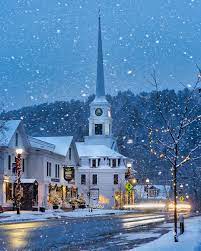
Introduction
Manchester, a pretty town about 95 mi/155 km south of Burlington, has been a summer resort since the 19th century and becomes the cultural capital of Vermont in the summer, with world-class performing acts scheduled throughout the season. Manchester is also a retail capital—there are more than 50 outlet stores and 50 more galleries and specialty shops.
Located in the heart of Manchester Village, the posh Equinox Resort dates to the 1700s and offers two unusual activities: a Land Rover 4x4 driving school and the British School of Falconry, which teaches you to handle your own birds of prey—hunting hawks and falcons. Among the town's other attractions is the American Museum of Fly Fishing, which includes a display of celebrity tackle once owned by the likes of Ernest Hemingway, Dwight D. Eisenhower and Bing Crosby.
The historic Georgian Revival mansion Hildene, the summer residence of Abraham Lincoln's son, Robert Todd Lincoln, has appealing formal gardens and excellent mountain views; it plays host to concerts by the Vermont Symphony Orchestra. Theater performances take place at the Dorset Theater and the Weston Playhouse.
The Northshire Bookstore is one of the state's largest and finest independent bookstores, and it frequently sponsors readings by well-known authors, some of whom live in the area.
After you've seen Manchester, drive the winding toll road up Mount Equinox (be sure your car's brakes are in good shape) for spectacular views of four states and a bit of Quebec. For more high-altitude fun, hit the slopes at Stratton Mountain Resort, which offers more than 90 trails suited to a variety of skill levels. The 12-passenger high-speed gondola known as Starship 12 whisks skiers and snowboarders to the summit in less than eight minutes. It has helped alleviate some of the long lift lines created by the large number of skiers, many of them vacationing New Yorkers.
At the base of the mountain is an alpine-style village with shops, restaurants and lodges.
Bromley Mountain Resort is also located in the Manchester area. South-facing Bromley Mountain claims to be a good deal warmer than Stratton Mountain, and it's popular with families (children younger than age 5 ski for free). During the summer or fall, try Bromley's alpine slide. The curved course has as many thrills as you desire—you control the speed of your sled, from pokey to terrifying.
For some genuine Americana, drive southwest of Manchester to Arlington, home of the Norman Rockwell Exhibition. An 1800s church displays hundreds of the artist's works, including many of his cover illustrations for the Saturday Evening Post. The artist lived there for nearly 25 years, until he moved his family to Massachusetts in the 1950s.
Overview
Introduction
Mandalay, Myanmar, the famous city of just more than a million people, has suffered from several major fires that destroyed many older buildings. However, Mandalay Hill is intact and still worth climbing via its 1,700 stairs. There are beautiful temples and shrines every 100 steps or so—you can also go up by minivan if the steps seem too strenuous. At the top, visitors have a great view of the city and the Ayeyarwady River.
At the bottom of the hill is the amazing Kuthodaw Pagoda (729 small temples, each containing a marble slab with writings from the Buddhist canon, surround a central pagoda—the complex has been called the "world's largest book"). Also nearby are the ruins of the once-huge Royal Palace. Most of the palace was destroyed in an air raid during World War II, but a restoration project has rebuilt many of the former structures. The palace is now partially occupied as military fort, but reconstructions of the royal areas are open to visitors bearing a city combo ticket.
Another Buddhist temple worth visiting is the Maha Muni Pagoda, which has a large golden Buddha, perhaps the most sacred image in all of Myanmar. Many visitors also enjoy trips to the Jade Market (there is an entrance fee) to watch vendors and jewelers shape, sell and haggle over one of the country's most valuable commodities.
Mandalay itself is a dirty and dusty town with some areas that have changed little throughout the past century: Riverboats, trishaws and other muscle-powered forms of transportation predominate. Go down by the riverside in the late afternoon for the amazing spectacle of water buffalo being worked to bring logs onto the bank. A couple of hours could also be spent in the sprawling Zegyo Market—you probably won't find anything of particular interest to buy there, but just absorbing the atmosphere and observing the sheer size of the place can make for an interesting visit. Mandalay is a must-see, though one night is generally enough for most visitors.
After you've seen the city, we highly recommend a trip on the Ayeyarwady River, which can be one of your most memorable experiences in Myanmar. A boat ride from Mandalay to Bagan (12-14 hours) makes for a beautiful journey. You can also make the trip on a "fast" (nine-hour) ferry. Pagodas and ruins line the shores. Along the way, passengers wade out to meet the ship, carrying anything from a bag of rice to a live pig tied to a pole. (In the past, you and the pig would be fighting for deck space: Today, tourists are assigned deck chairs.) Plan to make this trip in the "wet" season—otherwise, you risk being stuck on a sandbar for hours, if not days, on end. Mandalay is 350 mi/565 km north of Yangon.
Overview
Introduction
This fascinating region of highlands and hills is best appreciated if it's explored slowly. A good base in the highlands is the city of Maroua, which has interesting weaving and leather tanning centers and a nice market (we found some good buys on leather goods). If you have a car at your disposal, you can visit several villages in the Mandara Mountains. Head first for the remote village of Mabas, whose huts cling to steep hillsides. The nearby town of Djingliya has an interesting Artisan Center where local handicrafts are sold. In the afternoon, continue via the Kapsiki Plain (noted for its "candles"—dramatic volcanic plugs rising skyward like giant fingers) to the interesting village of Rhumsiki, home of the Kurdi people. If you arrive early enough, hike to the base of Mt. Rhumsiki to see a dazzling sunset. (But be forewarned—it's a substantial hike.) If you prefer an easier climb, it's only about a 20-minute walk up Garcon, a small peak near the town (hire a local guide, usually a boy, to show you the path). Overnight in Rhumsiki, and spend the following day shopping for handicrafts or watching the women curl cotton fibers. The nearby town of Pousse has an interesting palace and a cultural center dedicated to preserving the art of dome-building. 540 mi/870 km northeast of Yaounde. Overview
Introduction
There's not a lot to do in Mandeville, Jamaica, but this pretty town 60 mi/95 km west of Kingston and some 2,000 ft/610 m up in the mountains offers relief from the heat of beach resorts. It's an important center for bauxite and alumina mining, which takes place outside town.
Spend a day walking around town to see the British colonial architecture, some of it dating from the 1700s. Marshall's Pen is a cattle plantation and bird sanctuary. You can take a tour of the restored 200-year-old estate house by appointment. On weekends, be sure to see the colorful Mandeville Market (handicrafts, clothing, produce) in the center of town.
Golfers will enjoy playing at the Manchester Club, said to be the oldest golf course in the Western Hemisphere. Mandeville's main appeal is its splendid scenery that can be seen while driving narrow country lanes lined with fieldstone walls. Temperatures in Mandeville can be chilly, so take along a sweater.
Overview
Introduction
The Alu caves are a popular attraction in Mang City, formerly known as Luxi, in China's southwestern Yunnan province. Three main caves are joined by easy walking paths, and tours include a boat ride among the impressive formations within, which are lit by colorful hues and the reflections from shallow pools. The formations have exotic names such as "King Wei Deploys His Troops" and "Woman Longs for Her Husband."
Dehong Mangshi airport, about 4 mi/6 km from the city, offers regular 45-minute flights departing for Kunming. Both Dali and Kunming are about eight hours away by bus.
Overview
Introduction
The second-largest island in the area after Rarotonga, Mangaia is home to Teruarere Cave (almost 2 mi/3 km long and full of gleaming white stalactites and stalagmites). There are excellent hiking possibilities on the island, including a climb up the central peak, Rangimotia (555 ft/169 m). The island's many pineapple fields offer delicious refreshment. 130 mi/210 km southeast of Rarotonga. Overview
Introduction
This town at the end of Pago Bay is home to the University of Guam. Spend some time walking around the campus and you'll meet students from throughout Micronesia. The Micronesia Area Research Center, a well-regarded library of material on the entire region, is on the campus. The university bookstore stocks some good books on the area as well. 5 mi/8 km southeast of Hagatna. Overview
Introduction
This suburb of Pyongyang is usually seen as a half-day trip from the capital. It's the birthplace of Kim Il Sung, and you can visit the refurbished thatched cottage where he was born (be prepared for a torrent of praise for the Great Leader and his humble beginnings). There are also a 700-acre/280-hectare botanical garden and lovely views. Tourists might also be taken through a pair of nearby amusement parks, complete with a double-loop roller coaster, two-story carousel and vintage video arcade. 10 mi/16 km west of Pyongyang. Overview
Introduction
One of the atolls that make up the Tuamotu island chain, located 320 mi/510 km northeast of Papeete, Manihi exhibits the usual atoll traits. The land is a thin strip of coral that barely rises above the water and forms a ring around its very large lagoon. The emphasis is on water and sky and—as far as most visitors are concerned—black pearls and scuba diving.
The island is a leader in pearl production (with Tahiti's first black pearl farm), and visitors can tour the farms where they're grown and harvested. Those looking to buy may find lower prices on Manihi than on islands that aren't major pearl producers.
As for scuba diving, the prime site is the narrow pass leading into the lagoon (Turipaoa Pass). Sharks, rays and many other marine creatures gather there to feed on the rich supply of food riding the current through the pass. It's also possible to snorkel through some inspiring underwater gardens to find sea turtles or go on a fishing expedition.
Aside from those pursuits, Manihi is very low-key. Visitors have the chance to relax—totally. Those looking for excitement out of the water will soon grow restless. Accommodations on the island are limited to one large resort and several less-sophisticated offerings, so make your arrangements before you arrive.
A two-night stay is about right, unless you plan to do a lot of scuba diving. The air schedules for Manihi allow a visit there to be combined with Rangiroa. It is about one-hour flight from Papeete.
Overview
Introduction
Pearl divers make their home on this isolated atoll in the northern Cook Islands. In fact, Manihiki is one of the world's main sources of black pearls. The island now has an airstrip and twice-weekly service from Rarotonga. 750 mi/1,200 km north of Rarotonga. Overview
Introduction

Manila, Philippines, is a city of contradictions. Residents often complain about the pollution, garbage and lack of adequate infrastructure, but many choose to live in the city for its upbeat tempo and laid-back atmosphere. The sight of beggars confirms the country's economic struggles, but a few minutes in the shopping complexes show happy-go-lucky people who try to find a day's pleasure, regardless of what tomorrow may bring. A rising middle class is fueling growth among consumers, both domestic and international.
Despite Manila's vulnerable economic conditions, the mall culture has thrived. At an average of four stories tall and spanning entire blocks, malls are the landmark of even the poorest district—and the pride and joy of the most affluent neighborhoods. Filipinos have made the malls of Makati, Ortigas and Manila their second home. Many go to them to watch a movie, dine at a restaurant or just walk around in the air-conditioned environment. Sunday Masses are even held in malls.
Manila is a city where people live for the moment. The heritage sites in Intramuros, the old bombed city of Manila, have been transformed into speakeasies, government buildings and public schools. The development of government museums is slow—residents are too caught up in present-day life to secure the past.
It is this carefree spirit that marks the way of life in Manila: Work can be put off for tomorrow. The city appears crazy, chaotic and even incomprehensible to some visitors, but it is these same elements that will allow them to let their hair down and unwind. It also helps that foreign currency goes a long way in Manila, offering access to convenience and luxury beyond what many tourists experience in other cities.
Must See or Do
Sights—A ferry ride to Corregidor Island or around the bay; a calesa ride around the old fortress of Intramuros; The Manila American Cemetery and Memorial; sunset over Manila Bay.
Museums—The Ayala Museum; Casa Manila; Fort Santiago; the National Museum.
Memorable Meals—Chateau 1771; great service and authentic dishes at Sentro; the atmosphere at Dencio's; Chimara's neo-vegan cuisine at Greenbelt 3.
Late Night—The Eastwood City bar strip; Greenbelt 2 bar strip on a Friday or Saturday night; Malate's Remedios Circle, surrounded by bars and restaurants; Tomas Morate Avenue's rows of restaurants for a late-night meal.
Walks—Various walking tours of Carlos Celdran; a stroll through Rizal Park; visits to the Manila Cathedral and San Agustin Church in Intramuros.
Especially for Kids—Hands-on activities at the Ayala Museum; the Science Discovery Center, ice skating rink or IMAX theater at SM Mall of Asia.
Geography
Manila is actually made up of 13 cities and four municipalities that President Ferdinand Marcos placed under one urban umbrella in the 1970s. Many of the municipalities were granted city status and are now bustling beehives of commerce and industry.
The Pasig River connects the Laguna de Bay at the south with Manila Bay and the South China Sea. The river was once crystal clear with lilies adorning it, but it is now dull brown.
Manila lies on the west coast of the Philippine island of Luzon, the largest of the archipelago's three major land bodies (the other two are Visayas and Mindanao). From north to south, Navotas, Manila proper (the capital during the Spanish era), Pasay City, Paranaque City and Las Pinas lie along Manila Bay. Old Manila is defined by a breathtaking view of the bay, the presidential palace and other government buildings, as well as the landmarks of Rizal Park and Intramuros. Pier 15, where most foreign ships dock, is found in the south harbor.
To the east of Manila proper are the three business districts, which can be reached on a 30-minute to hour-long ride: Mandaluyong City, Pasig City and Makati. Quezon City, north of Mandaluyong City, is a hub for businesses and government offices. However, the country's main financial district can be found in Makati City. There are two stock exchanges, one in Makati and one in Ortigas.
Farther south is Muntinlupa City, the rising district of southern Manila, thanks to corporations that have established themselves there and high-end malls such as the Ayala Alabang Town Center.
History
Maynila, as the first Malayan settlers called it, started out as a thriving trading center—merchants from ancient China, Japan and Thailand bartered goods there. Aristocrats from the nearby island of Borneo settled in Maynila and transformed it into a city protected by strong wooden palisades. The area remained protected by local rulers until the Spanish arrived in the 16th century. Raja Sulayman, a fierce Maynilan ruler, was able to thwart the first Spanish attempts to take over the land, but Spain's empire eventually won out.
In 1791, Spanish conquistador Miguel Lopez de Legazpi completed his conquest of the Philippines and made Maynila—renamed Manila—the capital. The wooden palisades gave way to a stone-walled fortress protected by a battery of guns. The fortress became known as Intramuros, and only the most powerful, wealthy and purebred Spanish were allowed to live inside its walls. In the late 19th century, Filipinos, encouraged and inspired by a growing middle class of intellectuals, tried to shake off Spanish rule. The attempt failed, and Jose Rizal—the leader of the uprising—was executed publicly in Bagumbayan (now known as Luneta).
Under terms of the Treaty of Paris, Spain ceded the Philippines to the U.S. in 1898, and the islands remained a territory until 1946. Under U.S. control, some of Manila's most important buildings were constructed, including the Philippine General Hospital. The roads were improved, and an educational system was established.
During World War II, U.S. forces gave up Manila to hold their ground in Bataan where they, along with Filipino troops, fell to the Japanese. Liberation came in 1944 with the return of Gen. Douglas McArthur. But the infighting left Manila devastated. Entire buildings were razed, and the fleeing Japanese killed many residents.
From Manila's independence through the early 1970s, the country enjoyed a thriving democracy and economy. The atmosphere quickly changed when Ferdinand Marcos declared martial law in 1972, citing the Communist insurgency as a reason. Though the dictator was responsible for building many of the edifices and roads in the capital, he also institutionalized corruption in all systems of government, and the modern country is still recovering from the effects. After Marcos' main challenger, Benigno Aquino, was assassinated in 1983, popular opinion solidified behind his widow, Corazon Aquino, and she was elected in 1986. Marcos and his wife, Imelda, were forced to flee the Philippines.
Aquino was popular but not an effective leader: Her term was marked by a number of coup attempts. Ensuing leaders made some progress in alleviating the country's endemic corruption and poverty, but progress went downhill, and in 2001 President Joseph Estrada was forced from office in a massive nonviolent street protest known as the Second EDSA Revolution by those who accused him of embezzling millions. His successor, Gloria Macapagal-Arroyo, was able to partially restore investment confidence in the country, but her presidency was marred by several corruption allegations. Benigno Aquino III, son of Corazon and Benigno Sr., was elected to a six-year term as president in May 2010. Rodrigo Duterte was elected in 2016 as the first president from Mindanao.
Potpourri
In addition to the architectural splendor of the San Agustin Church in Intramuros, the remains of Manila's founder, Lopez de Legazpi, are also buried there together with other historical figures.
The Philippines has unique fabrics that are made from pineapple or banana fibers. Dita Sandico Ong, a local fashion designer in Manila, has popularized the use of such indigenous materials.
The University of Santo Tomas has a press that is one of the oldest in the world. The UST Press was founded in 1593.
Manila Bay is known not only for its sunset, but it was also the area where the famous Battle of Manila was fought in 1898 between the Spaniards and the Americans and Filipinos.
Manila's 12 million citizens occupy an area of 15 sq mi/39 sq km, making it the most densely populated city in the world.
Manila is actually a sprawling conglomeration of 12 cities and five municipalities, each an autonomous political entity but functioning as one city called Metro Manila.
Manila was originally named Ginto, which means the Land of the Gold. The name Manila comes from a mangrove plant with white star-shaped flowers called nilad. In the past, these plants grew abundantly along the shores of the Pasig River and Manila Bay, and so the city become known as may nilad, "the place where nilad grows".
In 1948, Quezon City was declared the national capital of the new Republic of the Philippines, thus robbing Manila of the title it had held since 1595. In 1976, President Ferdinand Marcos returned the national capital to Manila.
Location
Most ships from foreign shores dock at Pier 15 at the South Harbor. Compared to the other ports in the Philippines, this is regarded as the cleanest and most orderly. Vehicles that enter the terminal area are checked by security, and cabs cannot go in to pick up passengers; it is advisable that docking visitors have prior arrangements for pickup. The terminal is a short walk away from the heart of Old Manila where Rizal Park and Intramuros are.
Shore Excursions
Typical shore excursions include a tour around Manila Bay, a boat trip to the battle site of Corregidor or visits to Subic Bay. Small cruise ships usually dock at the CCP Terminal, and if you are going on your own, some caution is recommended. It's better to go with an organized tour group. There is a docking station for cruises around Manila Bay located beside the Shrine of Jesus Church across from the Mall of Asia.
Check with your ship's shore-excursion staff or your travel agent for additional information. You can also ask to be connected with a leading hotel's concierge and inquire about tour groups that you can join.
Overview
Introduction
When Europeans pushed into the land that's now Manitoba in the late 1600s, they went for the wildlife. Or more accurately, they went for the wildlife's fur. Today, the province's rich supply of furry and fishy creatures—and the unspoiled wilderness in which they live—still draws travelers. One animal in particular—the polar bear—is more easily seen in Manitoba than anywhere else. Each year, the town of Churchill becomes a kind of way station for the migrating bears, allowing people a close-up view of one the largest predators in North America.
Wilderness enthusiasts also enjoy seeking out Manitoba's moose, black bear, caribou, white-tail deer and wide variety of birds, including snow geese, Canada geese, ducks, grouse, snowy owls, eagles, falcons and hawks. The water-blessed province offers excellent fishing and boating on the inland lakes and rivers and the opportunity to view seals and beluga whales in Hudson Bay.
The southern part of Manitoba combines the majestic expanse of the prairie with distinct farming towns of Ukrainian, Russian, Icelandic and Mennonite heritage. And lest you think Manitoba is entirely farmland, forest, lakes and tundra, there is also Winnipeg, a cosmopolitan center of culture and industry rising from the prairie.
Geography
Bordered on the northeast by Hudson Bay, this fairly flat province is mostly covered by northern boreal forest, arctic tundra and three large inland lakes: Winnipeg, Manitoba and Winnipegosis. The southern part of the province, where 90% of the population lives, has good farm and grazing land on open prairie. There are some very small mountains in Riding Mountain National Park and Duck Mountain Provincial Park.
History
The Ojibwa, Cree and Assiniboine inhabited the flat grasslands of what is now southern Manitoba. Culturally related to the Great Plains tribes living farther south, they were nomadic hunters whose complex culture was based primarily on the hunting of bison and the processing of its meat and hide. In the north, the population was more culturally akin to the Inuit. They hunted caribou, fished, and collected wild vegetables and berries.
The first Europeans arrived in Manitoba in 1668. Two years later, King Charles II of England granted the charter that established the Hudson's Bay Co., which attempted to control the fur trade in most of western and northern Canada, including the region that is now Manitoba. It was not until 1812 that the first permanent European settlers arrived in the province. Their attempts at farming often met with natural disaster, and they were subject to frequent harassment from the North West Co., which was engaged in a bitter trading struggle with the Hudson's Bay Co.
The Dominion of Canada was established in the 1860s, and the lands of the Hudson's Bay Co. were scheduled to become part of the new confederation. A group of Metis and aboriginal people, led by Louis Riel, became concerned that they would lose their territory after the area became part of Canada. Their Red River Rebellion erupted in 1868, and Riel's forces were successful in establishing their own government for a brief time. The uprising was eventually put down, but the rebels did win property and language rights as a part of the 1870 legislation that joined Manitoba to the rest of Canada. (Riel, however, was later hanged for taking part in the rebellion.)
The arrival of the railways in the 1880s—and the immigrants of many nationalities and cultures who rode them—tied Manitoba more closely to the rest of Canada. The railways also raised its status as a breadbasket and commercial center that provided agricultural products and trade goods to the nation. Even today, when manufacturing constitutes a good share of the province's economy, Manitoba still depends greatly on agriculture for its prosperity.
Snapshot
Manitoba's chief attractions are fishing, hunting, wilderness scenery, polar bears, provincial parks, boating and white-water rafting, Winnipeg and a diverse culture.
Travelers seeking wilderness adventures and a vacation off the beaten track will have a great time in Manitoba. Those who are looking for the supercharged pace of a large metropolis may find that Winnipeg doesn't quite fill the bill (but that's one reason we like Manitoba's capital city.)
Potpourri
Winnipeg's Royal Canadian Mint not only produces Canadian coins, but has minted currency coins for some 60 other countries, from Australia to Yemen. The Mint also produced the world's first colored circulation coin: a memorial coin honoring Canadian cancer hero (and one-time Winnipegger), long-distance runner Terry Fox.
Manitoba's big on big things: a 76-ft/23-m replica of Van Gogh's Sunflowers painting on a giant easel in the town of Altona, the world's largest Coca-Cola can in Portage la Prairie, a giant fire hydrant at Elm Creek, Chuck the Channel Catfish at Selkirk, a monster mosquito in Komarno, a gargantuan pumpkin at Roland, and dozens more corny-but-cute statues and mascots erected by small towns around the province.
The Royal Winnipeg Ballet, Canada's oldest dance company, received the "royal" title in 1953 from Queen Elizabeth, the first such distinction she awarded anywhere.
Although Manitoba is considered one of Canada's western provinces, it is located near the geographic center of the continent. This gives Manitoba a bit of an identity crisis, having been moved to the Eastern Division of the Canadian Football League, yet primarily known for being the "Gateway to the West."
Wapusk National Park in northern Manitoba contains one of the world's largest polar-bear "nurseries." An estimated 1,200 winter dens are located within the park's boundaries. Perhaps 250 are occupied each year by females, which use them to give birth to and raise their infant cubs.
Polar bears are not white. Their skins are black, and their hair is clear—but each hair shaft is constructed to reflect light, making the animal appear white.
A huge population of nonvenomous red-sided garter snakes lives in pits about 4 mi/6 km north of Narcisse, west of Gimli. This is thought to be the greatest concentration of the breed in the world. The best time to see them (or avoid them, depending on your feelings about snakes) is mid-April to mid-May, when tens of thousands of snakes mate in giant, writhing masses.
Overview
Introduction
The Manitou Springs area, near Pikes Peak, offers a number of attractions. Garden of the Gods is made up of unusual red sandstone rocks that have been tilted and sculpted into fascinating shapes.
Cave of the Winds is an underground cavern in the tradition of the classic (that is, somewhat touristy) cave tours.
Miramont Castle, built in the late 1800s, is a large and odd mansion constructed of stone and clapboard. Manitou Cliff Dwellings Museum contains replicas of ancient Anasazi-style structures. Closer to Colorado Springs is Seven Falls, a group of waterfalls best viewed from the lookout known as Eagle's Nest.
Overview
Introduction
A lovely city high atop a ridge in the Cordillera Central, Manizales, Colombia, lies 157 mi/254 km south of Medellin. The city is one of Colombia's most attractive and least threatening urban centers, and is the most convenient access point for exploring the Zona Cafetera and the Parque de los Nevados, just a 90-minute drive to the east; the snow-capped peaks can be seen from the city.
Manizales has several universities and institutes, which lend the city a youthful energy.
Don't miss the huge (although ungainly) Gothic cathedral in Plaza de Bolivar, the central square; for a small fee you can ascend the spire—the tallest in Colombia—for a sweeping view of the city. The Bolivar Condor monument, dedicated to Simon Bolivar, is one of the city's other prime attractions.
Overview
Introduction
These smaller islands are situated in the straits between the main islands of Upolu and Savai'i. Manono Island has beautiful clear water and is a great place to lie on the beach, swim or fish. The absence of hotels, dogs, shops and cars makes this island a good place to relax for the day. Manono can be seen on a day trip from Apia, usually by boat from Manonouta on the western tip of Upolu Island. Manono is 2 mi/4 km northwest of Upolu.
The picturesque cone of an ancient volcano, Apolima Island lies about 4 mi/6 km northwest of Manono. To visit the island, you will need an invitation from a resident—uninvited visitors are perceived as intruders infringing on the islanders' hospitality.
Overview
Introduction
If you happen to be driving along the central Pacific coast 80 mi/130 km northwest of Guayaquil, a stop in Manta, Ecuador, offers a pleasant few hours.
A busy harbor town, Manta offers the Banco Central Museum (ancient Amerindian artifacts), an artisan market in Plaza Civica, an old wooden church and a picturesque fishing harbor.
The surrounding countryside of Manta has pristine beaches, backed by lush, rolling hills covered in orchards and cotton plantations. The sea has a dangerous undertow there, but the conditions December-April are right for surfing and international windsurfing competitions.
Don't miss Parque del Marisco, which translates as Seafood Park and offers fresh seafood and ceviches from stalls right on the beach at Playa Tarqui.
Nearby Portoviejo offers the museum Casa de la Cultura and botanical gardens.
Location
Cruise ships dock in Manta's large port, which is an easy walk from the town center. There is also a free shuttle that runs from the port and drops passengers off in front of a shopping center.
Shore Excursions
Shore excursions often include a small city tour with a visit to the archaeology museum, but then venture to nearby destinations. Montecristi, 6 mi/11 km west of Manta, is the home of the so-called Panama hat. See how these famous straw hats are made, find out why they were misnamed and browse a showroom for one to take home. Another regional craft is ivory nut carving. The nuts of the Tagua palm resemble ivory and are used to make crafts. Travelers visit ivory nut factories and showrooms for the creations.
For an experience of Ecuador's rich natural environment, take an excursion to the Pacoche Wildlife Reserve, home to more than 250 species of birds and a variety of orchids and other flora. A tour typically includes a craft demonstration with toquilla palm straw being used to make Panama hats and ivory nuts being carved.
From late June to early October, hundreds of humpback whales come to the warmer waters off Ecuador's shores to give birth. During this time, whale-watching is a very popular activity. Manta has some local tours, but Puerto Lopez, the most popular launch point for such a day cruise, is a bus ride south of the city. Excursions there often include a trip to Isla de la Plata (the "poor man's" Galapagos) and Machalilla National Park.
Overview
Introduction
If you have the time, the money and a true love of the rain forest, the journey into Manu National Park (located 100 mi/160 km northeast of Cusco) is a must—in our opinion, it's the most worthwhile jungle adventure in all of South America. It covers an area of more than 6,600 sq mi/10,620 sq km, making it one of the largest protected areas in Peru. According to UNESCO, "the biological diversity found in Manu National Park exceeds that of any other place on Earth."
More than 800 species of birds and 200 species of mammals exist within the park's mountains, valleys, lowland jungles and upland cloud forests. These include iconic creatures such as the giant river otter, giant armadillo, jaguars, pumas and, in the more mountainous areas, the Peruvian spectacled bear (of Paddington Bear fame). Human inhabitants are primarily indigenous tribal communities such as the Mascho-Piro, Yaminahua, Amahuaca and the larger Machiguenga group, all of which are nomadic. There are no large settlements within the park.
The park is divided into three zones: the Park Zone (scientists only), the Reserve Zone (tourist activities permitted, but permits and guides required) and the Cultural Zone along the park's southern border, which is open to everyone and offers accommodations. Tours can be booked through adventure-travel companies in Lima and Cusco; most tours last seven to ten days.
Tour operators leave from Cusco, traveling overland for a day through Paucartambo, Pilcopata, and Atalaya, after which the tour group typically takes a motorboat down the Alto Madre de Dios River (about seven hours) before heading down the Manu River and into the park. Alternatively, you can book a tour that involves a 40-minute flight by small aircraft from Cusco to Diamante (near Boca Manu and the main river entrance to the park), saving a significant amount of time and effort. A third and less popular option exists from Puerto Maldonado, involving a combination of cars and boats to Boca Manu, then another boat down the Manu River to the park. Note: Yellow fever is present in the park.
Overview
Introduction
The Manu'a Islands (Ta'u, Olosega and Ofu) are much less developed than the main island of Tutuila. Ta'u is the ancient headquarters of the Samoans and the place where Margaret Mead did much of her research in the 1920s. Olosega and Ofu, two islands connected by a causeway, offer spellbinding scenery and fabulous beaches.
American Samoa National Park encompasses a good part of the Manu'a Islands (including Mount Lata, the highest peak in American Samoa). Facilities in the park are being developed slowly, especially on Ta'u: The landscape is broken by craters, cliffs and sharp gullies—it's unlikely to be made fully accessible anytime soon. There is one good hike along the uninhabited east coast.
The park unit on Ofu encompasses the beach and coral reef stretching east from the island's airstrip and main guesthouse. The diving and snorkeling there are particularly good, although there are no dive shops on the island. Hikers can go up 1,620-ft/495-m Mount Tumu.
Be aware that all three islands offer only basic accommodations and facilities, and unreliable air and shipping services make it impractical to visit. Ofu is 70 mi/110 km east of Pago Pago; Olosega is 75 mi/115 km east of Pago Pago; and Ta'u is 80 mi/130 km east of Pago Pago.
Overview
Introduction
One of the most popular parks in Costa Rica, located 30 mi/48 km south of San Jose, Manuel Antonio National Park has become the focus of the debate that concerns Costa Rica as a whole. It was intended to preserve nature, but its popularity threatens the environment that visitors go to see.
Responding to some of the ill effects of mass visitation (including pollution from hotels and automobiles and deleterious interactions between humans and wildlife), the government has taken steps to limit the number of visitors to Manuel Antonio: Camping is no longer allowed, the park is closed on Monday, and only 600-800 visitors are allowed in daily, depending on the day of the week.
After wading through an estuary at the entrance to the park—anywhere from ankle deep to waist deep, depending on the tides—you can choose from exceptional white-sand beaches. (For a small fee, a boat will paddle you across.) Playa Espadilla Sur—also called Second Beach—is especially good for snorkeling and swimming.
A network of trails runs through the forest, allowing you to observe an abundance of wildlife: birds, white-faced capuchin monkeys, coatis, sloths, and colorful crabs and lizards. There are a number of activities that you can enjoy in the area surrounding the park, including rafting, surfing, sea kayaking, horseback riding and sportfishing (especially for sailfish mid-December to late April).
One excursion to consider is the canopy-safari trip, which includes breakfast, a Jeep ride into the forest and ziplining and rappelling through the forest. You can go in the morning and spend time on the beach when you return.
If you're planning to stay several days in the Manuel Antonio area, try to get a room at one of the hotels that line the road between the park and the town of Quepos. They're more expensive than those in town, and you must book well in advance, but they're worth it: Many are discreetly built into the jungle and take you close to the wildlife—we saw a sloth ever so slowly cross the road in front of our hotel.
Quepos, a fishing town with a marina, several sportfishing operators and a base for local activities, boasts a large number of restaurants and modest accommodations, plus shops and art galleries where you can catch up on your souvenir shopping.
For more information, visit http://www.manuelantoniopark.com.
Overview
Introduction
A small town in the wooded west-central part of the state, 215 mi/345 km northwest of New Orleans, Many is the nearest town to the restored Fort Jesup State Historic Site (6 mi/10 km east)—the fort was established by Zachary Taylor in the mid-1800s.
Also nearby is Hodges Gardens (about 20 mi/35 km south), open year-round. This 4,700-acre/1,900-hectare arboretum was established in the 1940s in a stone quarry—it's truly impressive. Hundreds of varieties of trees and flowers are found throughout the gardens. Plan to spend at least a half-day there.
Many is also a major gateway to Toledo Bend Lake, a large reservoir created by a dam across the lower Sabine River. The hunting, fishing and bird-watching around Many are superb.
Overview
Introduction

On the Pacific coast, halfway between the U.S. and Guatemala, Manzanillo, Mexico, is a prime resort destination. It can be unbearably hot in the summer, however, and is popular with Mexicans and spring-breakers from the U.S. and Canada; it's packed on weekends and holidays.
The area encompasses two large bays: Manzanillo Bay to the south and Santiago Bay to the north, which are separated by the Santiago Peninsula, where many fine resort hotels are located. The town is on the south end of Manzanillo Bay. It has a pleasant downtown seawalk, and there's a park along Santiago Bay.
The wide beaches on the bays are the big attractions. The town calls itself the "Sailfish Capital of the World," and deep-sea fishing is excellent November-May. Located 130 mi/210 km south of Guadalajara, Manzanillo is also the largest container port on the west coast of the Americas.
Side trips may be made to the largely undiscovered coast to the south and to Barra de Navidad, an hour's drive north of Manzanillo, which has good surfing beaches and a lagoon (and a huge resort). Less-developed beaches farther north are popular home rental areas for snowbirds escaping the cold weather up north.
Overview
Introduction
The sprawling and untidy town of Manzini and the adjoining industrial area of Matsapha, 20 mi/30 km southeast of Mbabane, are between them home to the largest urban population in Swaziland. Because of their central position, nearly all roads lead there, but they have the dubious distinction of being the least appealing part of the country, and there is nothing to hold visitors' attention for too long. The three shopping malls have supermarkets to stock up on provisions, and Manzini Market is a colorful place to observe Swazi life. Matsapha is where Swaziland's airport is located. Overview
Introduction
This beautiful monastery has a spectacular setting. The monastery, which was built in the 1800s, was badly damaged in the Stalinist antireligious fervor of the 1930s. Today, the damage is being repaired, and the monks are very friendly to foreign visitors. The monastery is usually seen on a day trip from Ulaanbaatar, but the area is rewarding for walkers, who can attempt to trek up one of the four Holy Peaks (the easiest is Tsetseeguun). You'll need a guide for the trip, and you'll also need to pack a picnic (the nearest food is at the lackluster town of Zuunmod, 5 mi/8 km away). There is a ger camp near the monastery. About 5 mi/8 km away, a Japanese corporation has partially financed a tourist camp called Ondor-Dov. The camp consists of a number of gers laid out in rows and a central restaurant/reception building—which looks somewhat like an airport control tower. The original idea was to attract Japanese golfers to a huge golf course nearby, but this has yet to happen. This seldom-used camp is a happy find for any visitor who is looking for a little comfort. (Good food, too.) 30 mi/50 km south from Ulaanbaatar. Overview
Introduction
Africa's tallest mountain, Mount Kilimanjaro is truly one of the most impressive sights on the continent. "Kili" can be seen from various points in northern Tanzania, and even as far away as Tsavo and Amboseli parks in Kenya. Part of its spectacular appeal is that Kilimanjaro is not part of a mountain range—it's a 19,342-ft/5,895-m dormant volcano rising dramatically from a relatively flat plain—it's the world's highest freestanding mountain.
Clouds blanket the famous snowcapped peak most of the time, often dissipating at dusk and dawn to offer stunning views from Moshi and elsewhere in the vicinity. However, the snowcap is gradually melting. Roughly 85% of the ice has disappeared since 1912, so you may want to see Kili sooner rather than later.
Going on an organized trek is compulsory—and a godsend if you get hurt or sick. Mount Kilimanjaro National Park includes the whole of the mountain above the montane forest belt (higher than 5,970 ft/1,820 m) and a daily park entrance fee is required along with the associated costs for guides and porters. Because of its relatively gentle slope, even inexperienced climbers can climb Kilimanjaro—it is the tallest mountain in the world that can be simply walked up. It is still hard work and you need to be fit (consult your physician first, because of the altitude). The climb takes a minimum of five days—four up and one down—but your odds of reaching the summit will be greatly improved if you add an extra night or two on the way up in order to acclimate to the altitude. Going on an organized trek with a guide and porters is compulsory—and a godsend if you get hurt or sick.
The springboard for all climbs is the town of Moshi, 50 mi/80 km east of Arusha. As such, many people combine a climb of Kili with a safari of the Northern Circuit parks and most tour operators offer this option. There are a number of different trails. The most popular is the Marangu trail, which is the recommended route for older people or younger people who are not in peak physical condition. This route makes use of rest huts that are along the way. (Mandara Hut is at 9,000 ft/2,750 m, Horombo Hut is at 12,225 ft/3,790 m and Kibo Hut is at 15,520 ft/4,811 m.) Experienced mountain climbers may opt for the Machame route, a more scenic and considerably more strenuous path up the mountain. On this, and the other routes, trekkers are accommodated in tents carried and set up by the porters. (The Machame route is known as the whiskey route, and the Marangu route is known as the Coca-Cola route. These nicknames are derived from the climbs' hard and soft natures, respectively.)
Several other possibilities are available, including the very gradual Shira Route and the less busy Rongai Route. Whichever route you take, go well-prepared—some 20,000 people attempt the climb each year, but only about half actually reach the summit. Altitude sickness, known locally as mountain sickness, is the primary reason most don't make it to the top—the important things to remember are to go prepared and take it slowly.
Kili is 295 mi/475 km northwest of Dar es Salaam.
Overview
Introduction
The largest city in the world north of the Arctic Circle, in the zone of the eternal frost and 630 mi/1,015 km north of St. Petersburg, Murmansk, Russia, is a port town and base for the Northern Fleet (submarines). It's said that Murman translated as the "end of the Earth" when the town was named—and with nine months of winter and 52 days of continual darkness, we can believe it.
Still, Murmansk is much warmer than most northern cities lying on the same latitude; because of the gulf stream, the average winter temperature there is 5 F/-15 C. Polar night lasts early December-early January, polar day late May-late June.
If you do find yourself there, go to the Panorama Restaurant for a full (and warm) view of the city, which stretches for 12 mi/20 km along the shoreline. Note the port's overhanging cliffs, which sheltered Allied supply ships from German air attacks during World War II. Sights in town include the Military Museum of the Northern Fleet (displays about the fleet's role from World War II to the present; http://www.museum.ru/m2047), Gun Monument (in memory of town defenders), St. Nicholas' Church and the aptly named Regional Ethnography Museum (natural displays and regional history exhibits).
Nearby is the ancient settlement of Kola, the northernmost city in Russia, with remnants of 13th-century earthen ramparts and a 400-year-old cross. Murmansk is still the base of the Northern Fleet and the nuclear submarine Kursk, which sank 93 mi/150 km offshore in 2000. Cruises to the North Pole also originate in Murmansk.
Overview
Introduction
Nanumaga, a small island skirted by a lovely coral reef, is a very difficult place for boats to land and, consequently, isn't visited very often. That's a shame, because it's such a lovely island. If you plan to go, read the 19th-century book by Louis Becke, who lived in the main village of Tonga for a year. Though it was written 100 years ago, it gives great insight into life on the island. 265 mi/425 km northwest of Funafuti. Overview
Introduction
This town is home to the University of Oklahoma. In 2005, the Fred Jones Jr. Museum of Art on the university campus opened a new wing that houses its impressive collection of French Impressionist paintings, American painting and sculpture (particularly Modernism and Southwest), Asian and Native American art . The Sam Noble Natural History Museum south of campus has exhibits ranging from dinosaurs to Native American history, much of it "hands on" and child friendly. You can look a Tyranosaurus Rex right in the eye from the second floor, or sit in an Indian canoe. Downtown Norman has a beautifully preserved brick railway station, and Main Street boasts the Sooner Theater, restored and maintained for art films and live performances, as well as Native American gallery shops. Norman also hosts a large Medieval Fair in March, as well as numerous smaller arts, crafts and music fairs throughout the summer. 15 mi/24 km south of Oklahoma City. Overview
Introduction
Home to one of the most protected anchorages in the region (known as The Bight), Norman Island, British Virgin Islands, is located on the Flanagan Passage and Sir Francis Drake Channel (south of Tortola). A favorite of sailors, it's an uninhabited, mountainous island with beautiful beaches, caves, good snorkeling and several good dive sites, including some underwater caves. Said to be the setting for Robert Louis Stevenson's Treasure Island, stories of hidden fortunes are still traded about. It's accessible only by private or charter boat.
If you go there, be sure to snorkel into The Caves, one of the region's most-visited snorkeling destinations. Some of the caves extend deeply into the island, and the reduced amount of sunlight makes the experience more like a night dive. Take an underwater flashlight if you want to do it right.
Near both Norman and Peter Islands, an area called the Indians is a great place for both snorkeling and diving. Four large rock formations jut out of the water, marking the spot where you'll find innumerable varieties of fish and coral. Charter boats regularly visit, and the surrounding mooring balls are often full, so don't expect to have the place to yourself.
Overview
Introduction
The strip of northern France known as Normandy stretches along the English Channel between Brittany and the Pays du Nord. The region offers bucolic scenery (rendered on canvas by impressionist painters), splendid beaches, quaint villages, rich green pastures and lots of history.
Geography
Nearby Bayeux, one of the first towns to be liberated by Allied forces, made it through the battle relatively unscathed. Today it has a beautiful city center, dominated by an imposing Gothic cathedral.
At the edge of the D-Day landing area is the town of Caen. You may think it looks familiar—it's often painted by artists. Unfortunately, little remains of Caen's old town. It was almost completely destroyed by bombardment in the days after D-Day in June 1944, when the British fought to recapture the town from the Germans.
Farther east along the coast is Deauville, which has been a favorite retreat for generations of wealthy Parisians.
Though Le Havre is usually thought of as a place to get on or off a ship, there is a bit more to this major seaport, including beautiful estuaries and early Norman architecture. About 20 mi/32 km north is Etretat, with its spectacular and often-photographed cliffs (you'll recognize them instantly).
Dieppe, a large town near the eastern edge of Normandy, has a castle containing a fine collection of ivory. The town also has a war memorial to Canadians who died in a massive 1942 raid (the German occupiers thought it was the invasion of Europe). Below the cliff upon which the castle was built is a long beach of round stones, which gives way to a fine sand beach at low tide.
Other interesting Normandy towns include Falaise, Honfleur and St. Laurent sur Mer (the American cemetery for soldiers who died in Normandy during World War II, buried under rows of white crosses). The Contentin peninsula has many picturesque corners, including the fishing villages of Barfleur and Portbail. It's worth a side trip to see the Nez de Jobourg, an impressive series of cliffs overlooking the sea.
On the southern coastal end of Normandy is the UNESCO World Heritage site of Mont-St-Michel, one of France's most recognizable landmarks.
On the northern stretch of coastline between Cap de la Hague and Pointe de Barfleur is Cherbourg, a port with ferry service to England. Smaller ports on the west coast offer the shortest access to the Channel Islands.
For more on each of these regional towns, see the individual city guides.
History
William the Conqueror launched his invasion of England from Normandy. It's also where Edward III landed to begin the Hundred Years War and where the Allied forces launched the liberation of Europe in 1944.
Overview
Introduction
Nosy Mangabe is a small island near Madagascar's Masoala Peninsula known for its population of aye-ayes, which were introduced there in the 1960s when this peculiar creature was thought to be on the brink of extinction. The aye-ayes are quite easy to locate, but since they are nocturnal, that's only on night walks. There are several other lemur species on the island, as well as chameleons, birds, frogs and a native snake.
It was a refuge for the Dutch in the 17th century and a trading port during the French colonization. You can still see inscriptions on the rocks left by Dutch sailors on the beach. The graves of the first inhabitants of the island are also still there.
Permits and transportation can be arranged in Maroantsetra. It's possible to stay overnight on Nosy Mangabe, which is 265 mi/425 km northeast of Antananarivo, but you must take your own tent.
Overview
Introduction
Located along historic Route 66, Oatman, Arizona, is straight out of an Old Western movie set.
Visitors can walk the wooden-plank-sidewalk-lined main street and browse the many novelty and souvenir shops. Dress up in Old West garb to get into the true spirit, and hand-feed wild burros that are straight from the mining days.
Catch a daily Wild West shootout show and maybe even witness a shotgun wedding. Put your culinary skills to the test at the annual Fourth of July Sidewalk Egg Fry, a truly unique cooking competition.
For more information, visit http://www.oatmangoldroad.org.
Overview
Introduction
When you arrive at Oman's ancient city of Nizwa, surrounded by mountains and desert, you'll encounter an unusual piece of roadside sculpture: a giant Arabic coffee urn surrounded by silver-lined cups. This modern rendition of a traditional symbol of Arab hospitality could stand for Oman's intriguing combination of old and new. Long isolated from the rest of the world, Oman only recently began welcoming travelers inside its borders. But even as it has opened its doors to the world and brought modern improvements to the remotest villages, it has also retained many of its traditional desert ways. Along the coast, boatbuilders in small fishing villages still craft dhows by hand. Inland, Bedouins carve out their living on rocky terraces, their villages perched on the precipices of a yawning gorge.
Travelers could also see the giant urn as a kind of magic lamp beckoning them to one of the most exotic places in the world: to wild desert villages and palm-lined oases, where women wear black silk robes and brightly hued masks, and men wear ankle-length robes and colorful cashmere turbans. But for those who prefer the more comfortable pleasures a genie might offer, there are also luxurious tropical seaside resorts, with opportunities for scuba diving and fishing.
Although Oman is not for everyone, it is certain to charm those with an eye for natural beauty and an interest in Arabic tradition.
One of the oldest states on the Arabian Peninsula, Oman was once an important sultanate whose influence was felt as far away as Zanzibar and Pakistan (it sent an ambassador to the U.S. in the 19th century). Today its people reflect a mixture of African, Indian and Arabian influences. Its customs are shaped by those cultures, overlaid by a very thin veneer of British practices (the British were dominant in the area from the mid-19th to mid-20th centuries).
Oman doesn't boast the extraordinary oil wealth of its neighbor, the United Arab Emirates, but the standard of living is still much higher in Oman than in many other Arab countries. Roads, electricity, water, health clinics and schools have arrived in even the most remote mountain villages. The economy remains among the best managed in the region. Although the population enjoys some political representation through a consultative parliament set up after the Gulf War in 1991, the country remains essentially an autocratic monarchy in which the line between the state and the Omani ruling family is blurred.
Geography
Vaguely boomerang-shaped, the Sultanate of Oman lies along the eastern edge of the Arabian Peninsula and occupies a land mass roughly equal to the U.S. state of Kansas. Its eastern side is bordered by the Gulf of Oman and the Arabian Sea. This coastline, which extends well over 1,000 mi/1,610 km, is remarkably picturesque and contains most of Oman's key cities and towns.
Beyond the western edge of Oman are the United Arab Emirates and Saudi Arabia. Yemen lies to the south. Spectacular spiny mountains in the northern and southern ends of the country enliven what is otherwise mostly a sparsely populated desert landscape.
History
Traces of ancient civilizations dating to the third century BC have been found around Oman, but the country's recognizable history really begins with the arrival of Arab tribes roughly 2,000 years ago. The state of Oman, founded by some of the earliest converts to Islam, was created in the eighth century AD.
Because the nation occupied a strategic position on the trade route between India and the West, European powers began to take an interest in Oman during the 1600s. In 1507, Portugal captured the capital of Masqat, but was expelled by 1650. The sultan of Oman began cultivating trade relationships with Britain, which quietly but significantly influenced Omani affairs for some three centuries.
Oman reached the height of its power and influence during the first half of the 19th century, under the rule of Sayyid Said bin Sultan. Alliances with the British government ensured military protection for Oman, allowing it to expand its territories and trade outposts. A second capital was established in Omani-controlled Zanzibar, which is about 25 mi/40 km off the coast of present-day Tanzania, and the nation also held sway in southerly parts of the Arabian Peninsula and coastal areas of modern Pakistan. By the 1850s, a crisis of succession led to a split in the Omani empire—one ruler controlled Zanzibar, the other took the Arabian lands—and the nation slid into a century of economic decline and political weakness. Tribes from the interior periodically mounted attacks on the rulers in Masqat. By the 1960s, Oman was closed to the outside world and economically stagnant.
That same year, Oman's current leader, Sultan Qaboos bin Said, staged a palace coup against his father, seizing power and starting the country on a modernization drive to educate the populace and build the nation's infrastructure. Tourism to Oman only began in the 1980s.
Snapshot
Oman's foremost attractions are desert sand dunes, 400-year-old forts, ancient ruins, beaches, mountains, oases, traditional bazaars, scuba diving, camel treks and Arab culture.
Oman will appeal to travelers who are willing to abide by laws and customs that may seem conservative and restrictive in order to see a relatively untouched country.
Potpourri
Of Oman's population of 2.9 million, some 600,000 are expatriates, and some of them are doing rather unusual jobs. During one of our trips, we met a Scot who was working as the chief repairer of bagpipes for the sultan's army band.
The country is home to the Arabian tahr, a rare variety of mountain goat, and large reserves of Arabian oryx.
As just one indicator of how undeveloped Oman once was, in 1970, it only had about 2 mi/3 km of paved road.
According to legend, Sinbad the Sailor departed for his seafaring adventures from the port of Sohar. The Seven Voyages of Sinbad the Sailor is a collection of travel-romance tales found in The Book of One Thousand and One Nights.
After years of bad blood, Oman and Yemen have finally established a permanent border. A paved highway now connects the two countries.
The workweek in Oman is Saturday-Wednesday.
The Sultan is a strong proponent of public cleanliness and hygiene, sometimes offering prizes to the country's cleanest towns. In 2003, Masqat was bestowed a Cleanest City award by the U.N.
Oman was converted to Islam during the prophet Muhammad's lifetime.
Women traditionally wear colorful garments from head to toe, leaving only the face and hands exposed. Women in rural areas wear leather or cloth masks (burkas).
Oman is one of the world's main producers of frankincense, which was valued as highly as gold in antiquity. It's also traditionally burned in new homes to ward off evil spirits.
Overview
Introduction
The holiest site in Sudan is located across the Nile from Khartoum. Omdurman makes a nice day trip to see the site of the Mahdi's Tomb (nonbelievers aren't permitted to enter); Khalifa's House (relics of the Mahdi and British Sudan); and a huge, fascinating market (excellent silver jewelry). Don't miss the Hamed al Niel Mosque (Sufi "whirling" dervishes dance there an hour before sunset on Friday, except during Ramadan). Omdurman presents quite a contrast to modern Khartoum. At the base of the Nile bridge, boat builders can be seen plying their trade. We consider Omdurman a must-see. 6 mi/10 km northwest of Khartoum. Overview
Introduction
Located near the Zambezi River delta, 670 mi/1,000 km northeast of Maputo, this port was the center of a thriving agricultural area before the war. Today greatly decayed, it is a center of copra (dried coconut meat) export and serves as a waypoint for travelers heading north or south.
The Marromeu Game Reserve lies to the southwest, and the Gile Reserve is to the northeast.
Overview
Introduction
Romania's modern history is as haunting as its old Dracula legend: The brutal reign of dictator Nicolae Ceausescu ended in 1989, but the country is still plagued by a past of poverty and political uncertainty.
Its capital, Bucharest, has come a long way in its post-communist hangover. Some of the massive potholes have been filled, and the roaming street dogs are gone, but now it suffers from the same polluting traffic as any other major European city.
And yet Romania offers an entirely different culture from what you'll find elsewhere in Europe. It has some of the most stunning mountain scenery on the continent, and many parts of the countryside seem untouched by modern history.
For adventurous travelers, the eerie castles, charming medieval villages and painted monasteries hidden away in deep forests more than make up for the often-drab cities and the irritating bureaucracy that lingers from the country's communist past.
Geography
The Carpathian Mountains run through the country in the north, and the equally scenic Transylvanian Alps run east-west through the center. The mountains, plus a lengthy Black Sea coastline, make Romania one of the most physically attractive destinations in Europe. Much of the country's southern border is defined by Europe's famous Danube River.
History
Ethnic Romanians, who make up 85% of the population, trace the nation's history to the Roman colony of Dacia. Turkish and European influences are evident (the area was part of the Ottoman Empire until 1877), although the eight regions of the country remain characteristically very different. Perhaps because it's composed of formerly independent parts, people identify with their local regions.
There is a strong Hungarian influence in Transylvania (once part of Hungary), which has only been united with Romania since 1918. And debate continues to this day over the future nationality of the area. (Saxon merchants moved in during the 12th century to defend Hungary's eastern borders.)
In 1916, Romania joined the side of the Triple Entente in World War I, eventually overthrowing Communist leader Bela Kun in Hungary. However, the country's government was unstable after the war, and between 1930 and 1940, there were more than 25 different administrations. Following World War II, the newly crowned King Mihai attempted to keep a broad-based government but was forced to abdicate in 1947 under pressure from the Communists. Romania then became a People's Republic.
Nicolae Ceausescu assumed leadership of Romania's Communist party—and the country—in the mid-1960s. His administration was notorious for cracking down on dissent among the people, who were suffering from shortages of food, fuel and other basic necessities.
The country's violent revolution of December 1989, which led to the execution of Ceausescu, left most of the ruling elite intact. Former Communist Ion Iliescu took the reins and, when he lost re-election in 1996, made history by being Romania's first leader to leave peacefully without being deposed or shot. His successors have struggled to modernize the country, and foreign investment has finally arrived.
Romania was invited to join NATO in 2002, and it became a member of the European Union in 2007. The country is actively boosting its economy via tourism. It
Snapshot
The country's main attractions are rural landscapes, medieval monasteries, wine country, sites relating to Count Dracula, Black Sea beaches, folk and classical cultural traditions, and skiing.
Romania will appeal to travelers who love haunting rural scenery, folk culture and outdoor activities. Be prepared to ride on winding mountain roads to get to some of the more interesting parts of the country. The country is not for those who demand deluxe accommodations throughout their stay.
Potpourri
If you peek into a countryside church and there's a wedding going on, expect to be invited to join the festivities and share in the food and drink that are brought to the ceremony.
Romanians are serious about their health spas: More than 1,000 Romanian doctors specialize in balneology—the science of using mineral baths for therapeutic treatment.
Because Romanian is a Romance language, certain words may seem similar to people who are familiar with Spanish, Italian or French. For example, supa is the word for soup, and buna seara means good evening.
In 1884, Timisoara was the first city in Europe to have electric street lamps.
The film industry has taken off in Romania, so don't be surprised if you are eating dinner next to a celebrity such as Nicole Kidman, Keifer Sutherland or Jean-Claude Van Damme.
Overview
Introduction
Granted, the notion of Germany's Romantische Strasse (Romantic Road) was simply a marketing scheme of the 1950s, but it was a good one. Some of the prettiest towns in Germany are scattered along the route, a fact that millions of tourists discover every year.
The route stretches from Wurzburg in the north to Fussen in the south. It passes through Tauberbischofsheim (a medieval town), Bad Mergentheim (home to a spa), Weikersheim (a former palace), Rottingen, Rothenburg, Feuchtwangen, Dinkelsbuhl, Nordlingen (with perfectly preserved medieval walls), Harburg (with an impressive castle), Augsburg and Schongau.
Take at least three days to see this area, spending time anywhere that appeals to you.
Overview
Introduction

Originally a fortified Roman camp, the historic university town of Salamanca, Spain, is an architectural delight with its narrow cobblestoned streets and buildings carved from a unique golden stone.
The town used to be a summer resort for Madrid's wealthiest families (only 130 mi/210 km to the southeast), and it retains an air of propriety.
Plaza Mayor, surrounded by four-story buildings with baroque ironwork, is one of the most beautiful in Spain (and, until 150 years ago, the site of bullfights). Outdoor cafes surround the square, and the streets that lead from it have great shopping (especially clothing and shoe boutiques).
A bit southwest of Salamanca toward the border with Portugal, the old military post and walled city of Ciudad Rodrigo is worth a night's stay. Set on the banks of the Agueda River, it's a fun town to explore: See the eight city gates, walk through its narrow and winding streets, and tour the 12th-century cathedral and 15th-century Palacio de los Castro (a beautiful home).
Stay at (or at least visit) the parador, a castle that's been converted into a hotel. If you're there during Carnival, you can watch the fighting bulls run through barricaded streets.
Overview
Introduction

A cultural oddity in a country usually associated with Columbus and Spanish domination, the town of Samana, 65 mi/105 km northeast of Santo Domingo, was founded in the 1750s and later settled by English-speaking U.S. slaves in the 1820s. This came about through the efforts of U.S. abolitionists and a Haitian general who worked to relocate thousands of slaves who had escaped Southern plantations via the Underground Railroad. Descendants of the original settlers—called Americanos—still live around the town, which is on the south coast of the Samana Peninsula. Some residents speak English as their first language. They continue to have a noticeable impact on the area's food, churches and architecture.
Samana was developed relatively recently as a tourist destination—the first road to the town was built only a few decades ago. A highway now allows travel from Santo Domingo in as little as two hours, and the Sanchez El Catey International Airport has further boosted the peninsula's fortunes. With its low-key atmosphere and many budget-type accommodations, Samana is a popular spot with Europeans and those interested in viewing whales.
Humpback whales inhabit Samana Bay December-early March before heading north for the summer, and the bay is a protected wildlife refuge. The World Wildlife Fund has named Samana Bay as one of the best spots in the world for whale-watching. It lives up to the title, as the views are second to none, made easier by the opening of a whale-viewing platform at Punta Balandra. Boat excursions let you get a close-up look at the huge mammals.
On the north side of the Samana peninsula is Las Terrenas, perhaps the Dominican Republic's most pleasant resort village. Its idyllic palm-fringed beaches are lined with some of the most pleasing boutique-hotels in the country (many, along with cosmopolitan but laid-back restaurants, run by European entrepreneurs). The mood remains relaxed, despite the proliferation of noisy motorbikes, burgeoning development and the arrival of the first all-inclusive hotels, which are located outside town on nearby Playa Coson. The drive over the mountains to reach Las Terrenas is one of the most breathtaking in the country. Be sure to stop at the Salto de Limon waterfalls when driving between Las Terrenas and Samana—horseback treks are offered from the village of Limon.
An even more laid-back spot on the Samana Peninsula is the seaside town of Las Galeras, 16 mi/25 km northeast of Samana. Las Galeras has several small hotels and an all-inclusive resort. Also nearby is Playa Rincon, a lovely secluded beach that can best be reached by four-wheel-drive vehicle or hired boat from Las Galeras.
Los Haitises National Park, on the south side of Samana Bay, is known for its mangrove and swamp areas, and caves with pre-Columbian Native American rock paintings. The park has varied plant life and fabulous birdlife (including frigatebird and boobie rookeries), but is best known for its spectacular karst formations rising sheer from the bay. Guided tours of the park leave from Samana, Sanchez and Sabana de la Mar.
Overview
Introduction
San German, Puerto Rico, is an old town with colonial buildings. Located between Mayaguez and Phosphorescent Bay, it can easily be seen in a few hours.
However, if you stay the night you can visit the bay and the beautiful Porta Coeli Chapel, which is now a religious-art museum.
Overview
Introduction
San Miguel de Tucuman is surrounded by beautiful scenery and best known simply as Tucuman. Founded by the Spanish in 1565, Tucuman is a nice place to take a vacation from your vacation in Argentina—it's 660 mi/1,065 km northwest of Buenos Aires, the pace is slow, the year-round climate is mild (60s-70s F/15-27 C), and accommodations are more than adequate.
Many Spanish colonial buildings remain, including the Casa de la Independencia, where Argentine independence was declared in 1816. For fine views of the city, excursions can be made to Villa Nougues or San Javier, the paragliding capital of Argentina thanks to its air currents and hilly location. North of Tucuman, near the town of Tafi, is Parque de los Menhires, where there are a number of dolmens (ancient monuments).
Tafi, with its lovely microclimate, lush gorges and green hills, is worth a visit in itself; it lies on the road connecting Tucuman to Quilmes and Cafayate. There are also many sacred stone circles in the area from ancient inhabitants.
Overview
Introduction
This huge national park affords a great opportunity to see lush rain forest and a wide variety of wildlife not far from Kuala Lumpur (110 mi/175 km northeast of the city). Within a day's walk from the park headquarters you'll hear and perhaps get a glance of gibbons, macaques, peacock-pheasants, wild pigs and even elephants. Visitors can explore the park on jungle treks, canoe trips or riverboat excursions. Some of the shorter trips include a canopy walk (a walkway suspended in the trees), a trip to an Orang Asli village (indigenous inhabitants) and guided boat trips upriver. Your best opportunity to encounter wildlife is on guided night walks (where you have a chance to see the animals that don't come out during the day) and at night viewing stations (clearings with water holes where animals gather). You can also go freshwater fishing and caving.
The park offers a range of accommodations (from campground to chalet) and rents camping equipment. You can also find reasonably priced accommodations and restaurants in the village on the other side of the river. Trails in the immediate vicinity of the camp are well-worn, but trails farther out can be poorly marked. Check with park rangers about trail conditions before you venture off. If you plan to go trekking for several days, it would be advisable to take a guide or join an excursion. The park is best visited during the dry season.
Overview
Introduction
Tamanrasset lies at an elevation of 4,500 ft/1,400 m in a region crossed by nomadic Tuareg tribesmen. It is, quite literally, the end of the road: From this point south, you must follow tire tracks in the sand. As romantic as all this may sound, the town itself has few redeeming qualities. We found it to be physically unattractive—it's basically a large truck stop, and the conservative values of its population tend to clash with those of visiting Westerners.
However, there's a site of incredible beauty at Assekrem plateau in the Hoggar (Ahaggar) Mountains, 50 mi/80 km east of town: The land is dominated by craggy cliffs and volcanic plugs, and the black igneous rock covering the ground is a surprising contrast to the pure, camel-colored sand to the west. You can stay overnight at a very basic guesthouse attached to a hermitage run by Trappist monks. The hermitage itself sits atop the eroded stump of a volcano 9,000 ft/2,700 m high—the view is superb. Be sure to go into the chapel, where a crudely carved crucifix is the only symbol of faith (animal skins on the floor provide seating, and candles and tiny windows provide light). The chapel's simple design meshes perfectly with the surrounding environment.
Also in the area are prehistoric rock drawings of ostriches, camels and people (though interesting, the sketches are not as fine as those found in Djanet). Day trips can be made to Amenokal's camp (where a Tuareg chief lives), 19 mi/30 km from Tamanrasset, or to the settlements of Hirafok, Ideles, Tazrouk, Tahifet and Tarhouhaout. At Arak Gorge, there's the possibility of seeing gazelles and camel herds. Two nights in the area would be about right (if one night is spent in Assekrem). 950 mi/1,530 km south of Algiers.
Overview
Introduction
The island-state of Tasmania, located 170 mi/275 km south of Melbourne off the country's southern coast, is known as "Tassie" by the locals. It is perhaps best known outside of Australia as the home of the Tasmanian devil—the whirling dervish of a marsupial that inspired the Looney Tunes cartoon character. But to Australians, it's a fabulous place to spend a week's vacation. Tasmania has long stretches of uninhabited beaches, jagged (and often snowcapped) mountains, slow-moving creeks and rivers, gorges, historical sites, forests and a rugged shoreline.
You can fly to the island from Melbourne or Sydney. But if seasickness isn't a problem, we recommend taking the ferry from Melbourne to Devonport. Then rent a car and drive to Queenstown for a boat tour up the Gordon River. On your return, drive to Russell Falls (a tropical waterfall decked with wild ferns) at Mount Field National Park, then go on to New Norfolk (eat at one of the restaurants along the Derwent River).
The next stop is Hobart, the largest city on Tasmania. Walk around this early-19th-century city to see old homes and buildings. Visit the dockside Maritime Museum or the Museum of Old and New Art. Browse through the arts-and-crafts galleries, coffeehouses and restaurants in the old sandstone warehouses of Salamanca Place (there's also a Saturday street market). At night, attend a performance at the Theatre Royal (Australia's oldest "legitimate" theater) or visit the Wrest Point Casino. Take half a day to climb 4,100-ft/1,250-m Mount Wellington for a great view, then drive to Glen Huon (great apples, if they're in season).
From Hobart, drive 60 mi/100 km past Eaglehawks Neck to Port Arthur, an old penal colony with another attractive view. For 57 years (1830-87), Port Arthur confined nearly 12,000 prisoners. Today, it has a museum displaying captains' logs that list the crimes of their passengers. Tasmanian Devil Park, located 12 mi/8 km to the north, is a refuge for the ferocious wolverinelike marsupials. Overnight at the Cascades at Koonya bed-and-breakfast in the old penal colony, or return to Hobart.
Hike up to Wineglass Bay in Freycinet National Park for a look at one of Australia's most beautiful beaches. Next, drive north through the center of the island to Launceston, the second-largest city on the island, to see the gorge and Tamar River scenery for two nights, then fly out.
Nature lovers will enjoy hiking through Cradle Mountain-Lake St. Clair National Park, near the center of the island, where some 70 mi/110 km of hiking trails cross jagged mountains, moors, streams and gorges. At night you might see Tasmanian devils, wallabies and other animals. During the day you can go canoeing, fishing and hiking.
Two islands in the Bass Strait between Tasmania and the Australian mainland will appeal to adventurous travelers who aren't solely interested in shopping, nightlife or the creature comforts of civilization. King Island has attractive beaches, good seafood and tasty cheeses; it rates up to a three-night stay. There's a variety of accommodations available, primarily in Currie, the main town.
Flinders Island, farther east (part of the Furneaux group), resembles King in that it has a rugged coast and good beaches. It's also a great place to hike and hunt for various precious gemstones (most of these are near the town of Palana).
No matter when you go, take a sweater—Tasmania is cold at night and may only reach the 40s F/3-7 C during the day. The Tasmanian summer in January seems to last for about two weeks. http://www.discovertasmania.com.
Overview
Introduction
Lying 15 mi/32 km off the southeastern coast of Pahang in peninsular Malaysia, this small tropical island was the stand-in for the mythical Bali Ha'i in the film South Pacific in the 1950s (none of the film was shot on the island). Since then, tourism development there has been sporadic, with mainly budget chalets for European backpackers dotting the island's many tiny coves. In truth, Tioman's beaches tend to be short and rocky, which is not ideal for swimming but great for snorkeling and scuba, two highly recommended activities.
There are no roads on Tioman Island, but it can be explored by boat. Most resorts and local boat owners offer tours. Stops on tours typically take in a waterfall at Mutuk village, the mountainous twin peaks at the southern end of the island known as the Dragon's Horns, and snorkeling in the marine park. The island's main village, Tekek, is home to many duty-free shops that sell alcohol, cigarettes and souvenirs.
Most accommodations tend to be simple, and there's only one upscale development on the island, the Berjaya Tioman Island Resort (which also has a golf course). Salang Beach is a popular place to stay. It has some midrange as well as budget accommodations, a few bars and some good fish barbecue restaurants. Tioman is easier to reach than many of the east coast islands, with charter flights available from Kuala Lumpur; otherwise, transport is by small boat from the coastal town of Mersing (this is rather tedious as it involves a long drive from Kuala Lumpur and then the boat journey). The limited access to the islands of the east coast is not beneficial for tourism. However, for those who like life in the slow lane and are planning an extended stay on one of the islands, they are idyllic.
Overview
Introduction
Known locally as Ooty, Udhagamandalam, India, was the most popular hill station in south India for colonial officials on summer holiday. It remains a popular tourist destination and is a common location for Indian feature films. Attractions include the Ooty Club, St. Stephen's Church (intriguing headstones in the cemetery) and the Government Botanical Gardens (more than 2,000 species of plants). Day trips include a drive to Doddabetta, literally "Big Mountain," which is the highest peak in the Nilgiris, and boat rentals from the Ooty Lake Boat House. Udhagamandalam is 540 mi/870 km southeast of Mumbai.
The drive from nearby Mysore up to Ooty is breathtaking. There are two routes that diverge while driving through the Mudumalai Sanctuary. The shorter and steeper one through Masinagudi is the better one, since there's a chance of sighting wild elephants early morning or late evening.
Overview
Introduction
Waimanalo, Hawaii, is a sleepy windward town with its roots still in agriculture. It has the longest sandy beach on Oahu and a decidedly local, rural feel.
The Makapu'u Point trail, along the Ka Iwi State Scenic Shoreline, is a paved trail that winds from Highway 72 to the Makapu'u Lighthouse on top of the peak. It offers great views of the waves crashing on the coastal lava, and you can see up the coast to Rabbit Island and beyond. In the wintertime when the seas are calm, you can see whales. It's a good walk in the wet seasons when all the other trails are muddy, but it can be hot midday. Remember to take water and binoculars.
Waimanalo Beach, Oahu's longest stretch of golden sand, is refreshingly short on crowds. With calm waves for swimming and lots of grass for just snoozing under a palm tree, Waimanalo is actually a collection of two county beach parks and a span of U.S. military beachfront property that's open to the public on weekends. Be aware that this beach has a large homeless population, so choose your parking spot carefully and don’t leave anything, valuable or not, in your car.
Located near a few of the best beaches in Oahu, Koko Crater Botanical Garden is a great place to explore. The roughly 60-acre/24-hectare garden is home to impressive collections of cactus, plumeria and other unique tropical plant life.
Overview
Introduction
Though Iceland's Westmann Islands are generally seen on a one-day air trip from Reykjavik, we prefer to spend up to two days (the only accommodation is in the village of Heimaey).
There are many active volcanoes—part of the attraction is seeing the results of their eruptions. For instance, the volcano on Heimaey erupted in 1973, nearly closing off the harbor and adding 15% to the landmass of the island. The eruption forced a dramatic evacuation of the island, but the flow of lava actually improved the harbor and provided the town with a cheap source of energy (residents heat their houses by pumping water over the hot ground).
The uninhabited islands (and Heimaey) have some of the best bird cliffs in Iceland, and puffins can be seen everywhere in August. The islands can also be reached by car-and-passenger ferry from the town of Thorlaks-hofn (30 mi/50 km southeast of Reykjavik). The islands are located 75 mi/120 km southeast of Reykjavik.
Read More
Travel Tips:
Capture the Romance on the World’s Greatest Rail JourneysTravel Tips:
Creative GermanyTravel Tips:
Find Your Own Fairytale in GermanyTravel Tips:
GermanyTravel Tips:
Germany…NaturallyTravel Tips:
Manzanillo Points of InterestTravel Tips:
Spotlight on Berlin, GermanyTravel Tips:
Spotlight on Dresden, GermanyTravel Tips:
Spotlight on Munich, GermanyTravel Tips:
Tahiti - The Center of the Universe for RomanceTravel Tips:
The Great Cities of Germany
Vincent Vacations - Authorized Man Vacation Planner
Questions? Call us at
1 (888) 976-0061
No-Obligation Man Vacation Quote Request Form
Free Vacation Package Quote
For Groups of 10
or more rooms, or 8 or more Cabins, please use of Group Form
Click Here for our Group Department