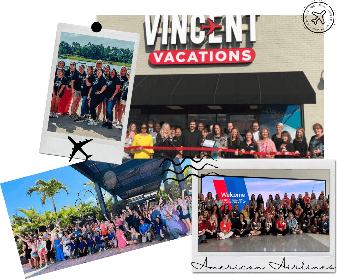
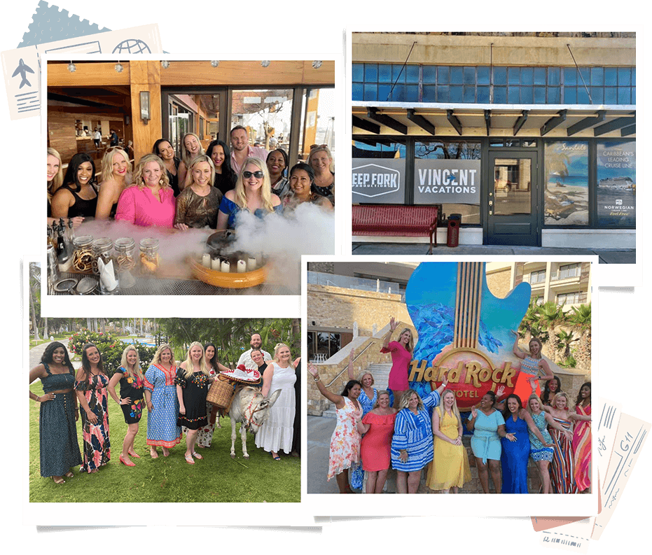
We recognize that vacations are not just an investment, but often the highlights of our lives, and we take that responsibility seriously. We want to ensure you have the best vacation experience.
Interested in a job in travel? Click here to learn: How to Become a Travel Agent
Overview
Introduction
Founded in 1543, Santiago de Guatemala (now known as La Antigua Guatemala, or simply Antigua) was the capital of Spain's Central American confederacy and the fourth most important city in the Americas (after Mexico City, Lima and Zacatecas) in the 1500s.
Antigua was devastated by an earthquake in 1773, which, combined with damage from earlier earthquakes, persuaded the government to relocate the capital to the site of present-day Guatemala City. That seeming misfortune turned out to be a blessing in disguise.
Isolation and longtime neglect served Antigua well. More than two centuries of underdevelopment left the town with a treasure trove of dilapidated but historical structures, many of which have been rehabilitated into chic restaurants, shops and hotels.
Antigua can be seen on a day's excursion from Guatemala City, which is 28 mi/45 km to the east, but it deserves more time. Some visitors prefer to use this colonial gem as their base for touring the country (instead of the capital). It has a large English-speaking community, a wide range of accommodations, upscale and medium-priced restaurants, espresso bars, delicious baked goods, literally dozens of language schools, plenty of galleries, and for nightlife, jazz clubs and discos.
Antigua is also one of the best places to go in Guatemala if you want to learn to speak Spanish. About 75 schools in town offer intensive classes. But be sure to check ahead of time to know exactly what you'll get, as not all of these schools are on the up-and-up. Some courses include lodging with Guatemalan families.
Visitors also can study various arts and crafts (backstrap weaving, drawing, painting, ceramics, photography and so forth) at the Art Workshops in La Antigua Guatemala. It's not a fully Guatemalan experience, however, as a group of U.S. for-profit artists operates those workshops, not the Guatemalans themselves.
Overview
Introduction
Guatemala, often trumpeted by travel agencies and guidebooks as "the country of eternal spring," is one of the most-often listed travel destinations in Central America: the stunning Maya ruins at Tikal, the well-preserved colonial city of Antigua, a vibrant indigenous culture, active volcanoes, highland lakes and exotic wildlife are its chief draws. But the savvy traveler knows that traveling to these gems and safely enjoying them can be a challenge in Guatemala, one of the poorest countries in the Western Hemisphere.
From the 1950s until the mid-1990s, political unrest, followed by the country's bloodiest civil war, were deterrents to travelers—though many of the major attractions were far from the areas of fighting. However, since the war ended in 1996, there has been a spate of improvements in tourist accommodations and infrastructure. Luxury hotels have been built, roads have been upgraded and cruise-ship passengers have begun arriving again at the country's two modern ports of Santo Tomas and Puerto Quetzal.
At the same time, despite these improvements, a continuing high crime rate—including some violent attacks targeting travelers (and those wishing to adopt children in particular)—and endemic poverty have made Guatemala at best unpredictable and potentially dangerous.
We still think Guatemala is an exceptional destination, but we don't take the risks lightly. We urge all visitors to be extremely cautious, and we strongly recommend that you stick to the major tourist destinations and see them on a tour organized by a reputable operator. For added protection, a security escort may be booked for tourist groups through the INGUAT, the Guatemalan tourist institute. Though the vast majority of travelers who venture off the beaten trail enjoy their trips without incident, keep in mind that the problems that do occur generally happen away from large groups or well-traveled areas.
Plenty of tours are available that take in the best of Guatemala. One destination that shouldn't be missed is Tikal—the greatest of the ruins left from the age of the ancient Maya, whose accomplishments in the fields of architecture, mathematics and astronomy are a source of national pride and universal awe. In fact, we think Tikal (and a trip to the nearby island of Flores) is one of the most impressive ruins in the world, in a class with such places as Machu Picchu in Peru or the Valley of the Kings in Egypt. Tikal, with its complex of more than 30 different sites, is alone worth a trip to Guatemala.
But you needn't stop there. Guatemala's ecotourism opportunities (especially bird-watching and forest trekking), continue to increase, particularly in the areas surrounding the natural beauty of the Rio Dulce and Lake Atitlan—considered by many as the world's most beautiful lake—as well as the international-traveler base in the colorful colonial town of Antigua.
Geography
Guatemala is at the top (northwest) end of Central America, bordered by Mexico, Belize, Honduras and El Salvador. It has a very small piece of Caribbean coastline and a longer stretch dotted with black-sand beaches along the Pacific. Much of the country is covered by jungle and rain forest. Mountains—including 35 active volcanoes—are concentrated in the central and western parts of the country. The highest volcano (also the highest in all of Central America), Tajumulco, reaches 13,800 ft/4,200 m.
History
The ancestors of the Maya developed agriculture at some point before 2000 BC and so became less dependent on hunting, fishing and gathering. Corn was the reliable staple that allowed the Maya and other great cultures of what is now Mexico and Central America to flourish.
The ancient Maya civilization eventually covered large areas of Mesoamerica. It reached its zenith between AD 250 and 800, though the civilization was still in existence—albeit in a much reduced state—when Europeans arrived in the early 1500s. Today, the Maya of Guatemala's highlands—those furthest removed from colonial influence—continue to practice many of their ancestors' traditions and beliefs.
The Spaniards conquered the weakened and then-divided Maya and took control of what is now called Guatemala in 1524. During the colonial period, Spanish-born colonists held the reins of power, but large groups of Creoles (Spaniards born in the New World) and mestizos (those of mixed Spanish and indigenous heritage) also developed. At the bottom of the social hierarchy were those of pure Amerindian or Afro-Caribbean heritage.
Guatemala gained independence from Spain in 1821, and after a few years as a member of a confederation of Central American states, it became a separate republic in 1847.
Guatemala's seemingly endless political unrest was exacerbated by a 1954 coup—assisted by the U.S. Central Intelligence Agency—that turned out a democratically elected leftist government. A series of military or military-influenced governments then ruled the country with a heavy hand, and resistance became armed and organized.
In response to growing popularity of guerrillas among the landless indigenous people in the 1960s, the army unleashed a campaign of terror in which thousands of people were killed and entire villages were massacred. In late 1996, the civil war ended when a series of agreements was signed between the Guatemalan government and guerrilla insurgents. Over its 36-year history, the war claimed the lives of as many as 200,000 people.
Since the 1996 peace treaty, relations have improved between the Maya and the Ladinos (as those of mixed Spanish and Amerindian descent are known). But Guatemalan life has been far from harmonious. The 2000-04 presidency of Alfonso Portillo (who had very close ties to former president Gen. Efrain Rios Montt) marked a period of skyrocketing crime and rampant corruption. Guatemala City in particular became a very dangerous place.
The next president, Alvaro Colom, took office in early 2008, successfully continuing his predecessor Oscar Berger's policy of curbing corruption and violence; many Guatemalans now believe social conditions are improving, although the economy remains problematic.
After relatively peaceful elections, Colom was succeeded in 2012 by Otto Perez Molina. He is the first former military official to be elected to the presidency since Guatemala's return to democratic elections in 1986, but is dogged by controversy, having proposed legalization of drugs, and is rumored to have committed human rights abuses when in the military.
The business climate of late has improved, but poverty remains widespread in Guatemala, Central America's most populous country. More than half of the people are Maya (the largest indigenous population in the region), the vast majority of whom still live in small farming villages, growing corn and beans as their ancestors did. They are famous for their intricate handmade textiles of brilliant reds, yellows and purples. Numerous Mayan dialects are still spoken in Guatemala—with many dialects spoken by fewer than 100 people. In remote areas of the highlands, you may hear more Mayan than Spanish, even though Spanish is the country's official language.
Snapshot
Guatemala's main attractions include Maya ruins (especially Tikal), beautiful scenery, indigenous markets and culture, Spanish colonial towns, lakes, volcanoes, rain forests, hiking, bird-watching, good food, and clothing and blankets hand woven in traditional Maya patterns.
Anyone interested in Central American (especially Maya) culture and history can enjoy Guatemala, but you should take appropriate precautions against crime. Those uncomfortable in developing countries and those who seek polished resort areas should find another destination.
Potpourri
Guatemala has 23 recognized Amerindian languages, more than any other country in Central America.
Stela D at the Maya ruins of Quirigua is so wonderfully decorated with carvings and glyphs that its image was chosen to adorn Guatemala's 10-centavo coin.
Guatemala boasts three UNESCO World Heritage sites: Tikal National Park, the colonial city of Antigua, and the archaeological park and Maya ruins at Quirigua. There are no fewer than 18 additional sites throughout the country that have been nominated as possible World Heritage sites.
During the colonial period in Guatemala from 1523 to 1821, 17 large earthquakes shook the city of Antigua. The worst hit in 1773—after which the city had to be completely rebuilt.
Tikal harbors more than Maya ruins. About 300 species of birds live there, along with howler and spider monkeys.
The country's Mam indigenous people, centered about Todos Santos Cuchumatan, are considered by anthropologists to have the most intact social structure and lifestyle of any in the country, with a way of life that has remained essentially unchanged for centuries.
Location
Guatemala's primary Caribbean port is Santo Tomas de Castilla (often referred to as Santo Tomas), situated in an inlet southwest of the industrial port of Puerto Barrios, and technically a part of that city. Most cruise ships tie up at Santo Tomas' modern pier, which is often busy with cargo ships as well. A small market has been set up on the dock so that cruise passengers can buy local handicrafts. The port isn't really geared for tourists yet—don't expect to find a tourist information booth or waiting taxi drivers. And there isn't much to do nearby—Santo Tomas itself, formerly known as Matias de Galvez, has a population of about 7,500 people. (The Santo Tomas port was built to replace the aging dock at Puerto Barrios, built in the early 1900s as a loading dock for bananas.)
If you don't sign up for a shore excursion, you can take a complimentary shuttle boat across the lagoon to the Best Western Cayos del Diablo Beach Hotel. You can lounge on the beach (don't expect much) or take a short guided walk on a jungle trail near the hotel for about US$5 per person. The hotel has a pool, as well as a bar and a restaurant.
Just north of Santo Tomas is Livingston (known locally as La Buga), a lively Caribbean-style village of brightly painted buildings that can be reached only by boat. Settled originally by Garifuna blacks who had escaped slavery, the town is rich in both history and culture. A few small ships stop there as part of an excursion up the Rio Dulce to Lake Izabal.
Guatemala's major Pacific port for cruise ships is tiny Puerto Quetzal, about halfway between Mexico and El Salvador on what is often called Guatemala's Pacific watershed. (Because of the area's proximity to the volcanic hills in the interior, you'll see long stretches of black-sand beaches.) Puerto Quetzal has replaced the seedier-looking Puerto San Jose, but nonetheless it isn't really geared for tourists either—the dock is used mainly for unloading cargo when cruise ships aren't around. There are no nearby attractions, except for a small beach—a better one can be found at Balneario Likin, an upscale resort and residential complex to the east that is popular with wealthy Guatemalans.
Shore Excursions
Cruise ships visit Guatemalan ports on either the Pacific or Caribbean coast, but air service within Guatemala has made it possible to enjoy many of the same shore excursions from either side of the country. Most cruise lines offer a tour to the ruins of Tikal in north-central Guatemala and a tour to the Copan ruins in northern Honduras. To go to either, you must travel from the port by chartered plane. Advance reservations are required—sign up early (especially for Tikal tours), as space is limited.
Other shore excursions visit Chichicastenango—if your ship stops in Puerto Quetzal on a Thursday or Sunday, don't miss the chance to attend the liveliest market in Guatemala. Another tour, which is usually offered only by ships stopping at Puerto Quetzal, includes a visit to Antigua and Guatemala City, definitely two must-see destinations. Other options include trips to the quaint villages and beautiful scenery at Lake Atitlan, the Maya ruins at Quirigua and the jungle environment of Rio Dulce. Increasingly, bird-watching and coastal trekking excursions are also offered in conjunction with cruise lines.
Overview
Introduction

Officially founded in 1776, Guatemala City, Guatemala, is the capital of the country and the largest city in Central America. It has a crowded and noisy old section—where almost all of the colonial-era architectural and historic sites are found—that is almost impossible to drive through, but the other side of the city is modern and dynamic, with shopping malls, luxury hotels and convention and financial centers. As with most large cities in the developing world, it has sprawling shantytowns.
Overview
Introduction
Jurmala, which means "seaside," is a lovely 20-mi-/32-km-long cluster of 14 historical centers on the shore of the Gulf of Riga (promotionally known as the Baltic Riviera), 10 mi/15 km west of Riga.
The most popular points are Majori and Dzintari. Several international music festivals are held in Dzintari regularly. Majori, in turn, is a perfect place for a stroll, with a nice pedestrian walkway lined with small souvenir shops, ice-cream parlors and sidewalk cafes. Bulduri has the most sumptuous mansions of the 19th century, and the sea is rather shallow there.
The area abounds with wide beaches, dunes and elegant cottages near piney woods. Latvians go there to enjoy the area's spas, mineral springs and therapeutic mud. Beaches meet the European Union's water-quality standards, and the shallow waters are frequently warm. Amber can occasionally be found on the beach after a storm.
Overview
Introduction
At the southern tip of Lake Malawi, this national park encompasses the bulk of the Nankhumba Peninsula, all of the Cape Maclear Peninsula and several offshore islands. In addition to boating, visitors can enjoy bird-watching and animal viewing (baboon, hippos and monkeys predominate). An underwater trail at Mitande Rocks, southwest of Thumbi Island, provides one of the best views of Lake Malawi's many freshwater fish. Most of these fish are in the cichlid family and are brightly colored and patterned. Again, it is important to be aware that bilharzia—the parasite that can cause liver damage—may be present in certain parts of the lake. The best way to explore the park is by kayak, which can be hired for a gentle paddle around the rocky coastline. 150 mi/245 km east of Lilongwe. Overview
Introduction
Malabo, the nation's capital, on the northern end of Bioko, was first colonized by the Portuguese in 1494. It later fell into Spanish hands and then became a British naval station in the 19th century. After British interest in the area waned, the Spanish took over again until independence came in 1968. Much of the town appears to belong to previous centuries—the cathedral square is characterized by old colonial architecture, thick walls, shutters and blinds on the buildings, corrugated-iron roofing, wrought-iron work and Spanish tiles. The petroleum boom has created sharp contrasts in wealth and modernization around the city, leaving pleasant neighborhoods adjacent to trash-strewn shantytowns.
Worth visiting is the Spanish Cultural Center of Malabo, which is a nice example of Spanish architecture and host of monthly cultural events. Classes in Spanish are also offered periodically. Afterward, try a walk out onto the peninsula where the revitalized Hotel Bahia sits. The hotel's patio is a nice place to sip a drink and look at the ocean. Malabo is built around a natural harbor that's the crater of an ancient volcano. You'll see the presidential compound on the crater arm opposite the hotel (do not take pictures). Also visit the modest but tasteful cathedral. Much of Malabo has a languid, sleepy feel to it, but with the infusion of foreigners from the petroleum industry, there is hustle and bustle in the streets and a modest amount of nightlife in the nightclubs and bars.
A worthwhile excursion out of the city for hardy and adventurous souls is an ascent of Pico de Basile (10,200 ft/3,110 m), directly inland from the capital city. (You must obtain permission for this ascent from the local authorities, but they often are reluctant to grant it because of a radio beacon on top of the peak.) On the ascent, the lucky (and observant) can see birds and monkeys unique to the island.
Overview
Introduction

Long known primarily as a package holiday mecca, Malaga continues to give incoming passengers even more reason to stick around. The strategy of positioning itself as an urban cultural center, in contrast to its smaller, strictly sun-and-beach-resort neighbors, pays off.
Of course, being the birthplace of Pablo Picasso is no bad thing, and city officials have leveraged that to great advantage, attracting big-name art collections to settle there. In fact, Malaga even comes across as a bit museum-crazy, focusing on everything from wine production to the global development of music to automobile design.
Although the urban sprawl may be unappealing at first glance, the Old City of Malaga is actually green, lively and conveniently compact, with its cultural and entertainment offerings in close proximity to beaches. The redevelopment of the port into a retail and leisure area, along with the second-largest cruise ship facility in Spain, make Malaga even more attractive and accessible.
Must See or Do
Sights—Admiring the Alcazaba's outer ramparts and the interior details of its palace; taking in the panoramic view from the Castillo de Gibralfaro; appreciating the Cathedral of Malaga's majesty, both inside and out.
Museums—Seeing the full range of Picasso's talent at Museo Picasso; journeying through art of the 20th and 21st centuries in the Centre Pompidou Malaga; the impressive variety of temporary exhibits at the Centro de Arte Contemporaneo.
Memorable Meals—Splurging on the 20-dish tasting menu at Michelin-starred Jose Carlos Garcia; sipping local wines and munching Iberian cured meats and cheeses while enjoying the incredible atmosphere at Bodega El Pimpi; trying an espeto de sardinas or pescaito frito at a beachside chiringuito.
Late Night—Wine and fantastic tapas at El Meson de Cervantes; sipping on a cocktail in the classy lounge at Puerta Oscura.
Walks—Window-shopping your way down Calle Marques de Larios and through the lanes of the Old City; strolling through the tropical lushness of the Parque de Malaga or the Jardin Botanico-Historico La Concepcion; promenading along the Paseo Maritimo.
Especially for Kids—A fun, hands-on music lesson from a virtual teacher at the Museo Interactivo de la Musica; cycling along the seaside promenade.
Location
The port of Malaga, right in the city, has three cruise ship berths and two terminals offering all the usual passenger-handling and hospitality services, including tourist information desks. Shuttle buses run at frequent intervals taking passengers to and from the Old City.
Within walking distance is Muelle Uno, an open-air shopping center that has restaurants and bars overlooking the marina; it's also home to the Centre Pompidou Malaga art museum. Adjacent to that is Muelle Dos, which features an attention-grabbing tall white pergola along the quayside, as well as even more restaurants and a museum dedicated to the sea life of the western Mediterranean. Just across the street from there is the lush Parque de Malaga and, beyond that, Malaga's Old City. The nearest beach is about a 10-minute walk.
Shore Excursions
Most shore excursions focus on the Old City attractions, including walking, cycling and tapas tours. Popular half-day excursions include Marbella and Puerto Banus. Full-day trips will take you to Ronda, or to Granada to visit the Alhambra.
Overview
Introduction
This island, the second largest in the Solomons, is most often seen on a full-day air tour from Guadalcanal.
The two most visited areas are actually offshore: Alite Village and Laulasi Village are located on small man-made islands that sit on the reefs surrounding Malaita. The islands were built more than 300 years ago to protect the lowland villagers from ferocious hill tribes. The villages offer a good look at a more authentic island lifestyle than is seen in the capital. You can watch shell money being made (you can exchange your money for the finished versions) and ride in a canoe to Alite Village. Also, be sure to see Langalanga Lagoon (excellent snorkeling) and visit a customhouse.
If you get a chance, visit the Shark Worshippers. These islanders believe that sharks are the reincarnated souls of their ancestors. During a ritual "shark calling," the high priest summons each shark by its human name, and a boy standing on a submerged rock feeds the shark a piece of cooked pork. Incredibly, the sharks eat the pork offerings without harming the villagers swimming among them.
The main town, Auki, offers limited accommodations—advance reservations are recommended. Conditions are somewhat primitive, so this is really a destination for experienced travelers only. In addition, Kwaio tribesmen, who don't recognize the government, live in the mountainous part of Malaita. Travelers should avoid that area.
Overview
Introduction
This island is rich in traditional culture—many people there live much the same way their ancestors did centuries ago. Ceremonial spears and masks are important to their everyday life. Near Sanwir you can hike to a long-unused site where cannibalism was practiced by the Big Nambas (the other major cultural group on the island are known as the Small Nambas). Be sure to visit one of the caves where Big Nambas chiefs were buried. Good examples are found near Tenmaru and Tanmial. To learn more about the Small Nambas, head for Wintua, where you can arrange visits to local villages known for maintaining the traditional ways (dress, dancing and handicrafts). If you have the time, we recommend a side trip to tiny Vao island: You get there by canoe. Malekula is 100 mi/160 km northwest of Efate and just south of Espiritu Santo. Overview
Introduction
A visit to this interior city offers a welcome relief for visitors arriving from the hot desert area: Malange, at an elevation of 4,000 ft/1,220 m, is much cooler. But there isn't much to do there, aside from leaving the city to see the nearby Kalandula Waterfall. 220 mi/350 km southeast of Luanda. Overview
Introduction
Most people visit tiny Malawi on their way somewhere else. Squeezed between southern and eastern Africa, this poor, densely populated little country makes a convenient stopover for those en route from, say, Mozambique to Tanzania.
Those who do make the stop may be surprised. For such a thin sliver of a country, Malawi offers a variety of attractions: lakes, rivers, mountains, game parks and villages. Its people are also a big attraction, and they are often referred to as some of the friendliest people in Africa.
We think Malawi has a subtle appeal; if you get the chance to perch on a mountain cliff above Cape Maclear and watch the sun sink into Lake Malawi as fishermen return to shore with the day's catch, you'll understand what we mean. The pace of life in Malawi is timeless, and the warm, sleepy atmosphere makes it impossible not to relax.
Geography
Landlocked Malawi is dominated by Lake Malawi and the Great Rift Valley, which cuts through the country north to south (on either side of the valley are plateaus 3,000-4,000 ft/900-1,200 m high). In the north, the Nyika Uplands reach 8,500 ft/2,600 m, and in the south, mountains climb to 9,848 ft/3,002 m.
Lake Malawi is the ninth-largest lake in the world. It is roughly 350 mi/560 km long, 50 mi/80 km wide and 2,300 ft/700 m deep, and forms most of the eastern border between Malawi and Mozambique. For such a large body of water, only one river, the Shire, drains from it, which eventually joins the Zambezi River farther south in Mozambique.
History
Malawi enjoyed relative calm and isolation from the outside world until the 1820s, when Arab slave traders marched into the area from the coast and carried away many of its residents to sell in the slave markets of Kilwa Kivinje and Zanzibar. Europeans—except for some wandering Portuguese merchants—didn't pay much attention to Malawi until 1859. That was the year the explorer and missionary Dr. David Livingstone (of "Dr. Livingstone, I presume?" fame) laid eyes on Lake Malawi, which he described as a "lake of stars," referring to its glittering surface. He reported that the residents called the lake Nyasa, though it is actually just a local word meaning "lake." Nyasaland was colonized by Great Britain in 1883 and remained under British control until 1964, when it gained its independence. The country's name was changed to Malawi, which means "reflected light of bright haze."
For the first three decades of its existence, Malawi was ruled by the aged despot Dr. Hastings Banda, best known for intransigent and idiosyncratic policies such as banning short skirts on women and hair below the collar on men, and recognizing apartheid South Africa. A referendum in 1993 ended one-party rule, and in elections the following year, Banda was voted out of office. His death in 1997 (at age 99) marked the end of an era.
Malawi is a poor and crowded country that relishes political freedom but is struggling to recover from economic mismanagement and rising crime. Most of the population relies on subsistence farming and fishing to survive. The country has suffered from drought and poor harvests in and has often had to look south to the richer African nations for food aid.
Snapshot
The foremost attractions in Malawi are spectacular mountain and lake scenery, tea plantations, traditional villages, wild game and history.
Malawi will appeal to travelers who are in the area and enjoy cool mountain scenery or lounging on lake beaches. Don't go expecting to see a wide variety of animals (any other country in southeastern Africa—except Mozambique—is better), and don't expect good shopping or active nightlife.
Potpourri
Lake Malawi National Park near Cape Maclear at the southern tip of the lake is a World Heritage Site and was the world's first freshwater national park.
Lake Malawi, Africa's third-largest lake, covers 20% of the country. The lake's fish provide the main source of protein for most Malawians, and an estimated 500-1,000 fish species are thought to be unique to Lake Malawi. The variety of fish there is greater than any found in all the lakes of both Europe and North America.
Lilongwe, Malawi's capital city, was custom-built using apartheid funds. It replaced Zomba as the capital in 1975. However, Zomba remained the seat of parliament and site of the president's residence until 1994.
The mushroom-shaped straw roofs in Malawi are designed to protect the mud walls of huts during heavy rains.
The three major ethnic groups in the country are the Chewa (central), the Nyanja (south) and the Tumbuka (north). Other peoples represented include the Ngoni (a Zulu offshoot), Tonga and Yao. Though there are clear differences, there is little feuding between the groups.
Courtesy and cooperation are highly valued in Malawi, and most visitors are impressed with the residents' warmth and politeness. Although the country is densely populated and the people are relatively poor, they welcomed, housed and fed close to 1 million refugees from the civil war in Mozambique. Most of those refugees returned to Mozambique after the civil war ended in 1994.
Malawi fishermen use canoes (bwatos) made from hollow tree trunks to fish on the lake.
Overview
Introduction
Malaysia has fervently embraced modern technology—it boasts two of the world's tallest skyscrapers and a super multimedia/cyber corridor.
But Malaysia still has some of the world's most remote rain forests (in Sabah and Sarawak); one of Southeast Asia's most vibrant old ports (George Town, Penang); and an atmospheric, colonial hill station (the Cameron Highlands). Even in Kuala Lumpur, the capital, which bristles with ambitious new building projects, you can still find exotic markets and plenty of local color. As a result, travelers to Malaysia can easily ratchet up or down the levels of adventure and comfort they want to experience.
Although Malaysia is predominantly an Islamic country, most Muslims there practice a more moderate form of Islam. Muslim women who choose to wear headscarves and modest clothing usually do so with bright and cheerful flair. More conservative followers prevail along the east coast of the peninsula, particularly in Kelantan and Terengganu, where alcohol is strictly controlled and women there find increased restrictions on their clothing and activity choices. These things will have little impact on visitors; however, respecting local customs and practicing modesty in clothing and attitude will go a long way in winning favor there.
Like many of its neighbors, Malaysia suffered damage and loss of life from the tsunamis that struck Southeast Asia in December 2004, but because much of the nation was shielded from the impact of the waves by Sumatra, only the northern regions, especially the islands of Penang and Langkawi, suffered considerable damage.
Geography
The South China Sea divides Malaysia roughly in half. Peninsular Malaysia, the western half, is home to two-thirds of the country's 31.6 million inhabitants. The states of Sabah and Sarawak make up the eastern half, which mostly occupies the northern third of the island of Borneo. In both areas, coastal lowlands give way to mountainous interiors and lush, tropical vegetation abounds. The rain forests are believed to be some of the oldest in the world. The nation includes dozens of small islands.
History
History books have made note of Malaysia since the Srivijaya Empire, which controlled much of the region from the seventh century to the 10th century. Afterward, the first kingdom centered on the Malay Peninsula was founded in Melaka (also often spelled Malacca) in the early 15th century. Melaka soon became a sultanate with close ties to both China and India. The increase in the spice trade turned Melaka into one of Southeast Asia's leading ports. Subsequent alliances with China and Arabia brought Chinese and Arab traders together in Malaysia, initiating a unique Chinese-Muslim cultural blend.
Local control of the peninsula, however, was short-lived. Portuguese traders and soldiers took over Melaka in 1571, adding yet another influence to the cultural mix, and remained until the Dutch took over in 1641. In time, the Dutch were gradually supplanted by the British, who also turned Penang into a thriving port and eventually brought all of Malaysia into their colonial empire. Three generations of "White Rajahs" ruled in Sarawak until the independent state was finally ceded to the British Crown after World War II. Malaysia agitated for and won its independence in 1957. Until it was rocked by the economic crash in 1997-98 that affected most of Asia, the country's increasing commitment to modernization continued to pay off. Today it appears to be back on the path to prosperity.
Snapshot
Malaysia's chief attractions are a mix of cultures (predominantly Malay, Chinese and Indian), Muslim and Western influences, indigenous tribal people, ancient rain forests, tropical beaches, coral reefs, ecotourism and adventure tours, exciting bazaars, wildlife, handicrafts, exotic food and world-class luxury resorts.
Malaysia will appeal most to experienced, somewhat adventurous travelers who have a strong interest in Asian cultures. Don't go unless you have a high tolerance for heat and humidity.
Potpourri
The 1999 film Anna and the King, based on the fictional romance of a young English schoolteacher in the court of a Siamese king, was shot on Langkawi Island because the Thai authorities refused to allow the production company to film in Thailand. Thailand's King Mongkut, depicted in the story as a proud and backward buffoon, was actually, by all accurate records, a brilliant leader.
The largest cave in Malaysia is the Sarawak Chamber in Gunung Mulu National Park. Several Boeing 747s could easily fit inside.
Sabah is home to the rafflesia, the largest flower in the world. This rare parasitic plant's flower can be 3 ft/1 m in diameter and weigh 15 lbs/7 kg, but it emits a repulsive odor, similar to that of rotting meat. Hence it is referred to as the "corpse flower."
The indigenous people of peninsular Malaysia are called collectively "Orang Asli" (original people). On Borneo they are known as Dayak, and they were once feared headhunters. Malays are also known as "Bumiputra," or "sons of the soil," a title that affords them some special privileges in the federation (other people such as the Orang Asli, Sabahans, Sarawakians and Peranakans, are also classified as Bumiputra).
The national language of Malaysia is Bahasa and is commonly spoken. However, many people, especially in Kuala Lumpur, speak English fluently. The government has encouraged English as the language of business, but it continues to thrive for other reasons. For instance, the Chinese of Malaysia do not share a common tongue and often speak English to one another. The same applies to Indians.
Overview
Introduction
Founded in 1543, Santiago de Guatemala (now known as La Antigua Guatemala, or simply Antigua) was the capital of Spain's Central American confederacy and the fourth most important city in the Americas (after Mexico City, Lima and Zacatecas) in the 1500s.
Antigua was devastated by an earthquake in 1773, which, combined with damage from earlier earthquakes, persuaded the government to relocate the capital to the site of present-day Guatemala City. That seeming misfortune turned out to be a blessing in disguise.
Isolation and longtime neglect served Antigua well. More than two centuries of underdevelopment left the town with a treasure trove of dilapidated but historical structures, many of which have been rehabilitated into chic restaurants, shops and hotels.
Antigua can be seen on a day's excursion from Guatemala City, which is 28 mi/45 km to the east, but it deserves more time. Some visitors prefer to use this colonial gem as their base for touring the country (instead of the capital). It has a large English-speaking community, a wide range of accommodations, upscale and medium-priced restaurants, espresso bars, delicious baked goods, literally dozens of language schools, plenty of galleries, and for nightlife, jazz clubs and discos.
Antigua is also one of the best places to go in Guatemala if you want to learn to speak Spanish. About 75 schools in town offer intensive classes. But be sure to check ahead of time to know exactly what you'll get, as not all of these schools are on the up-and-up. Some courses include lodging with Guatemalan families.
Visitors also can study various arts and crafts (backstrap weaving, drawing, painting, ceramics, photography and so forth) at the Art Workshops in La Antigua Guatemala. It's not a fully Guatemalan experience, however, as a group of U.S. for-profit artists operates those workshops, not the Guatemalans themselves.
Overview
Introduction
Guatemala, often trumpeted by travel agencies and guidebooks as "the country of eternal spring," is one of the most-often listed travel destinations in Central America: the stunning Maya ruins at Tikal, the well-preserved colonial city of Antigua, a vibrant indigenous culture, active volcanoes, highland lakes and exotic wildlife are its chief draws. But the savvy traveler knows that traveling to these gems and safely enjoying them can be a challenge in Guatemala, one of the poorest countries in the Western Hemisphere.
From the 1950s until the mid-1990s, political unrest, followed by the country's bloodiest civil war, were deterrents to travelers—though many of the major attractions were far from the areas of fighting. However, since the war ended in 1996, there has been a spate of improvements in tourist accommodations and infrastructure. Luxury hotels have been built, roads have been upgraded and cruise-ship passengers have begun arriving again at the country's two modern ports of Santo Tomas and Puerto Quetzal.
At the same time, despite these improvements, a continuing high crime rate—including some violent attacks targeting travelers (and those wishing to adopt children in particular)—and endemic poverty have made Guatemala at best unpredictable and potentially dangerous.
We still think Guatemala is an exceptional destination, but we don't take the risks lightly. We urge all visitors to be extremely cautious, and we strongly recommend that you stick to the major tourist destinations and see them on a tour organized by a reputable operator. For added protection, a security escort may be booked for tourist groups through the INGUAT, the Guatemalan tourist institute. Though the vast majority of travelers who venture off the beaten trail enjoy their trips without incident, keep in mind that the problems that do occur generally happen away from large groups or well-traveled areas.
Plenty of tours are available that take in the best of Guatemala. One destination that shouldn't be missed is Tikal—the greatest of the ruins left from the age of the ancient Maya, whose accomplishments in the fields of architecture, mathematics and astronomy are a source of national pride and universal awe. In fact, we think Tikal (and a trip to the nearby island of Flores) is one of the most impressive ruins in the world, in a class with such places as Machu Picchu in Peru or the Valley of the Kings in Egypt. Tikal, with its complex of more than 30 different sites, is alone worth a trip to Guatemala.
But you needn't stop there. Guatemala's ecotourism opportunities (especially bird-watching and forest trekking), continue to increase, particularly in the areas surrounding the natural beauty of the Rio Dulce and Lake Atitlan—considered by many as the world's most beautiful lake—as well as the international-traveler base in the colorful colonial town of Antigua.
Geography
Guatemala is at the top (northwest) end of Central America, bordered by Mexico, Belize, Honduras and El Salvador. It has a very small piece of Caribbean coastline and a longer stretch dotted with black-sand beaches along the Pacific. Much of the country is covered by jungle and rain forest. Mountains—including 35 active volcanoes—are concentrated in the central and western parts of the country. The highest volcano (also the highest in all of Central America), Tajumulco, reaches 13,800 ft/4,200 m.
History
The ancestors of the Maya developed agriculture at some point before 2000 BC and so became less dependent on hunting, fishing and gathering. Corn was the reliable staple that allowed the Maya and other great cultures of what is now Mexico and Central America to flourish.
The ancient Maya civilization eventually covered large areas of Mesoamerica. It reached its zenith between AD 250 and 800, though the civilization was still in existence—albeit in a much reduced state—when Europeans arrived in the early 1500s. Today, the Maya of Guatemala's highlands—those furthest removed from colonial influence—continue to practice many of their ancestors' traditions and beliefs.
The Spaniards conquered the weakened and then-divided Maya and took control of what is now called Guatemala in 1524. During the colonial period, Spanish-born colonists held the reins of power, but large groups of Creoles (Spaniards born in the New World) and mestizos (those of mixed Spanish and indigenous heritage) also developed. At the bottom of the social hierarchy were those of pure Amerindian or Afro-Caribbean heritage.
Guatemala gained independence from Spain in 1821, and after a few years as a member of a confederation of Central American states, it became a separate republic in 1847.
Guatemala's seemingly endless political unrest was exacerbated by a 1954 coup—assisted by the U.S. Central Intelligence Agency—that turned out a democratically elected leftist government. A series of military or military-influenced governments then ruled the country with a heavy hand, and resistance became armed and organized.
In response to growing popularity of guerrillas among the landless indigenous people in the 1960s, the army unleashed a campaign of terror in which thousands of people were killed and entire villages were massacred. In late 1996, the civil war ended when a series of agreements was signed between the Guatemalan government and guerrilla insurgents. Over its 36-year history, the war claimed the lives of as many as 200,000 people.
Since the 1996 peace treaty, relations have improved between the Maya and the Ladinos (as those of mixed Spanish and Amerindian descent are known). But Guatemalan life has been far from harmonious. The 2000-04 presidency of Alfonso Portillo (who had very close ties to former president Gen. Efrain Rios Montt) marked a period of skyrocketing crime and rampant corruption. Guatemala City in particular became a very dangerous place.
The next president, Alvaro Colom, took office in early 2008, successfully continuing his predecessor Oscar Berger's policy of curbing corruption and violence; many Guatemalans now believe social conditions are improving, although the economy remains problematic.
After relatively peaceful elections, Colom was succeeded in 2012 by Otto Perez Molina. He is the first former military official to be elected to the presidency since Guatemala's return to democratic elections in 1986, but is dogged by controversy, having proposed legalization of drugs, and is rumored to have committed human rights abuses when in the military.
The business climate of late has improved, but poverty remains widespread in Guatemala, Central America's most populous country. More than half of the people are Maya (the largest indigenous population in the region), the vast majority of whom still live in small farming villages, growing corn and beans as their ancestors did. They are famous for their intricate handmade textiles of brilliant reds, yellows and purples. Numerous Mayan dialects are still spoken in Guatemala—with many dialects spoken by fewer than 100 people. In remote areas of the highlands, you may hear more Mayan than Spanish, even though Spanish is the country's official language.
Snapshot
Guatemala's main attractions include Maya ruins (especially Tikal), beautiful scenery, indigenous markets and culture, Spanish colonial towns, lakes, volcanoes, rain forests, hiking, bird-watching, good food, and clothing and blankets hand woven in traditional Maya patterns.
Anyone interested in Central American (especially Maya) culture and history can enjoy Guatemala, but you should take appropriate precautions against crime. Those uncomfortable in developing countries and those who seek polished resort areas should find another destination.
Potpourri
Guatemala has 23 recognized Amerindian languages, more than any other country in Central America.
Stela D at the Maya ruins of Quirigua is so wonderfully decorated with carvings and glyphs that its image was chosen to adorn Guatemala's 10-centavo coin.
Guatemala boasts three UNESCO World Heritage sites: Tikal National Park, the colonial city of Antigua, and the archaeological park and Maya ruins at Quirigua. There are no fewer than 18 additional sites throughout the country that have been nominated as possible World Heritage sites.
During the colonial period in Guatemala from 1523 to 1821, 17 large earthquakes shook the city of Antigua. The worst hit in 1773—after which the city had to be completely rebuilt.
Tikal harbors more than Maya ruins. About 300 species of birds live there, along with howler and spider monkeys.
The country's Mam indigenous people, centered about Todos Santos Cuchumatan, are considered by anthropologists to have the most intact social structure and lifestyle of any in the country, with a way of life that has remained essentially unchanged for centuries.
Location
Guatemala's primary Caribbean port is Santo Tomas de Castilla (often referred to as Santo Tomas), situated in an inlet southwest of the industrial port of Puerto Barrios, and technically a part of that city. Most cruise ships tie up at Santo Tomas' modern pier, which is often busy with cargo ships as well. A small market has been set up on the dock so that cruise passengers can buy local handicrafts. The port isn't really geared for tourists yet—don't expect to find a tourist information booth or waiting taxi drivers. And there isn't much to do nearby—Santo Tomas itself, formerly known as Matias de Galvez, has a population of about 7,500 people. (The Santo Tomas port was built to replace the aging dock at Puerto Barrios, built in the early 1900s as a loading dock for bananas.)
If you don't sign up for a shore excursion, you can take a complimentary shuttle boat across the lagoon to the Best Western Cayos del Diablo Beach Hotel. You can lounge on the beach (don't expect much) or take a short guided walk on a jungle trail near the hotel for about US$5 per person. The hotel has a pool, as well as a bar and a restaurant.
Just north of Santo Tomas is Livingston (known locally as La Buga), a lively Caribbean-style village of brightly painted buildings that can be reached only by boat. Settled originally by Garifuna blacks who had escaped slavery, the town is rich in both history and culture. A few small ships stop there as part of an excursion up the Rio Dulce to Lake Izabal.
Guatemala's major Pacific port for cruise ships is tiny Puerto Quetzal, about halfway between Mexico and El Salvador on what is often called Guatemala's Pacific watershed. (Because of the area's proximity to the volcanic hills in the interior, you'll see long stretches of black-sand beaches.) Puerto Quetzal has replaced the seedier-looking Puerto San Jose, but nonetheless it isn't really geared for tourists either—the dock is used mainly for unloading cargo when cruise ships aren't around. There are no nearby attractions, except for a small beach—a better one can be found at Balneario Likin, an upscale resort and residential complex to the east that is popular with wealthy Guatemalans.
Shore Excursions
Cruise ships visit Guatemalan ports on either the Pacific or Caribbean coast, but air service within Guatemala has made it possible to enjoy many of the same shore excursions from either side of the country. Most cruise lines offer a tour to the ruins of Tikal in north-central Guatemala and a tour to the Copan ruins in northern Honduras. To go to either, you must travel from the port by chartered plane. Advance reservations are required—sign up early (especially for Tikal tours), as space is limited.
Other shore excursions visit Chichicastenango—if your ship stops in Puerto Quetzal on a Thursday or Sunday, don't miss the chance to attend the liveliest market in Guatemala. Another tour, which is usually offered only by ships stopping at Puerto Quetzal, includes a visit to Antigua and Guatemala City, definitely two must-see destinations. Other options include trips to the quaint villages and beautiful scenery at Lake Atitlan, the Maya ruins at Quirigua and the jungle environment of Rio Dulce. Increasingly, bird-watching and coastal trekking excursions are also offered in conjunction with cruise lines.
Overview
Introduction

Officially founded in 1776, Guatemala City, Guatemala, is the capital of the country and the largest city in Central America. It has a crowded and noisy old section—where almost all of the colonial-era architectural and historic sites are found—that is almost impossible to drive through, but the other side of the city is modern and dynamic, with shopping malls, luxury hotels and convention and financial centers. As with most large cities in the developing world, it has sprawling shantytowns.
Overview
Introduction
Jurmala, which means "seaside," is a lovely 20-mi-/32-km-long cluster of 14 historical centers on the shore of the Gulf of Riga (promotionally known as the Baltic Riviera), 10 mi/15 km west of Riga.
The most popular points are Majori and Dzintari. Several international music festivals are held in Dzintari regularly. Majori, in turn, is a perfect place for a stroll, with a nice pedestrian walkway lined with small souvenir shops, ice-cream parlors and sidewalk cafes. Bulduri has the most sumptuous mansions of the 19th century, and the sea is rather shallow there.
The area abounds with wide beaches, dunes and elegant cottages near piney woods. Latvians go there to enjoy the area's spas, mineral springs and therapeutic mud. Beaches meet the European Union's water-quality standards, and the shallow waters are frequently warm. Amber can occasionally be found on the beach after a storm.
Overview
Introduction
At the southern tip of Lake Malawi, this national park encompasses the bulk of the Nankhumba Peninsula, all of the Cape Maclear Peninsula and several offshore islands. In addition to boating, visitors can enjoy bird-watching and animal viewing (baboon, hippos and monkeys predominate). An underwater trail at Mitande Rocks, southwest of Thumbi Island, provides one of the best views of Lake Malawi's many freshwater fish. Most of these fish are in the cichlid family and are brightly colored and patterned. Again, it is important to be aware that bilharzia—the parasite that can cause liver damage—may be present in certain parts of the lake. The best way to explore the park is by kayak, which can be hired for a gentle paddle around the rocky coastline. 150 mi/245 km east of Lilongwe. Overview
Introduction
Malabo, the nation's capital, on the northern end of Bioko, was first colonized by the Portuguese in 1494. It later fell into Spanish hands and then became a British naval station in the 19th century. After British interest in the area waned, the Spanish took over again until independence came in 1968. Much of the town appears to belong to previous centuries—the cathedral square is characterized by old colonial architecture, thick walls, shutters and blinds on the buildings, corrugated-iron roofing, wrought-iron work and Spanish tiles. The petroleum boom has created sharp contrasts in wealth and modernization around the city, leaving pleasant neighborhoods adjacent to trash-strewn shantytowns.
Worth visiting is the Spanish Cultural Center of Malabo, which is a nice example of Spanish architecture and host of monthly cultural events. Classes in Spanish are also offered periodically. Afterward, try a walk out onto the peninsula where the revitalized Hotel Bahia sits. The hotel's patio is a nice place to sip a drink and look at the ocean. Malabo is built around a natural harbor that's the crater of an ancient volcano. You'll see the presidential compound on the crater arm opposite the hotel (do not take pictures). Also visit the modest but tasteful cathedral. Much of Malabo has a languid, sleepy feel to it, but with the infusion of foreigners from the petroleum industry, there is hustle and bustle in the streets and a modest amount of nightlife in the nightclubs and bars.
A worthwhile excursion out of the city for hardy and adventurous souls is an ascent of Pico de Basile (10,200 ft/3,110 m), directly inland from the capital city. (You must obtain permission for this ascent from the local authorities, but they often are reluctant to grant it because of a radio beacon on top of the peak.) On the ascent, the lucky (and observant) can see birds and monkeys unique to the island.
Overview
Introduction

Long known primarily as a package holiday mecca, Malaga continues to give incoming passengers even more reason to stick around. The strategy of positioning itself as an urban cultural center, in contrast to its smaller, strictly sun-and-beach-resort neighbors, pays off.
Of course, being the birthplace of Pablo Picasso is no bad thing, and city officials have leveraged that to great advantage, attracting big-name art collections to settle there. In fact, Malaga even comes across as a bit museum-crazy, focusing on everything from wine production to the global development of music to automobile design.
Although the urban sprawl may be unappealing at first glance, the Old City of Malaga is actually green, lively and conveniently compact, with its cultural and entertainment offerings in close proximity to beaches. The redevelopment of the port into a retail and leisure area, along with the second-largest cruise ship facility in Spain, make Malaga even more attractive and accessible.
Must See or Do
Sights—Admiring the Alcazaba's outer ramparts and the interior details of its palace; taking in the panoramic view from the Castillo de Gibralfaro; appreciating the Cathedral of Malaga's majesty, both inside and out.
Museums—Seeing the full range of Picasso's talent at Museo Picasso; journeying through art of the 20th and 21st centuries in the Centre Pompidou Malaga; the impressive variety of temporary exhibits at the Centro de Arte Contemporaneo.
Memorable Meals—Splurging on the 20-dish tasting menu at Michelin-starred Jose Carlos Garcia; sipping local wines and munching Iberian cured meats and cheeses while enjoying the incredible atmosphere at Bodega El Pimpi; trying an espeto de sardinas or pescaito frito at a beachside chiringuito.
Late Night—Wine and fantastic tapas at El Meson de Cervantes; sipping on a cocktail in the classy lounge at Puerta Oscura.
Walks—Window-shopping your way down Calle Marques de Larios and through the lanes of the Old City; strolling through the tropical lushness of the Parque de Malaga or the Jardin Botanico-Historico La Concepcion; promenading along the Paseo Maritimo.
Especially for Kids—A fun, hands-on music lesson from a virtual teacher at the Museo Interactivo de la Musica; cycling along the seaside promenade.
Location
The port of Malaga, right in the city, has three cruise ship berths and two terminals offering all the usual passenger-handling and hospitality services, including tourist information desks. Shuttle buses run at frequent intervals taking passengers to and from the Old City.
Within walking distance is Muelle Uno, an open-air shopping center that has restaurants and bars overlooking the marina; it's also home to the Centre Pompidou Malaga art museum. Adjacent to that is Muelle Dos, which features an attention-grabbing tall white pergola along the quayside, as well as even more restaurants and a museum dedicated to the sea life of the western Mediterranean. Just across the street from there is the lush Parque de Malaga and, beyond that, Malaga's Old City. The nearest beach is about a 10-minute walk.
Shore Excursions
Most shore excursions focus on the Old City attractions, including walking, cycling and tapas tours. Popular half-day excursions include Marbella and Puerto Banus. Full-day trips will take you to Ronda, or to Granada to visit the Alhambra.
Overview
Introduction
This island, the second largest in the Solomons, is most often seen on a full-day air tour from Guadalcanal.
The two most visited areas are actually offshore: Alite Village and Laulasi Village are located on small man-made islands that sit on the reefs surrounding Malaita. The islands were built more than 300 years ago to protect the lowland villagers from ferocious hill tribes. The villages offer a good look at a more authentic island lifestyle than is seen in the capital. You can watch shell money being made (you can exchange your money for the finished versions) and ride in a canoe to Alite Village. Also, be sure to see Langalanga Lagoon (excellent snorkeling) and visit a customhouse.
If you get a chance, visit the Shark Worshippers. These islanders believe that sharks are the reincarnated souls of their ancestors. During a ritual "shark calling," the high priest summons each shark by its human name, and a boy standing on a submerged rock feeds the shark a piece of cooked pork. Incredibly, the sharks eat the pork offerings without harming the villagers swimming among them.
The main town, Auki, offers limited accommodations—advance reservations are recommended. Conditions are somewhat primitive, so this is really a destination for experienced travelers only. In addition, Kwaio tribesmen, who don't recognize the government, live in the mountainous part of Malaita. Travelers should avoid that area.
Overview
Introduction
This island is rich in traditional culture—many people there live much the same way their ancestors did centuries ago. Ceremonial spears and masks are important to their everyday life. Near Sanwir you can hike to a long-unused site where cannibalism was practiced by the Big Nambas (the other major cultural group on the island are known as the Small Nambas). Be sure to visit one of the caves where Big Nambas chiefs were buried. Good examples are found near Tenmaru and Tanmial. To learn more about the Small Nambas, head for Wintua, where you can arrange visits to local villages known for maintaining the traditional ways (dress, dancing and handicrafts). If you have the time, we recommend a side trip to tiny Vao island: You get there by canoe. Malekula is 100 mi/160 km northwest of Efate and just south of Espiritu Santo. Overview
Introduction
A visit to this interior city offers a welcome relief for visitors arriving from the hot desert area: Malange, at an elevation of 4,000 ft/1,220 m, is much cooler. But there isn't much to do there, aside from leaving the city to see the nearby Kalandula Waterfall. 220 mi/350 km southeast of Luanda. Overview
Introduction
Most people visit tiny Malawi on their way somewhere else. Squeezed between southern and eastern Africa, this poor, densely populated little country makes a convenient stopover for those en route from, say, Mozambique to Tanzania.
Those who do make the stop may be surprised. For such a thin sliver of a country, Malawi offers a variety of attractions: lakes, rivers, mountains, game parks and villages. Its people are also a big attraction, and they are often referred to as some of the friendliest people in Africa.
We think Malawi has a subtle appeal; if you get the chance to perch on a mountain cliff above Cape Maclear and watch the sun sink into Lake Malawi as fishermen return to shore with the day's catch, you'll understand what we mean. The pace of life in Malawi is timeless, and the warm, sleepy atmosphere makes it impossible not to relax.
Geography
Landlocked Malawi is dominated by Lake Malawi and the Great Rift Valley, which cuts through the country north to south (on either side of the valley are plateaus 3,000-4,000 ft/900-1,200 m high). In the north, the Nyika Uplands reach 8,500 ft/2,600 m, and in the south, mountains climb to 9,848 ft/3,002 m.
Lake Malawi is the ninth-largest lake in the world. It is roughly 350 mi/560 km long, 50 mi/80 km wide and 2,300 ft/700 m deep, and forms most of the eastern border between Malawi and Mozambique. For such a large body of water, only one river, the Shire, drains from it, which eventually joins the Zambezi River farther south in Mozambique.
History
Malawi enjoyed relative calm and isolation from the outside world until the 1820s, when Arab slave traders marched into the area from the coast and carried away many of its residents to sell in the slave markets of Kilwa Kivinje and Zanzibar. Europeans—except for some wandering Portuguese merchants—didn't pay much attention to Malawi until 1859. That was the year the explorer and missionary Dr. David Livingstone (of "Dr. Livingstone, I presume?" fame) laid eyes on Lake Malawi, which he described as a "lake of stars," referring to its glittering surface. He reported that the residents called the lake Nyasa, though it is actually just a local word meaning "lake." Nyasaland was colonized by Great Britain in 1883 and remained under British control until 1964, when it gained its independence. The country's name was changed to Malawi, which means "reflected light of bright haze."
For the first three decades of its existence, Malawi was ruled by the aged despot Dr. Hastings Banda, best known for intransigent and idiosyncratic policies such as banning short skirts on women and hair below the collar on men, and recognizing apartheid South Africa. A referendum in 1993 ended one-party rule, and in elections the following year, Banda was voted out of office. His death in 1997 (at age 99) marked the end of an era.
Malawi is a poor and crowded country that relishes political freedom but is struggling to recover from economic mismanagement and rising crime. Most of the population relies on subsistence farming and fishing to survive. The country has suffered from drought and poor harvests in and has often had to look south to the richer African nations for food aid.
Snapshot
The foremost attractions in Malawi are spectacular mountain and lake scenery, tea plantations, traditional villages, wild game and history.
Malawi will appeal to travelers who are in the area and enjoy cool mountain scenery or lounging on lake beaches. Don't go expecting to see a wide variety of animals (any other country in southeastern Africa—except Mozambique—is better), and don't expect good shopping or active nightlife.
Potpourri
Lake Malawi National Park near Cape Maclear at the southern tip of the lake is a World Heritage Site and was the world's first freshwater national park.
Lake Malawi, Africa's third-largest lake, covers 20% of the country. The lake's fish provide the main source of protein for most Malawians, and an estimated 500-1,000 fish species are thought to be unique to Lake Malawi. The variety of fish there is greater than any found in all the lakes of both Europe and North America.
Lilongwe, Malawi's capital city, was custom-built using apartheid funds. It replaced Zomba as the capital in 1975. However, Zomba remained the seat of parliament and site of the president's residence until 1994.
The mushroom-shaped straw roofs in Malawi are designed to protect the mud walls of huts during heavy rains.
The three major ethnic groups in the country are the Chewa (central), the Nyanja (south) and the Tumbuka (north). Other peoples represented include the Ngoni (a Zulu offshoot), Tonga and Yao. Though there are clear differences, there is little feuding between the groups.
Courtesy and cooperation are highly valued in Malawi, and most visitors are impressed with the residents' warmth and politeness. Although the country is densely populated and the people are relatively poor, they welcomed, housed and fed close to 1 million refugees from the civil war in Mozambique. Most of those refugees returned to Mozambique after the civil war ended in 1994.
Malawi fishermen use canoes (bwatos) made from hollow tree trunks to fish on the lake.
Overview
Introduction
Malaysia has fervently embraced modern technology—it boasts two of the world's tallest skyscrapers and a super multimedia/cyber corridor.
But Malaysia still has some of the world's most remote rain forests (in Sabah and Sarawak); one of Southeast Asia's most vibrant old ports (George Town, Penang); and an atmospheric, colonial hill station (the Cameron Highlands). Even in Kuala Lumpur, the capital, which bristles with ambitious new building projects, you can still find exotic markets and plenty of local color. As a result, travelers to Malaysia can easily ratchet up or down the levels of adventure and comfort they want to experience.
Although Malaysia is predominantly an Islamic country, most Muslims there practice a more moderate form of Islam. Muslim women who choose to wear headscarves and modest clothing usually do so with bright and cheerful flair. More conservative followers prevail along the east coast of the peninsula, particularly in Kelantan and Terengganu, where alcohol is strictly controlled and women there find increased restrictions on their clothing and activity choices. These things will have little impact on visitors; however, respecting local customs and practicing modesty in clothing and attitude will go a long way in winning favor there.
Like many of its neighbors, Malaysia suffered damage and loss of life from the tsunamis that struck Southeast Asia in December 2004, but because much of the nation was shielded from the impact of the waves by Sumatra, only the northern regions, especially the islands of Penang and Langkawi, suffered considerable damage.
Geography
The South China Sea divides Malaysia roughly in half. Peninsular Malaysia, the western half, is home to two-thirds of the country's 31.6 million inhabitants. The states of Sabah and Sarawak make up the eastern half, which mostly occupies the northern third of the island of Borneo. In both areas, coastal lowlands give way to mountainous interiors and lush, tropical vegetation abounds. The rain forests are believed to be some of the oldest in the world. The nation includes dozens of small islands.
History
History books have made note of Malaysia since the Srivijaya Empire, which controlled much of the region from the seventh century to the 10th century. Afterward, the first kingdom centered on the Malay Peninsula was founded in Melaka (also often spelled Malacca) in the early 15th century. Melaka soon became a sultanate with close ties to both China and India. The increase in the spice trade turned Melaka into one of Southeast Asia's leading ports. Subsequent alliances with China and Arabia brought Chinese and Arab traders together in Malaysia, initiating a unique Chinese-Muslim cultural blend.
Local control of the peninsula, however, was short-lived. Portuguese traders and soldiers took over Melaka in 1571, adding yet another influence to the cultural mix, and remained until the Dutch took over in 1641. In time, the Dutch were gradually supplanted by the British, who also turned Penang into a thriving port and eventually brought all of Malaysia into their colonial empire. Three generations of "White Rajahs" ruled in Sarawak until the independent state was finally ceded to the British Crown after World War II. Malaysia agitated for and won its independence in 1957. Until it was rocked by the economic crash in 1997-98 that affected most of Asia, the country's increasing commitment to modernization continued to pay off. Today it appears to be back on the path to prosperity.
Snapshot
Malaysia's chief attractions are a mix of cultures (predominantly Malay, Chinese and Indian), Muslim and Western influences, indigenous tribal people, ancient rain forests, tropical beaches, coral reefs, ecotourism and adventure tours, exciting bazaars, wildlife, handicrafts, exotic food and world-class luxury resorts.
Malaysia will appeal most to experienced, somewhat adventurous travelers who have a strong interest in Asian cultures. Don't go unless you have a high tolerance for heat and humidity.
Potpourri
The 1999 film Anna and the King, based on the fictional romance of a young English schoolteacher in the court of a Siamese king, was shot on Langkawi Island because the Thai authorities refused to allow the production company to film in Thailand. Thailand's King Mongkut, depicted in the story as a proud and backward buffoon, was actually, by all accurate records, a brilliant leader.
The largest cave in Malaysia is the Sarawak Chamber in Gunung Mulu National Park. Several Boeing 747s could easily fit inside.
Sabah is home to the rafflesia, the largest flower in the world. This rare parasitic plant's flower can be 3 ft/1 m in diameter and weigh 15 lbs/7 kg, but it emits a repulsive odor, similar to that of rotting meat. Hence it is referred to as the "corpse flower."
The indigenous people of peninsular Malaysia are called collectively "Orang Asli" (original people). On Borneo they are known as Dayak, and they were once feared headhunters. Malays are also known as "Bumiputra," or "sons of the soil," a title that affords them some special privileges in the federation (other people such as the Orang Asli, Sabahans, Sarawakians and Peranakans, are also classified as Bumiputra).
The national language of Malaysia is Bahasa and is commonly spoken. However, many people, especially in Kuala Lumpur, speak English fluently. The government has encouraged English as the language of business, but it continues to thrive for other reasons. For instance, the Chinese of Malaysia do not share a common tongue and often speak English to one another. The same applies to Indians.










 Officially founded in 1776, Guatemala City, Guatemala, is the capital of the country and the largest city in Central America. It has a crowded and noisy old section—where almost all of the colonial-era architectural and historic sites are found—that is almost impossible to drive through, but the other side of the city is modern and dynamic, with shopping malls, luxury hotels and convention and financial centers. As with most large cities in the developing world, it has sprawling shantytowns.

