Ston Disney Travel Agents Near Me
We recognize that Disney vacations are not just an investment, but often the highlights of our lives, and we take that responsibility seriously. We want to ensure you have the best vacation experience.
Interested in a job in travel? Click here to learn: How to Become a Disney Travel Agent
Jump to section:
A B C D E F G H I J K L M N O P Q R S T U V W X Y Z
See our Disney travel agents near me.
Categories: Us Cities > Boston
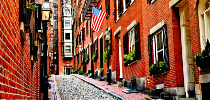
One of the country's oldest cities, Boston remains also one of the most charming and inviting for visitors with its characteristic European feel. Boston is the largest city and the capitol of the state of Massachusetts. The jewel of New England, Boston proper has over 600,000 residents, while the greater Boston metropolitan area is home to nearly 5 million people, and hosts over 12 million visitors each year. The city is considered a cultural epicenter with its significant history, leading educational institutions, and popular sport teams and events.
Free Boston Vacation Package Quote
Situated on the Massachusetts Bay, the city is quite compact in its design with many of the main attractions easily within reach by foot or by the easy-to-use public transportation system, known as the T. A great way to trace the city's history is by following the pedestrian path and self-guided tour of the Freedom Trail, which carves through historic neighborhoods and offers many cultural landmarks such as Faneuil Hall and Bunker Hill Monument. Notable Boston neighborhoods include Newbury Street with its upscale shopping and dining that runs through the Back Bay and the Public Garden, the North End with its characteristic cobble-stone streets and famous Italian eateries, Beacon Hill with its elite residences, the South End's art galleries, and of course the picturesque Waterfront home to Faneuil Hall and the Quincy Marketplace that is always buzzing with tourists and is a great spot for photo ops and grabbing a bite of Boston's famous fare such as clam chowder, lobster rolls and even a decadent cannoli. This family-friendly city is known for its vast history dating back to the founding of the country and offers many important landmarks, interesting attractions and a rich culture making for an inviting city to discover.
Quick Facts
- Climate:
From June to September, temperatures range from 60-76° F; from October to December, temperatures range from 37-51° F; from January to March, temperatures range from 25-39° F and in April and May, temperatures range from 44-60° F
The Compass
The park kicked off its winter season last month, and there are plenty of activities to choose from during the frostier months.
Featured Articles
See all articles
Free Boston Vacation Package Quote
Categories: Us Cities > Boston
Categories: Us Cities > Houston
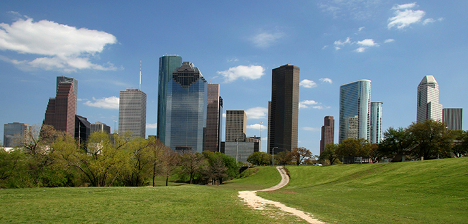
Houston, Texas is the fourth most-populated city in the U.S. and its large size offers travelers many exciting things to do. Performing arts, shopping and live music and just some of the things visitors can enjoy in this southern Texas city.
Free Houston Vacation Package Quote
Houston’s Museum District is considered by many to be the city’s cultural center. It’s comprised of 19 museums, 11 of which are free to visit all the time. There’s the Contemporary Arts Museum Houston, The Children’s Museum of Houston, the Health Museum and the Houston Museum of African American Culture, among many others. For even more cultural experiences, travelers are often encouraged to visit the downtown theatre districts which spans 17 blocks and is home to the Houston Grand Opera, Bayou City Performing Arts, Broadway at the Hobby Center and many other performing arts companies.
Another big draw for travelers to Houston is the music scene. Houston is a music city and has top-notch live music performances year-round. The Toyota Center is a large arena that hosts many big concerts and is also where the Houston Rockets basketball team plays. Visitors interested in smaller acts have many options too, like the House of Blues and many other performance halls, parks and bars.
Attending performances or sports events at a big arena may seem a big expense for a vacation, but Houston has plenty of free activities that travelers can take advantage of. From March to October, the Miller Outdoor Theatre hosts many different performances like classical music, dance, film and Shakespeare plays. The 12-acre Discovery Park in downtown Houston has happy hour music and a small market in the warmer months and ice skating in the winter. The Houston Arboretum and Nature Center is a 155-acre nature sanctuary with five miles of trails and interactive exhibits. This is just a sampling – there are many other opportunities to experience Houston for free.
Other Houston highlights include the NASA Space Center Houston in Clear Lake and Galveston Island, both about a 45-minute drive from the city but definitely worth a visit. The Upper Kirby and River Oaks neighborhoods have plenty of upscale shopping and dining. And, speaking of shopping, all shopping is tax-free, so shoppers can get a bit more with their money. The types of stores range from Texas-centric cowboy boots to off-the-runway trends to locally-produced artisan items and beyond. For travelers wanting to get outside, the Sam Houston National Forest is about 50 miles north of the city. The 128-mile Lone Star Hiking Trail winds through the forest and has some primitive campsites along it.
The Compass

The park kicked off its winter season last month, and there are plenty of activities to choose from during the frostier months.
Featured Articles
See all articles
Free Houston Vacation Package Quote
Categories: Us Cities > Houston
Overview
Introduction
Nestled in the valley of the Appalachian foothills 57 mi/92 km east of Birmingham, Anniston was founded as a planned community in 1833. Today, it is a thriving city, with a lot to offer any traveler coming through the area. Explore the historic downtown before visiting the areas outside the city.
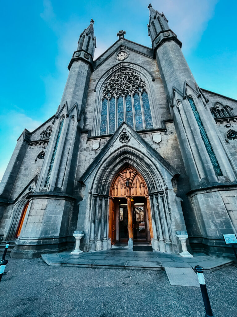
Known for its outstanding architecture, the Church of St. Michael and All Angels was built by one of the town's founding families. The Noble McCaa Butler House, with its hand-carved mantels and jeweled-glass front doors, was the residence of a town founder. A drive through Tyler Historic Hill District offers a look at Victorian homes.
Next, visit the Anniston Museum and Gardens, which includes the Longleaf Botanical Gardens, Anniston Museum of Natural History, including old diorama bird collections, and the Berman Museum of World History, which features private collections of arts and antiques—some more than 3,000 years old. https://www.exploreamag.org.
After driving through town, you'll start to notice the area's vast outdoors. The Talladega National Forest starts in Anniston and offers a plethora of outdoor activities, including camping and fishing. The scenic byway will take you to the Pinhoti Hiking Trail, which spans 110 mi/175 km into Georgia.
Noccalua Falls Park in Gadsden, 35 mi/55 km north of Anniston, has a 90-ft/27-m waterfall named after Native American Princess Noccalua, who jumped to her death from the falls. The park, which has a museum, pioneer village and hiking trails, also contains the starting point of Lookout Mountain Parkway—a scenic drive to Chattanooga, Tennessee.
For more scenic views, visit the highest point in the state (2,407 ft/734 m) at Mount Cheaha State Park in Delta, 27 mi/43 km from Anniston. The 2,800-acre/1,130-hectare mountain retreat has two lodges, campgrounds, cabins and an observation tower. For something closer to the ground, visit Coldwater Covered Bridge, one of the state's oldest remaining covered bridges in Oxford, 4 mi/6 km south of Anniston.
Anniston is a great spot for a day trip to the Talladega Motor Speedway 15 mi/24 km west (https://www.talladegasuperspeedway.com). The International Motorsports Hall of Fame (https://www.motorsportshalloffame.com) next door to the track is a must-see for any speed enthusiast, as it is home to the fastest boat in the world.
Overview
Introduction

Boston, Massachusetts, is inundated with visitors every year and for good reason: It's partly a walkable historic park (especially the Freedom Trail) and partly a modern waterfront metropolis (the "Hub of New England") with no lack of things to do once darkness descends. Fenway Park—one of the nation's most hallowed baseball stadiums—is a destination in itself.
Although the city has never stopped reaching for the future and now welcomes leading-edge financial services and tech companies, it has lovingly preserved the treasures of its past. Boston cherishes its patriotic connections with the Boston Tea Party and Bunker Hill. It is a living symbol of the melting pot early residents fought to create, including lively ethnic neighborhoods, sophisticated centers of academia and sedate sanctuaries of old wealth. Each seems a world unto itself, yet each is an integral part of Boston's urban identity.
Even with so much to do and so many doing it, the city is a relatively easy place to visit. Boston's attractions and historical sites are laid out in simple-to-follow walking tours, and its subway system efficiently whisks passengers around the city. You won't need a car, which is good: Driving in Boston is hair-raising, even for locals. The most difficult part of your visit may be opening your credit-card bill after you get home: Boston can be expensive, but you'll find a lot to enjoy for each dollar spent.
Must See or Do
Sights—The Freedom Trail, which passes 16 of the most famous sites from early U.S. history; Boston Common with its wonderful gardens, along with adjacent Boston Public Garden and the swan boats; Newbury Street for its boutiques, ethnic restaurants and art galleries; the North End for old-world, Italian ambience; Fenway Park; Harvard Yard in Cambridge.
Museums—The Museum of Fine Arts for impressionists and antiquities; the interactive Boston Tea Party Ships & Museum; the charming Isabella Stewart Gardner Museum with its stunning three-story garden atrium and important works of art; the Institute of Contemporary Art; the Harvard Museum of Natural History; Cambridge's Peabody Museum.
Memorable Meals—Giulia for fresh Italian at its finest; Mooo for mouthwatering local meats; Oleana for excellent organics in season; Flour Bakery for delectable sticky buns.
Late Night—Faneuil Hall Marketplace or Harvard Square (both are well-lit and populated, with bars and restaurants galore); dancing at Jillian's Boston and Lucky Strike on Landsdowne Street; Black Rose (across from Faneuil Hall) for Irish music; Middle East (in Cambridge) for alternative rock and hip-hop.
Walks—The Charles River Esplanade for a romantic stroll or a vigorous jog; Beacon Hill, with its old brick sidewalks and Federal bow-front architecture; Harvard Square; the Commonwealth Avenue Mall from the Public Garden to Kenmore Square; the walking paths through the Arnold Arboretum; the Rose Kennedy Greenway.
Especially for Kids—The New England Aquarium with its giant ocean tank, as well as a shark and ray touch tank; the lowland gorillas at the Franklin Park Zoo; the USS Constitution (better known as Old Ironsides) in Charlestown, the oldest actively commissioned ship in the world; the interactive exhibits of the Children's Museum; the displays, giant-screen Omni Theater and planetarium at the Museum of Science.
Geography
Although its main attractions are in a relatively compact area compared to other large cities, Boston is made up of distinct districts. Knowing where the most popular ones lie will help you find your way.
The central city sits on a peninsula, surrounded by the Charles River, Boston Inner Harbor and Fort Point Channel. Downtown is roughly in the middle of the peninsula and encompasses many of the Freedom Trail's historic sites, as well as the Financial District and City Hall. Adjoining downtown to the west are Beacon Hill (also rich in history) and the green expanses of Boston Common and the Boston Public Garden. Farther west is Back Bay (a prime shopping, entertainment and dining district), and then the Fenway area.
Northeast of downtown—on the tip of the peninsula—is the North End, the atmospheric Italian neighborhood. South of downtown are Chinatown and the South End. Across the Charles River from downtown (directly north) is Charlestown, home to the Bunker Hill Monument and the USS Constitution.
Cambridge, across the river, is another popular area for visitors and home to Harvard and MIT. Boston and Cambridge may often be spoken of in one breath, but locals never fuse the two. If they were sisters, Boston would be the traditional, practical one and Cambridge the hip, liberal academic. But like any sisters, they have more in common than they will ever admit.
When getting an address for a Boston destination, be sure that you ask not only for the street address but also for the neighborhood, any nearby landmarks and the nearest T stop (subway station). For instance, a cabdriver may not recognize a Dalton Street address for your hotel, but if you mention "It's in Back Bay behind the Pru (the Prudential building)," he or she will find it.
History
The Boston area was inhabited by several Wampanoag tribes before the arrival of Europeans, who brought with them various diseases and an ambition for land that greatly reduced the Native Americans' numbers. The first permanent English colonists, led by separatist (from the Anglican church) John Winthrop, settled in 1630 and named their settlement after the city of Boston, England. Winthrop's ambition, as he said in his shipboard sermon "A Modell of Christian Charity" (1630), was to create a place of great virtue, "as a city upon a hill."
Boston prospered and soon became the capital of the Massachusetts Bay Colony. By the mid-1700s, it had become an important seaport and trading center, second only to Philadelphia and perhaps New York City in terms of influence and power. As the colonists grew more successful—and self-reliant—England became more controlling. Increased taxes on sugar, stamps and, finally, tea helped push the wheels of the American Revolution into motion.
During the 19th century, waves of immigrants were drawn to Boston for the manufacturing jobs generated by another revolution—the Industrial Revolution. The Irish who settled on the fringes of the city eventually put as strong a stamp on Boston's character as the patrician residents of Beacon Hill, who bolstered the city's status as a center of learning and culture. Charlestown and South Boston, which is known locally as "Southie," remain Irish enclaves. A large influx of Italian immigrants settled the area known as the North End, African Americans settled in Roxbury and Chinese established themselves in Chinatown.
After World War II, Boston's importance as an industrial hub faded. However, it grew in prominence as a center for education and technology, largely because of the presence of the Massachusetts Institute of Technology (MIT) and Harvard University in nearby Cambridge, as well as Boston University, nearby Tufts and Brandeis universities, and Babson and Wellesley colleges. For its size, the metro Boston area has more colleges and universities than any other city in the Western Hemisphere.
The city's importance as a seaport has declined, but cruise-ship traffic has increased enormously, and Boston Harbor remains a defining presence.
Potpourri
Beacon Hill used to be one of three prominent peaks collectively called Trimountain. This is the origination of the name Tremont in Boston, such as Tremont Street. In the 1850s, two of the hills were leveled, and the dirt was used to fill in part of the Beacon Hill neighborhood.
Boston's Big Dig project used enough concrete to build a sidewalk from Boston to San Francisco and back four times. It was the largest and costliest public-works project in U.S. history, exceeding the Panama Canal in time and expense.
Some major Hollywood movies and several television shows have been filmed in Boston, such as The Departed, Gone Baby Gone, American Hustle, The Witches of Eastwick, Love Story, Mystic River, Good Will Hunting, the long-running Ally McBeal, Cheers and Spencer for Hire. The city keeps producing stars, too, many of whom have homes in the area, including Mark Wahlberg, members of the band Aerosmith, Maria Menounos, Jay Leno and Geena Davis.
Perhaps the narrowest house in the U.S., The Skinny House, located on Hull Street along the Freedom Trail, is a mere 10 ft/3 m wide.
Greater Boston is the site of many "oldests" in the U.S.—among others, the oldest public park (Boston Common, 1634), oldest telephone exchange (between Boston and Lowell, 1875), oldest historical society (Massachusetts Historical Society, 1792), oldest lighthouse station (Boston Light, 1716), oldest school (Boston Latin, 1635), oldest college (Harvard, 1636), oldest subway (1897), oldest marathon (Boston marathon, 1897) and oldest professional sports venue (Fenway Park, 1912).
The costliest art heist in history occurred in Boston in 1990. Thieves posing as Boston Police officers carried off 13 paintings from the Isabella Stewart Gardiner Museum, worth a collective US$500 million. While there have been promising leads over the years, the criminals have yet to be apprehended, and a US$10 million reward remains available for those with information leading to the artworks' recovery.
At 90 ft/27 m below the surface, Boston's Ted Williams Tunnel is the deepest in North America.
Location
Cruise ships dock at the Black Falcon Cruise Terminal in South Boston, which is about 2 mi/3 km south of downtown. Originally a World War I military warehouse, the terminal has several berths and is the oldest port in the Western Hemisphere. More than 100 ships tie up to Boston's docks every year, and six make Boston their permanent home.
There's a covered parking garage across from the terminal in the Marine Industrial Park. Expect to pay about US$20 a day to park with a valid cruise ticket. (Reservations not required.)
The terminal is two blocks from the nearest Silver Line bus station (Black Falcon Avenue and Design Center Place), slightly more than 1 mi/2 km from the nearest subway station (South Station), and 3 mi/5 km from Logan International Airport.
The Seaport district provides an important link between the waterfront and downtown, with dozens of restaurants, shops and the Institute of Contemporary Art within a 2 mi/3 km radius from the terminal. You can also take a taxi downtown, or hop aboard the downtown shuttle operated by Beantown Trolley, which has regular departures based on vessel schedules. The shuttle's numerous stops include the Aquarium, Faneuil Hall, Copley Square and Newbury Street. Toll-free 800-343-1328.
If you do decide to hoof it, however, it's a fairly easy two blocks to the Silver Line stop at Black Falcon Avenue and Design Center Place or an easy trek to the South Station subway, where you can board the Red T Line. Along the way, stop off at the World Trade Center complex and enjoy a dinner of fresh seafood that probably was caught just hours earlier.
Kiosks with tourist brochures are set up in the cruise terminal, along with other amenities and concessions. The best sources of local information are at the Boston National Historical Park Visitor Center, across from the Old State House, or the Boston Common Visitors Information Center on Boston Common at the start of Freedom Trail where the red bricks begin.
Shore Excursions
Because Boston is a point of embarkation for some cruise-ship passengers, most cruise lines offer a limited number of shore excursions. Keep in mind that many of Boston's best sights have been incorporated into walking tours that you can do on your own. There are also a number of relatively inexpensive trolley tours available that can save you some walking and also provide information on the sights.
If you decide a fully guided tour is more to your liking, you may want to opt for one of the excursions offered by your ship. They may not be the least expensive way to see the city, but you won't have to waste your limited time making arrangements yourself—and you won't have to worry about missing the ship. Shore excursions—and their prices—vary from cruise line to cruise line.
Some typical ship-sponsored excursions are a trip to the John F. Kennedy Library and the home of John Adams, a walking tour of the Freedom Trail, a visit to Fenway Park and the Red Sox Hall of Fame, a Back Bay architectural tour, Harvard Yard tours or a tour of Boston's most famous landmarks. Check with your ship's shore-excursion staff or your travel agent for more information.
Overview
Introduction
North of Worcester, in Boylston, Massachusetts, the Tower Hill Botanic Garden offers an educational and peaceful detour. Its 18th-century-style greenhouse filled with subtropical specimens is a nice escape in winter. Overview
Introduction

Fierce local pride is a Charleston institution. It has helped sustain the city for more than 300 tumultuous years—from colonial times, through the Revolutionary and Civil wars, to the present. Pride has also sustained hundreds of historic Charleston buildings—a big reason that travelers visit today. Be sure to take a stroll down East Bay Street (especially the section known as Rainbow Row) to admire the pastel houses bedecked with their breeze-cooled piazzas.
Spend some time lolling in the near-tropical warmth of Charleston's beaches, admiring the stoic architecture of The Citadel (the state's military college) or exploring the Charleston historic district, and you'll likely find this a very pleasing corner of the cosmos.
Must See or Do
Sights—The woodwork at the Heyward-Washington House; the work yard at the Aiken-Rhett House; the Old Exchange and Provost Dungeon; the iconic Arthur Ravenel Jr. Bridge.
Museums—Sterling silver and sweetgrass baskets at the Charleston Museum; the miniature collection and gift shop at the Gibbes Museum of Art; the floating, circular staircase at the Nathaniel Russell House.
Memorable Meals—Fried chicken, sweet tea and Coca-Cola cake at Jestine's Kitchen; anything off the daily changing menu at Husk; anything from the locally sourced daily menu at FIG.
Late Night—Jazz at Charleston Grill at the Charleston Place Hotel; late-night Irish coffee and pie at Kaminsky's Dessert Cafe; relaxing with a Hemingway Daiquiri at Proof; a midnight snack at 39 Rue de Jean.
Walks—A stroll along Rainbow Row, the line of colorful houses on East Bay Street; the gardens at Middleton Place; a walk along the shoreline at Folly Beach; breathtaking views of the harbor from the promenade along Waterfront Park, plus swings for the kids.
Especially for Kids—Native marine-life displays at the South Carolina Aquarium; swamp life at the Magnolia Plantation; the scavenger-hunt map available at the Old Exchange and Provost Dungeon; interactive exhibits at the Children's Museum of the Lowcountry.
Geography
Charleston is on a peninsula bordered by two rivers, the Ashley and the Cooper, which provide a natural, watery barrier that has pushed growth and development toward the north. For instance, King Street, the city's main shopping strip, is now bustling not only on its lower end (long famous for high-quality antiques) but also on its upper end (known for bars, restaurants and shopping that also appeal to the younger set).
The city's original settlers laid out the streets in a checkerboard plan, beginning with the intersection of King and Broad streets, which remains the premier address of old Charleston law and real estate firms. The corner of Broad and Meeting is aptly called the "Four Corners of Law" because of the four types of law represented on each corner: the U.S. Post Office (U.S. law), City Hall (municipal law), South Carolina State Courthouse (state law) and St. Michael's church (God's law).
South of Broad (nicknamed SOB), the residential neighborhood encircled by the harbor, is still the most expensive spot to call home (a few bed-and-breakfasts allow you to do this, if only for a short time). You'll probably hear locals refer to the area around and in between North and South Market streets as "the Market," a popular spot that includes many eateries, touristy shops and the historic covered market, where vendors sell various goods.
Areas such as East Cooper and West Ashley carry the implicit phrase "of the" (as in East of the Cooper), which explains their locations with respect to the city's two rivers and provides visitors with a useful trick to get their bearings.
Various islands dot Charleston's harbor and coast, such as Isle of Palms, Sullivan's Island, James Island and Kiawah Island, some of which have historic sites, beaches or other attractions.
History
In 1670, a group of English colonists traveled up the Ashley River and settled Charles Towne, named in honor of King Charles II of England. Ten years later, the colony relocated across the river to a more desirable site—the peninsula. By 1690, the city had become the fifth-largest in North America—a port town with busy wharves and a harbor full of sailing ships. But it was the area's tremendously successful rice-cultivation industry, made possible by the knowledge of enslaved people from the rice-growing regions of Sierra Leone, that made it rich. The Lowcountry rice plantations proved so profitable that their owners filled the city and countryside with elegant mansions.
At the outbreak of the Revolutionary War in 1776, Col. William Moultrie's fort on Sullivan's Island held against the firing of British forces, giving the new nation one of its first victories. After the war, Charles Towne became the city of Charleston, and its native sons played a key role in the formation of the new national government.
The city prospered and grew tremendously in the antebellum period. Charleston's rich plantation economy depended on an enslaved labor force. Africans and African Americans not only worked on the plantations, but also served as domestic servants and craftspeople in the city. The antebellum structures that remain today were built by slaves.
Tensions over states' rights and slavery led the state of South Carolina to secede from the U.S. in December 1860. Charlestonians cheered from the rooftops as the first shots of the Civil War were fired at Fort Sumter in Charleston Harbor. Though the Confederates won that battle, the ensuing siege nearly destroyed Charleston. The war brought an end to slavery and forever changed the city's way of life. By the early 1900s, phosphate mining and a navy yard were bringing jobs and new residents to Charleston.
The city's wealth of architectural gems survives in no small part because of local citizens who, during the 1920s and '30s, formed the country's first historic district with regulatory control, thus preserving the structures. In the 1970s, the abundance of historic buildings and rich legacy were finally tapped by the Charleston Chamber of Commerce. Travelers still visit Charleston for its architecture, southern charm and appealing seaside climate.
Potpourri
According to Charleston legend, an African American butler by the name of William Deas created the world-renowned she-crab soup at the John Rutledge Inn.
Charleston hasn't only been prone to the ravages of civil war and hurricanes. On 31 August 1886, a 7.6-magnitude earthquake rocked the city, killing 110 people and causing major damage to the city's buildings.
During the colonial era, Charleston was enclosed by a fortification wall with defensive bastions to protect it from invasion by pirates and enemies of the English empire. The wall was later removed. But, wall or no wall, Charleston shares its history with some of the most infamous pirates of all time, including Irish-born Anne Bonney, Edward Teach (known as Blackbeard) and "gentleman" pirate Stede Bonnet.
The Charleston, a famous 1920s-era dance, started in Charleston and was patterned after Gullah dance steps.
Comedian Stephen Colbert of The Colbert Report grew up in Charleston and attended Porter-Gaud, a prestigious local prep school.
The Charleston area is home to a large number of best-selling novelists, including Pat Conroy, Sue Monk Kidd, Dorothea Benton Frank, Mary Alice Monroe and fantasy author Robert Jordan.
Sullivan's Island, home of Fort Moultrie, which sits at the mouth of Charleston Harbor and was the site of significant action during the Revolutionary War, has been featured in works by both contemporary novelist Pat Conroy and dark poet Edgar Allan Poe. Poe's story The Gold Bug was set there.
Charleston is also known as the "Holy City" because of the prevalence of church steeples on the city skyline. There are more than 400 houses of worship throughout the city. The oldest church, St. Michael's, dates back to 1761.
Location
Cruise ships dock at Charleston's Union Pier Passenger Terminal, located by the harbor at Market Street and near the center of the city's Historic District. Representatives from the convention and visitors bureau staff the terminal during port-of-call arrivals, offering information and visitors guides.
Transportation services are easily accessible, with taxis lined up on nearby Concord Street. Short-term parking is available for the general public. Reservations are not required for long-term parking, but it's only available for cruise line passengers. A shuttle service operates between the terminal and parking lots. Many restaurants are located within walking distance of the terminal. Phone 843-577-8189. http://www.port-of-charleston.com/locations/cruise-terminal.
Shore Excursions
Shore excursions and their prices vary from cruise line to cruise line. A variety of Charleston shore excursions are available, including debarkation day excursions that double as airport transfers (see a bit of the city and catch a ride to the airport—all for one price), a trip to Fort Sumter, walking tours, garden tours, carriage tours, plantation tours and shopping at the City Market.
Overview
Introduction
Situated in the middle of the state's western region, Charleston is the state capital and West Virginia's largest city. Be sure to visit the Cass Gilbert-designed state Capitol with its six types of marble and striking gold-colored dome. The area around the Capitol has many other worthwhile sights: the Governor's Mansion, the Booker T. Washington Memorial and the West Virginia State Museum (aka the Cultural Center), which has exhibits depicting state history.
The Sunrise Museum is a combination art and science museum housed in two large mansions. Stern-wheeler rides on the river are another possibility. Schedule at least a full day to see Charleston.
Overview
Introduction
Easton, Maryland, is a charming town, 45 mi/70 km southeast of Baltimore, full of gracious homes and alluring shops housed in well-preserved buildings from the 1700s and 1800s.
Attractions include the Historical Society of Talbot County Museum, the late-1700s James Neall home, some beautiful old gardens and the Third Haven Friends Meeting House, an old frame church visited by both Lord Baltimore and William Penn.
Most visitors stop for a couple of hours or see Easton while staying in nearby St. Michaels. Those planning to stay longer might want to inquire about performances by the Mid-Atlantic Symphony Orchestra or the Avalon Theatre. The Academy of the Arts also presents cultural-entertainment programs.
In November, Easton hosts the Waterfowl Festival, a wildlife art fair and goose-calling competition.
Overview
Overview
Introduction
Estonia feels a little like Finland South, which is not surprising given its closeness to Finland, both geographically and ethnically. And although its people can seem a bit Finnish, too, in their emotional reserve, we've found that Estonians tend to greet tourists warmly—they take pleasure in telling visitors about their country's sites and history.
With a legacy of medieval castles and pagan ruins, German manor houses and grim Soviet skyscrapers, Estonians are sifting through their past, trying to reclaim their European heritage. The excitement of rebuilding their country has died down to some extent, but their pride in being Estonian is still as powerful as ever.
Estonia is a successful, business-friendly Eastern European country, which has become a tech powerhouse in recent years, with a burgeoning startup scene. Estonia is also the home of the NATO Cooperative Cyber Defence Centre of Excellence.
As foreign investments have poured in, Tallinn, Estonia's capital, has been dramatically transformed: The medieval buildings of its Old Town form a charming backdrop for its vibrant civic life. The city seems flooded with Finns and other Scandinavians who've gone over to take advantage of lower prices than they'll find at home.
Geography
Estonia's land was shaped by crushing glaciers tens of thousands of years ago. As the glaciers retreated, they left behind lakes and a relatively flat, low-lying plain, strewn with boulders. Forest covers about 40% of the land, marshlands about 50%. The rest is made up of meadowlands, farmlands and cities. The country also has about 1,500 islands, ranging from small outcroppings to the 1,000-sq-mi/2,700-sq-km island of Saaremaa.
History
Over the ages, foreign domination and repression have recurred with regularity in Estonia. The first settlers, tribes related to ancestors of the modern-day Finns, arrived in the area more than 6,000 years ago. In the 13th century, Teutonic knights invaded to convert the residents to Christianity—with fire, ax and the rod. Visitors from Sweden and Poland showed up next, dividing Estonia between them in the 1500s. Russia then gained Estonia in the Northern War, only to lose it two centuries later in World War I.
Estonia, along with the other Baltic states, was independent from 1918 until 1940. But then the three Baltic countries were annexed by the Soviet Union. More than 50 years of Soviet rule followed, characterized by deportations of thousands of dissidents (actual or potential), massive industrialization (and massive pollution) and the immigration of hundreds of thousands of ethnic Russians, Ukrainians and other Slavs.
Estonian patriotism always ran strong, however, and most native Estonians never considered their land to be part of the Soviet Union. (Many foreign governments also refused to recognize the annexation.) Nationalist feelings prompted an Estonian declaration of independence in 1991.
Initially, independence was difficult, but the economy has rebounded at an impressive rate, and today the country maintains an enviable level of stability among eastern European countries. In November 2002, Estonia became a member of NATO, and on 1 May 2004, Estonia was one of 10 countries that joined the European Union. In January 2011, Estonia adopted the Euro as its official currency.
Snapshot
The main attractions of Estonia are medieval architecture, historic sites, Tallinn, Baltic culture, scenic islands and the countryside. Outside of Tallinn, first-class accommodations and service can be found in stately, renovated old manor houses, which are often located near national parks.
Potpourri
The midsummer holiday (also known as St. John's Day) that occurs every year around the summer solstice is one of the most important holidays in Estonia. The celebration is particularly lively, and bonfires burn all night.
Estonians are very proud of their language, a Finno-Ugric tongue related only to Finnish and Hungarian. The first national poet to write in the language was Kristjan Jaak Peterson (1801-22).
Because of a deliberate Soviet policy to bring in Russian workers and take out political prisoners, Estonians today make up barely 60% of the country's population.
The city of Tartu has been sacked and burned to the ground no fewer than 65 times.
Look for doughnut-shaped pebbles when walking the beaches of Hiiumaa. One particular beach has a pile of such stones. According to island lore, if you place one of these stones on the pile, your wish will be granted.
Estonian engineers played an important role in developing the leading telecommunications application Skype.
Overview
Introduction

Galveston, Texas, is a charming, slow-paced island city along the Gulf of Mexico. A popular Texas tourism destination, Galveston is home to lots of lovely beaches, restored 19th-century storefronts and fancy Victorian mansions. Galveston has approximately 1,500 landmarks listed on the National Register of Historic Places.
The commercial buildings in Galveston's Strand National Historic Landmark District, commonly called the Historic Downtown Shopping District, are among the finest collections of Victorian iron-front architecture in the U.S. This area houses boutiques, bars, restaurants and galleries. It's also the site of major entertainment festivals such as Mardi Gras (February or March) and Dickens on the Strand (December).
The nearby revitalized Postoffice Street Arts and Entertainment District, considered part of Galveston's Historic Downtown Shopping District, is home to Gallery Row and its art galleries.
For these reasons, Galveston attracts thousands of visitors who find that a stroll downtown can be just as pleasant as a walk on one of its beaches.
Must See or Do
Sights—Bishop's Palace, one of the country's most exquisite architectural landmarks; the downtown historic Strand district.
Museums—Vintage aircraft at the Lone Star Flight Museum and the Texas Aviation Hall of Fame; the 1877 tall ship Elissa, located next to the Texas Seaport Museum.
Memorable Meals—The Gulf snapper at Gaido's; juicy Texas bone-in rib eye from The Steakhouse at the San Luis Resort.
Late Night—Old Quarter Acoustic Cafe, a funky Texas acoustic music bar.
Walks—A romantic stroll along Galveston's 10-mi-/16-km-long Seawall.
Especially for Kids—Moody Gardens with its huge aquarium, indoor rain forest and outer-space exhibits; a day at the beach, especially along Seawall Boulevard and Stewart Beach.
Geography
The city of Galveston (about 50 mi/80 km southeast of Houston on Interstate 45) sits on the northeastern tip of a barrier island called Galveston Island and is separated from mainland Texas by Galveston Bay. The city's southern shore is lapped (and occasionally lashed) by the Gulf of Mexico.
The city is connected to the mainland by a multilane causeway at the southern tip of I-45. Daily ferry service also connects the island's east end to the Bolivar Peninsula and Highway 87. Once visitors cross the causeway, I-45 turns into Broadway Avenue, one of the city's two main thoroughfares, which crosses the center of the island in an east-west direction. To the south is Seawall Boulevard, which follows the Seawall and the beach. Cruise passengers going to the island take the Harborside Drive Exit (the first exit after crossing the causeway) to get to the Port of Galveston.
History
The history of Galveston has been largely shaped by its proximity to the Gulf of Mexico. Most of the evidence of Galveston's early inhabitants has been washed away by hurricanes. It is known, however, that the Akokisa hunted, fished and camped in the area and were there when Spanish explorer Cabeza de Vaca was shipwrecked in 1528.
In the late 1600s, Galveston was claimed for France and named St. Louis by French explorer Robert Cavelier La Salle. The Spanish returned in the mid-18th century and built a presidio, which they named Galveztown for the Spanish governor of nearby Louisiana, Bernardo de Galvez. (The spelling later evolved into Galveston.) Spain's relations with France disintegrated, and the Spanish left the island to the French.
When the French gave up their U.S. colonies, they turned Galveston over to Mexican revolutionaries, who stayed until pirate Jean Lafitte made the island the base of his operations beginning in 1817. After attacking an American ship in 1821, Lafitte was forced to abandon the island, but only after he threw a big party and burned his settlement. Some claim he left behind buried treasure, but it has never been found.
In the late 1830s, the colony joined Texas in its revolution against Mexico. Once Texas won its independence in 1836, Galveston became a major port and was incorporated as a city in 1839. During the Civil War, Union troops captured the port, but the Confederates reclaimed it near the end of the war.
By the late 1800s, Galveston was the third-largest port in the U.S. and a major international business and banking center. Strand Street, its main thoroughfare at the time, was known as the Wall Street of the South.
Then disaster struck. On 8 September 1900, the city was lashed by a hurricane—still the most devastating natural disaster in U.S. history. The low-lying barrier island was swept by winds estimated at 140 mph/225 kph and a storm surge of nearly 16 ft/5 m. When the hurricane—known to locals as the 1900 Storm—was over, more than 6,000 people had died, the port had been wiped out and 3,600 buildings had been destroyed.
To prevent such destruction in the future, a 4-mi-/6-km-long seawall was erected and, using sand dredged from surrounding waterways, much of the island's grade was raised from 6 ft/2 m to almost 18 ft/5 m above sea level. Another hurricane in 1915, almost as fierce, tested the seawall, and it held. Today, the seawall stretches 10 mi/16 km and is 16-20 ft/5-6 m high.
The fear of another catastrophe and neighboring Houston's growing importance led to the dredging of a ship channel between Houston and Trinity Bay, helping to make the larger city the new economic hub of the state. Through the 1920s-50s, Galveston survived as a resort town, with dinner clubs and casinos drawing top-name entertainers and attracting people from around the world before the Texas Rangers shut down a number of illegal activities in 1957. The city's fortunes declined again until the late 1960s, when it was rediscovered as a beach retreat.
Unlike many cities where progress resulted in the leveling of entire inner-city neighborhoods, Galveston's slow-moving economy allowed its lovely turn-of-the-century structures to be ignored, but not destroyed. When preservationists became interested in Galveston, they discovered some of the finest examples of Victorian architecture in the U.S. The subsequent restoration effort increased starting in 2000 and sparked an unheralded construction boom as more and more major investors recognized the island as a major tourist destination.
Galveston has since been hit by several hurricanes (including destructive Hurricane Ike in 2008), but the area is resilient and proud with a rebuilt tourist district that continues to show the region's history and spirit.
Potpourri
Galveston is sometimes called Oleander City. It's a well-deserved nickname—the city boasts more than 60 varieties of the flowering shrub that were transplanted to the island from Jamaica in 1841. After the devastating 1900 Storm, original oleander plant cuttings survived and propagated when much of the island was completely replanted with vegetation.
Galveston Island was second only to Ellis Island as a port of entry for immigrants. Most came from Europe, particularly Germany and what is now the Czech Republic.
In the mid-19th century, Galveston was known as the Wall Street of the South, and its people loved their lavish lifestyles. In 1858 alone, residents purchased a total of 800 gallons of brandy, 3,600 gallons of French wine and 23 grand pianos.
The Galveston County Daily News is the oldest continuously published newspaper in Texas, first published on 11 April 1842.
Painted on the Seawall, the SEE-wall Mural is thought to be the longest mural in the world (14,760 ft/4,576 m). It was painted by some 20,000 Galveston-area residents.
Galveston is one of the top birding spots in the U.S. and hosts several important sites along the Great Texas Coastal Birding Trail. During the spring and fall migrations, more than 300 species of birds pass through the city. Every April, the city sponsors a major birding festival called FeatherFest.
Location
Galveston is a destination port, with two cruise lines offering weekly departures for cruises to Mexico, and various points in the Caribbean and Florida. Cruise ships dock at Pier 25 and Pier 27, which are located along Harborside Drive between 22nd and 25th streets. You'll find a choice of two port-operated parking lots on Harborside Drive at 33rd Street (drop off your bags first, then park and let a shuttle take you to the terminal) or privately operated lots nearby (directions and reservations available by calling Lighthouse Parking, phone 409-750-0175). Shuttles are available to take you from the lots to the terminal. The Port of Galveston also allows cruise passengers to reserve a prepaid parking spot. Phone 409-766-6100. http://www.portofgalveston.com.
Cruise passengers whose ships leave from Galveston may fly into one of Houston's two airports. (Galveston's local airport is not serviced by commercial passenger airlines.) The closest Houston airport is William P. Hobby Airport (HOU), about 45 mi/72 km north on I-45. The other large airport is George Bush Intercontinental Airport (IAH), about 65 mi/105 km from Galveston. Cruise ships often provide airport-to-port transportation; check with your travel agent.
If you arrive early or are making your own arrangements, Galveston Limousine provides transportation between Houston's airports and Galveston's port and hotels. Phone 409-744-5466. Toll-free 800-640-4826. https://galvestonlimo.com.
Shore Excursions
Available shore excursions include, but are not limited to, snorkeling and scuba diving, kayaking, horseback riding, historical city tours, helicopter tours and ziplining.
Overview
Introduction
Glastonbury, England, located 20 mi/30 km southwest of Bath, has a long tradition as a spiritual site. The tor—a conical hill jutting from the plain at the edge of town, with a ruined church on the top—is associated with the mythical Isle of Avalon and the Holy Grail. The site is especially appealing in late afternoon: Time your walk up the tor to catch the sunset (about an hour's climb). It's become the location of major new-age gatherings around the summer solstice. The city's abbey ruins are just as legendary: Some believe that King Arthur and Guinevere were buried there.
The enormous Glastonbury Festival is England's most popular summer music festival. Careful planning and a degree of luck are needed to get tickets. http://www.glastonburyfestivals.co.uk.
Glastonbury is best paired with a visit to nearby Wells (a picturesque town we actually prefer). The cathedral in Wells is magnificent, with hundreds of unusual stone carvings. Also take time to drive through the Cheddar Gorge, an area of limestone cliffs and caves—don't forget to sample the local cheese as well.
Overview
Introduction

When Houston, Texas, dubbed itself Space City, it was referring to its connection to the stars (via nearby NASA's Johnson Space Center, built in 1961). But the nickname could just as well refer to the enormous amount of earthbound space the town occupies within the city limits, much less the metro area's sprawl. The Houston Metro area is bigger than the state of New Jersey, so don't plan on seeing it all in one trip.
Houston's attractions and immense size also bring a certain magnificence: The city is headquarters to 22 companies on the Fortune 500 list and its port is ranked first in foreign tonnage and second in the U.S. in total tonnage.
Oil money and corporate largesse enable Houston to have professional resident companies in all four areas of the performing arts: ballet, opera, theater and symphony. Additionally, more than 200 institutions are dedicated to the arts, history and science, and Houston is also home to professional sports teams for five major-league sports—the Houston Astros (baseball), the Houston Rockets (basketball), the Houston Texans (football), the Houston Dynamo (men's soccer) and the Houston Dash (women's soccer).
One surprise for most Houston visitors is how green the city is. The subtropical climate (it's approximately the same latitude as northern Florida) causes lush growth in grass, trees and plants, and the mild winters leave plenty of greenery untouched.
Houston's cultural diversity (more than 90 languages are spoken there) and its low cost of living also have made it one of the fastest-growing metropolitan areas in the U.S. Houston is home to more than 90 foreign consulates.
Must See or Do
Sights—Skyscraping downtown architecture; NASA's Johnson Space Center; the Williams Tower and WaterWall at the Galleria; historic Sam Houston Park; Discovery Green.
Museums—The Museum of Fine Arts (and its Lillie and Hugh Roy Cullen Sculpture Garden); the Houston Museum of Natural Science; Bayou Bend; the Menil Collection; the Rothko Chapel.
Memorable Meals—Smoked rack of lamb and sweet tres leches desserts at Americas; pepper crabs and garlic butter shrimp at Kim Son; churros stuffed with dulce de leche, Mexican hot chocolate and housemade chocolate at Hugo's.
Late Night—Enjoying an IPA on the porch of The Gingerman pub in Rice Village; visiting downtown's pulsing nightspots on Main Street.
Walks—Houston Arboretum & Nature Center; the Heights Boulevard walking trail; Buffalo Bayou Park walking trails; Hermann Park; Memorial Park.
Especially for Kids—Interactive exhibits and special activities at the Children's Museum of Houston; the space shuttle simulator at Space Center Houston; miles/kilometers of beaches for making sandcastles on Galveston Island.
Geography
Houston is situated on the gulf coastal plains of southeast Texas, about 55 mi/90 km from the Gulf of Mexico and about 120 mi/195 km from the border with Louisiana. The city is connected to Galveston Bay, which opens into the Gulf of Mexico to the southeast by the Ship Channel.
Houston's extensive freeway system is shaped much like a wagon wheel and is dispersed across the city's sprawl. Two concentric rings circle the city—Loop 610 and Beltway 8 (Sam Houston Tollway). Farther west, Highway 6 makes a half-circle, and beyond, Highway 99 circles from the far southwest to the northeast. Interstate 10 runs east-west and cuts the city in half, and I-45 and U.S. I-69/Highway 59 intersect each other in the center, like wheel spokes, and run more or less north-south. The Hardy Toll Road also runs north and is the fastest route to the Bush Intercontinental Airport from downtown. State Highway 290 goes only northwest, and State Highway 288 shoots directly south of the city. The latter is the main route to the Texas Medical Center.
Mass transit can be problematic, consisting mostly of buses crisscrossing the city, except for METRORail's 23-mi/37 km light-rail through downtown, the Texas Medical Center and the Museum District. The most dependable way to get around the city and surrounding areas is by car with a GPS or good map.
Most areas are referred to as being inside or outside the 610 loop. The area enclosed by the loop, though still a large area, is often referred to as the "inner loop" or "inner city." There you will find such major areas as the Theater District downtown; the Museum District and the Texas Medical Center south of downtown; Greenway Plaza, an office and retail complex west of downtown; and the Port of Houston east of downtown. Inner-loop neighborhoods include Montrose (artsy and bohemian, with a significant LGBTQ population); Rice Village and Upper Kirby (hip centers for restaurants and small retail shops); River Oaks and West University (the city's two most affluent neighborhoods); and Houston Heights (Victorian homes and antiques shops).
Just outside the loop to the west are the Galleria and Post Oak areas, renowned centers for shopping and international commerce. Southwest of downtown, on the southern perimeter of the loop, is NRG Park, which includes NRG Stadium and the now abandoned Astrodome. Between the loop and Beltway 8, south of downtown, is William P. Hobby Airport. Outside Beltway 8 to the north is George Bush Intercontinental Airport.
And keep in mind that Houston is only about a 50-minute drive away from Galveston Island on the Gulf of Mexico, a popular tourist destination with historic, turn-of-the-century homes and miles/kilometers of sandy beaches, although they're sometimes awash with tarry globs of oil from the rigs offshore and pesky beds of seaweed. Then there are the hurricanes, which threaten the area annually during August and September, the hottest and stickiest time of year to visit.
History
Houston was founded in 1836 by two brothers from New York, John and Augustus Allen. For US$1.40 an acre/US$3.46 a hectare, they bought 7,000 acres/3,000 hectares at the confluence of Buffalo Bayou and the San Jacinto River—hence another of the metropolis' nicknames, the Bayou City. Flamboyant promoters, the Allens created a small trading post in spite of mud, mosquitoes, alligators and natives who weren't eager to give up their land. They named the new town after their friend Sam Houston, president of the young Republic of Texas, and boasted it would become the next New Orleans.
Serving twice as the capital of the Republic of Texas, Houston flourished for a while because of cattle and cotton. After Texas became a U.S. state in 1845, the city languished until the arrival of the railroads in the late 1880s. Then two very different events conspired to change its course: The Great Storm, the 1900 hurricane, destroyed its neighbor Galveston, a thriving island port and major banking center on the Gulf of Mexico. A year later, the discovery of oil at Spindletop, 100 mi/160 km to the east of Houston, brought a wave of entrepreneurs to Houston in search of quick riches. With its new prosperity, the city widened Buffalo Bayou, creating the Ship Channel, and Houston replaced Galveston as a leading port.
World War II transformed Houston into a major center for shipbuilding and steel manufacturing, in addition to oil refining. It became the headquarters of several U.S. oil companies in the 1970s when oil prices rose to historic heights (known locally as the oil boom) and the industry flourished. But the local economy suffered when oil prices collapsed worldwide in the 1980s. A concerted effort to diversify into health care, aeronautics, international banking and high technology revived the city. Houston remains resilient in all economies.
The city attracts major corporations to headquarter there and is home to the world's largest medical center, which continues to expand. Houston's local economy is somewhat impacted by the ups and downs of the oil and gas industries, but has continued to grow with a major push into the high-tech field, especially related to energy, medical and software industries, and expansion into fledgling, leading-edge industries such as nanotechnology.
Once a place for legendary cowboys and oil wildcatters, this Texas town has evolved into a sprawling, diverse melting pot of industry and cultures. Houston accounted for the largest growth in the Hispanic population in the last U.S. Census, and there are also growing Asian and Middle Eastern populations. There are places of worship for every major religion and restaurants representing almost every ethnicity. In fact, Houston is noted as the most diverse major American city.
Potpourri
"Houston" was the first word spoken from the moon when NASA astronauts landed there 20 July 1969 on the day of Neil Armstrong's famous lunar stroll.
The Houston area is home to more than 10,000 restaurants and more than 700 food trucks, and is considered to have one of the country's best bevy of restaurant choices, with options ranging from world-renowned chefs' institutions to authentic taquerias and noodle-houses.
The Houston metropolitan area is more than 90 mi/145 km wide in any direction, so everything is spread out. Residents think nothing of driving 20 minutes to the nearest post office or grocery store.
With a history of wildcatters and eccentrics such as the legendary philanthropist Howard Hughes, Houston's quirky spirit lives today through many art icons, such as the Orange Show, a monument to the fruit; the Beer Can House, which gives new meaning to home improvement; the Flower Man House, an unbelievable collection of art and greenery; and the Art Car Museum and Parade, which showcases cars transformed into myriad four-wheeled wonders.
If you can't find an address, it may be because you are on the wrong section of a street. Many streets end abruptly because a missing section was never built. Check your map: You may find the next section starts a few blocks away. This frustrates the locals as well, so you're not alone. Other streets, such as Westheimer Road and Memorial Drive, are about 20 mi/30 km in length, so make sure you are in the right area of town.
Don't let the heat (or humidity) get to you: Houston is one of the most air-conditioned cities on the planet.
Overview
Introduction
Though the village of Keystone is known primarily for its slopes, there are plenty of things a visitor can do beyond downhill skiing. Off-mountain activities include cross-country skiing, snowshoeing, ice skating, sleigh rides and snowmobiling.
Keystone is a haven for culinary enthusiasts with the highest gourmet restaurant in North America, the Alpenglow Stube, and another fine restaurant, Keystone Ranch.
When the snow melts, Keystone's three mountains and the surrounding Arapaho Forest offer extensive hiking, biking and outdoor adventure opportunities. Visitors will find everything from golf to scenic gondola rides to white-water rafting.
Keystone is about an 80-minute drive from Denver. Take Interstate 70 West to Highway 6 (Exit 205, Silverthorne/Dillon). For more information, phone toll-free 800-354-4386 or visit the Web site at http://www.keystone.snow.com.
Overview
Introduction
This town 20 mi/32 km southwest of Rapid City is the entrance to Mount Rushmore. Keystone was also the home of journalist Carrie Ingalls Swanzey, sister of famed author Laura Ingalls Wilder.
Shop for souvenirs, take a guided tour of Big Thunder Gold Mine or take a Mount Rushmore history lesson at the Gutzon Borglum Historical Center. Exhibits on Mount Rushmore include newsreels of the carving progress. You can also take an aerial tram for a bird's-eye view of the monument.
Overview
Introduction

Though not a major tourist spot like Montego Bay or Ocho Rios, Kingston is worth seeing because it is the cultural and musical center—as well as the capital and commercial business hub—of Jamaica.
If you're in Jamaica primarily for a beach vacation, the best way to see Kingston might be on a day tour offered from the other, more tourist-oriented cities.
Overview
Introduction
A historic city with old-fashioned charm and the first capital of Upper and Lower Canada, Kingston, 160 mi/260 km east of Toronto, was built where Lake Ontario empties into the St. Lawrence River. Kingston's major attraction is Fort Henry, which was built by the British during the War of 1812.
Cruises of the Thousand Islands depart from Crawford Dock in Kingston and usually last two to three hours. Shorter harbor cruises are also available.
If you have time, head to Merrickville, a charming village off the beaten track northeast of Kingston. There you can putter in antique shops, stay in a charming bed-and-breakfast, sample regional cuisine and simply enjoy the relaxed atmosphere.
Overview
Introduction
The historic village of Kingston is home to the University of Rhode Island (URI)—the main entrance to the university is on Kingston's main street. On the campus is the Watson House, a colonial farmhouse with 18th- and 19th-century furniture, household items and tools on display. URI men's basketball is one of the state's hottest sports tickets.
The old Washington County Jail is now a local history museum, and just west on Route 138 is the International Scholar Athlete Hall of Fame and historic Kingston Station. The South County Bike Path begins at the parking lot of the railroad station.
A drive east on Route 138 will bring you to the intersection with Route 1 at Tower Hill. For a great view, as well as a taste of local folklore, climb the Observation Tower at Hannah Robinson Park. During the 18th century, Hannah Robinson, the daughter of a prominent local citizen, had a forbidden love affair with her French tutor, who later deserted her. She is said to have wept over her lost love at the rock (sometimes called Sad Rock, Crying Rock or the Meditation Rock) where she and her lover had met in happier days. Located near the rock is a 100-ft/30-m-high wooden tower that offers impressive views of Narragansett Bay and the Atlantic. Kingston is 30 mi/48 km south of Providence.
Overview
Introduction
A small coastal town on the Amatique Bay, Livingston is distinct from much of Guatemala because it's inhabited by Caribbean blacks known as Garifunas, who have their own culture and language. They also speak Spanish, and some Garifunas speak English as well, like the people of nearby Belize. In fact, with its easygoing Caribbean atmosphere and colorful wooden architecture, Livingston appears to have more in common with Belize than it does with the rest of Guatemala.
Located 140 mi/225 km northeast of Guatemala City, Livingston has a laid-back atmosphere that attracts backpackers and budget travelers from around the world, but that may be changing—the town is being slowly developed and some luxury hotels have opened.
Try the tapado at one of the restaurants in town—this regional specialty is a rich seafood stew, with fresh fish and shellfish combined with coconut milk and herbs. Livingston is a great starting point for guided boat excursions up the Rio Dulce ("sweet river"), which winds through lush tropical jungle to Lake Izabal, Guatemala's largest lake. You will pass hot springs and beautiful vacation homes. You will also see birds such as herons and egrets, and perhaps monkeys and other wildlife.
Tourist launches usually stop at the Biotopo Chocon-Machacas, a nature reserve established mainly to protect endangered manatees that inhabit the Rio Dulce. There you will find a visitors center with information on the area's flora and fauna, plus a well-signed (in Spanish and English) interpretive nature trail. Livingston is only accessible by boat and can be reached by ferry and privately owned boats from Puerto Barrios.
Overview
Introduction
A stop in Livingston, Montana, 25 mi/40 km west of Bozeman, is a "must-do" for art-loving visitors to Yellowstone National Park.
Livingston is just an hour's drive through gorgeous Paradise Valley from Yellowstone, and is home to more than a dozen art galleries, featuring works by exceptional Western artists and photographers.
Throughout the summer, the community hosts monthly art walks. Visitors who enjoy fly-fishing will love the Fly Fishing Discovery Center, filled with aquariums and exhibits about the history of fly-fishing. Excellent local dining and lodging options make an overnight stay enjoyable.
Overview
Introduction
Located 220 mi/350 km southwest of Lusaka near the Zimbabwe border, Livingstone was named after the explorer David Livingstone. It is Zambia's oldest city.
Most people go to Livingstone to see Victoria Falls (which is only about 6 mi/10 km from town), but Livingstone itself does have a few sites worth noting.
Overview
Introduction
This beautiful historical town is perched high on the Livingstonia Escarpment on the top of a road with 22 hairpin bends. The settlement resembles an English village and has a spectacular view of the lake and surrounding region. Livingstonia was settled by Scottish missionaries in 1894 and named after the explorer David Livingstone. Besides the view, Livingstonia also has a nice museum on local history. If you visit the nearby Manchewe Falls (195 ft/60 m tall), peek into the caves behind the falls, which used to be a hideout from slave traders. This is the highest waterfall in Malawi. 240 mi/385 km north of Lilongwe. Overview
Introduction
The quarries at Pipestone National Monument, just north of the city of Pipestone, attracted Native Americans from all over northern North America for thousands of years. They went to Pipestone to mine the deep-red rock that artisans fashioned into peace pipes and other ceremonial objects. Native American craftspeople preserve this tradition today at the park. The Song of Hiawatha pageant takes place nearby on weekends during July and early August. 165 mi/265 km southwest of Minneapolis and St. Paul. Overview
Introduction
About an hour's drive north of Dubrovnik, Ston, Croatia, is known for its mussel and oyster beds. Every restaurant there serves the fresh, sweet oysters, nearly straight from the sea.
The town, located where the Peljesac Peninsula joins the mainland, is surrounded by ancient walls—supposedly the longest city walls outside of the Great Wall of China.
Overview
Introduction
Stone Town, the old city and cultural heart of Zanzibar, is a UNESCO World Heritage site.
Most of the fine Arabic buildings clustered along narrow alleyways were built by the Omani sultans in the 19th century when Zanzibar was an important trading center on the Indian Ocean coast. But you can also see European features such as balconies, which were added during the British colonial period.
Many of Stone Town's 1,900 historical houses have been beautifully renovated as hotels decorated with genuine antiques including "Zanzibari beds"—elaborately carved four-posters with lovely inlaid hand-painted ceramic tiles.
At least two nights are warranted in Stone Town as it is a delightful and atmospheric place to not only spend the night, but also to explore the intriguing warren of back streets and bazaars. Museums to visit include Beit-el-Ajaib (House of Wonders), the tallest building in Stone Town and the former palace of Sultan Barghash.
There is also the opportunity to go on a half-day guided Spice Tour to the plantations in the interior of the island, to sample the famous spices (as well as fruit) after which Zanzibar gets its other colloquial name—the Spice Island. The nightly food market at Forodhani Park on the seafront is a great place to eat at the numerous stalls piled high with fish kebabs, giant prawns and crab claws. But we think the nicest places to dine are the hotels' romantic rooftop restaurants, where a drop-dead gorgeous sunset is an added bonus.
Stone Town is 45 mi/72 km northeast of Dar es Salaam.
Overview
Introduction
Stonehenge, the circle of megalithic stones on the Salisbury Plain 80 mi/130 km southwest of London, may have been a religious site as long ago as 5000 BC. Various evidence points to ancient burials and possible religious activities.
With Stonehenge now designated a UNESCO World Heritage site, a visitors center is in the works and improvements have been proposed to divert road traffic away from the stones and restore the site to the "lonely temple to the winds" described by Thomas Hardy.
Large crowds can spoil the atmosphere of this site, as does the giant fence around the stones, but it remains one of the wonders of the prehistoric age. Some of the stones were brought from the Preseli mountains in western Wales when no roads or machinery existed. And how were the 50-ton lintel stones raised? It's no wonder that supernatural powers and aliens are intrinsic to Stonehenge folklore.
Unfortunately, visitors can no longer walk among the stones except at the summer solstice or by special arrangement. The best time to visit is off-season or early in the day.
There is a less imposing—but far more extensive—complex of standing stones and burial mounds 20 mi/30 km north at Avebury. It's still very impressive, you won't see so many people there, and you can still touch and walk among the stones. (Other examples of standing stones can be found throughout England.)
Overview
Introduction
First a trading post, then a famous port and shipbuilding center, Thomaston, Maine, has always had a strong presence in Maine commerce. In the mid-1800s, only seven millionaires existed in the U.S., and two of them lived in Thomaston.
The town is also famous for being home to the Maine State Prison until 2002, when it moved to Warren, but Thomaston remains home to an unusual shopping experience, courtesy of Maine’s state prisoners: the Maine State Prison Showroom. https://www.maine.gov/corrections/industries/index.html.
The town's antique shops are worth a stop, and war history buffs will enjoy a visit to Montpelier, home of Gen. Henry Knox, now a beautiful museum. http://knoxmuseum.org.
Also well worth the detour is the Olson House (https://www.farnsworthmuseum.org/visit/historic-homes/olson-house), enshrined in Andrew Wyeth’s painting Christina's World. Technically in the town of Cushing, the Olson house can be easy to miss: While in Thomaston, look out for signs that indicate where to turn off from Route 1.
Overview
Introduction
The name Tombstone conjures up visions of the Wild West, and a visit to this town in the southeastern part of Arizona 185 mi/295 km southeast of Phoenix will provide enough activities to satisfy even the most die-hard western buff.
Like many towns established in Arizona in the 1800s, Tombstone was a mining center. The silver and gold in the area attracted prospectors beginning in the late 1870s, and Tombstone quickly became a boom town full of brothels, bars and brawls. From time to time, folks relied on their six-shooters to take what they wanted or to settle a disagreement.
Tombstone's greatest fame stems from the 1881 gunfight at the O.K. Corral, which pitted the Earp brothers and their pal Doc Holliday against the Clantons. You can visit the site today, between Third and Fourth streets downtown. There are some wonderfully hokey figures positioned around the corral grounds to illustrate where the gunslingers supposedly stood. Historians continue to debate what happened and where. The latest theory suggests that the gunplay occurred in a vacant lot next to the corral. Better yet, be there at 2 pm any day of the week to watch a live re-enactment of the shoot-out.
For a better understanding of the rest of Tombstone's early history, visit the Tombstone Courthouse State Historic Park. The restored building has artifacts and photos about the town, and the courthouse gallows stands ominously outside. This was the next-to-final stop for some of Tombstone's rougher customers.
The final stop, Boot Hill Graveyard, is north of downtown. An assortment of outlaws, gunslingers, prostitutes and just regular folks were laid to rest there. The preserved grave markers contain a good dose of history and humor. The site is pretty to behold, too, located on a hill that provides views of the surrounding mountains.
Other major Tombstone sights include the Crystal Palace Saloon, where you can belly-up to the bar in the same spot that the old-timers did, and the Bird Cage Theater, which once operated as a combination saloon, gambling den and brothel.
If you've ever wondered what riding in a stagecoach was like, you can find out firsthand by riding the Tombstone Stage Coach around the town.
Allow a full day for a visit to Tombstone, especially if you're making a day trip from Tucson. If you want to time your visit to coincide with a special event, Wyatt Earp Days take place in May, and the Rendezvous of Gunfighters is held on Labor Day weekend. Helldorado Days, in October, is Tombstone's oldest, biggest and most popular (crowded) event, with a parade, street dances, costumes and plenty of gunslinging.
For something completely different, visit the Rose Tree Museum on Fourth Street, home of what is claimed to be the world's largest rosebush. It's a white Lady Banksia that came from Scotland in 1885 and now extends more than 8,600 sq ft/800 sq m.
About 10 mi/16 km west of Tombstone, there's a reminder that European settlement in this area preceded the Earps and Clantons by more than a century. The Spanish presidio of Santa Cruz de Terrenate served briefly as a bulwark against Apaches before being abandoned in 1780. Well-marked ruins are all that remain, but the spectacular Fremont cottonwoods in the surrounding San Pedro Riparian National Conservation Area are well worth a visit in their own right.
Overview
Introduction
This community, 220 mi/355 km southwest of Billings, is the most popular entry or exit point for Yellowstone National Park. West Yellowstone offers fantastic fly-fishing, horseback riding, snowmobiling and wildlife viewing in all seasons. Rendezvous Ski Trails offers cross-country skiing on 22 mi/35 km of trails. Hiking and biking are popular on the trails during summer months. Other attractions include the Grizzly & Wolf Discovery Center (live grizzly bears and wolves in a natural habitat area, along with a permanent exhibit Bears: Imagination and Reality), the Madison River Canyon Earthquake Area (spectacular scenery and visitors center at an area altered by a 1959 quake that measured 7.5 on the Richter scale) and the Playmill Theater's summer productions (be sure to try Heidi's fudge, a longtime attraction at the theater).
Wild West Yellowstone Rodeo offers exciting events ranging from bronco-riding to barrel-racing June-August. The Yellowstone Historic Center Museum, housed in the historic Union Pacific Depot building, has many displays and wildlife exhibits along with vintage Park transportation. It is surrounded by the four-block Oregon Short Line Historic District, which includes eight structures built by the Union Pacific Railroad during passenger service operation to the Park's west entrance 1908-1960. Yellowstone's IMAX Theatre offers several exciting films including Yellowstone, which highlights all aspects of the national park on the six-story screen.
West Yellowstone is not the only Montana gateway to Yellowstone National Park. The others are Gardiner/Mammoth Hot Springs and Cooke City.
Overview
Introduction
The village of Weston, 75 mi/120 km southeast of Burlington, is home to one of Vermont's best-known institutions: the Vermont Country Store. It has all the cozy details you might expect: a potbellied stove, a candy counter, and bolts of calico and gingham. The store has probably done as much for Vermont's cracker-barrel image as Ben & Jerry's Ice Cream.
The Weston Village Store, which was actually the town's original general store (established in 1891), is also worth a look.
Weston has a postcard-perfect town green, or square, complete with a gazebo. Facing the green is the old white-pillared Weston Playhouse, which stages shows all summer from Shakespeare to Schonberg. In the fall, visitors flock to Weston for its annual antiques-and-crafts show, held every October.
Okemo Mountain Resort, northeast of Weston in the town of Ludlow, has modern ski lifts and great snowmaking capability. With nearly 100 trails, including two half-pipes, the mountain caters to skiers and snowboarders of all ability levels. Okemo is especially popular with college students, who can take advantage of special discounts on lift tickets and equipment rentals.
Overview
Introduction
Located 71 mi/114 km northeast of Charleston, Weston, West Virginia, is filled with Civil War history.
Researchers will not want to miss the Central West Virginia Genealogy and History Library in Horner, 6 mi/10 km north of Weston.
Nearby is Jackson's Mill, where Stonewall Jackson spent his childhood, and Stonewall Resort (one of the state’s finest) at Stonewall Jackson Lake State Park. Each June sees a gold robbery re-enactment in Weston, and Civil War re-enactments are held annually at Carnifex Ferry and Bulltown.
To the south of Weston is Sutton, home to Cafe Cimino (one of West Virginia's best restaurants) and the Landmark Studio for the Arts, where a variety of performances are held. There’s also good entertainment at the Mountain Lakes Amphitheater, a bit farther south in Flatwoods.
Overview
Introduction
Williston makes a good base to explore two historic forts: Fort Buford State Historic Site (where Sitting Bull surrendered to the U.S. Army) and Fort Union Trading Post National Historic Site. Fort Union, founded in 1828, was a vital trading post during the height of the fur trade. Exhibits, an interpretive trail and guided tours bring the fort's history alive. (You can also hike, fish or go cross-country skiing in the park.) The Fort Union Trading Post Rendezvous, held annually in June, includes a re-creation of the fur-trading days along with competitions and arts-and-crafts displays.
Before the forts were established, explorers Lewis and Clark passed through the area as they traveled along the Missouri River. You can learn more about their journey at the Lewis and Clark Trail Museum in Williston. (A park named for the explorers—Lewis and Clark State Park—is located 20 mi/30 km east of town near Lake Sakakawea.) You might also want to visit the Buffalo Trails Museum in the nearby town of Epping. Williston is 235 mi/375 km northwest of Bismarck.
Overview
Introduction
Located 95 mi/155 km west of Raleigh in the Piedmont Triad, Winston-Salem, North Carolina, is a medium-sized city known for its historic and cultural attractions, the arts, higher education, and as the birthplace of Krispy Kreme Doughnuts.
Winston-Salem is the site of the first North Carolina settlement founded by Moravians, a small religious community that came from Pennsylvania in 1753.
The Moravians started a small town called Bethabara (House of Passages), then, in 1776, started a larger town, Salem, a few miles/kilometers away. The restored houses of Old Salem are now among the top tourist attractions in North Carolina.
The city is also the birthplace and headquarters of the Krispy Kreme Doughnuts company. The original doughnut-making machine was sent to the Smithsonian in 1997 on the 60th anniversary of the company's 1937 founding. The tasty treats are now found throughout the world.
Known as a world-class research center, Winston-Salem also boasts a number of colleges and universities: Wake Forest University, the University of North Carolina School of the Arts, Winston-Salem State University, Salem Academy and College, Piedmont Baptist College and Forsyth Technical Community College.
Geography
Winston-Salem is in the northern part of North Carolina on the Piedmont Plateau, the state's central section between the Atlantic Ocean and the Blue Ridge Mountains. It is the largest city in and county seat of Forsyth County and one of three cities of the so-called Piedmont Triad, along with Greensboro and High Point.
The soil in the region is loam, with a clay subsoil that gives it a distinctive red color. The climate is pleasant, with long spring and autumn seasons, a short and often rainy winter, and a short and sometimes hot summer. Although summer humidity can be high, it is tempered by an elevation of nearly 1,000 ft/305 m above sea level. The area has many parks and trees, and there's almost always a breeze.
The city is not quite equidistant from Raleigh to the east (95 mi/155 km) and Asheville to the west (133 mi/214 km) via Interstate 40, which runs through the southern part of the city. The in-town bypass Business 40 bisects the center city. Interstate 77 is about 40 mi/65 km west of Winston-Salem, connecting to Charlotte and Atlanta.
Overview
Introduction
Yellowstone is the oldest national park in the world—and still the most famous. It has gorgeous mountains, abundant wildlife and placid lakes set within a multicolored land of steam and waterfalls. The unique qualities of the area were recognized when Yellowstone National Park was established in 1872, 18 years before Wyoming became a state.
Yellowstone is best known for its large number of geothermal features—steaming mud pots, fumaroles, hot springs and active geysers, including Old Faithful. The park contains more than 10,000 thermal sites, more than in all the rest of the world, and new geysers and other features emerge constantly. Yellowstone Park also contains fossil forests, a volcanic-glass mountain and dozens of spectacular waterfalls.
The breathtaking scenery and the possibilities of unforgettable wildlife encounters (moose, elk, trout, bears, wolves) make this a must-see area. Hike one of the many trails to an isolated waterfall or geyser and enjoy the wildflowers, landscape features and wildlife along the way.
Even with so much to see, Yellowstone has problems of overcrowding in such major spots as Old Faithful, Fishing Bridge and Mammoth. Most visitors never stray far from the road, however, so going for a hike is a great way to leave the crowds behind. Another option is to plan your travel for an off time or a "shoulder" season. Many visitors find a trip in late spring or early fall gives them a great Yellowstone experience without the crowds.
Adventurous travelers visit in winter, when access is limited and most travel is by skis, snowmobile or snowcoach. Consider spending a few days at one end of the park and a few at the opposite end. This will reduce your point-to-point driving time, leaving you more time for sightseeing, hiking and soaking up the scenery.
Must See or Do
Sights—Old Faithful; Grand Canyon of the Yellowstone; Tower Falls.
Museums—Buffalo Bill Center of the West.
Memorable Meals—The Lake Hotel Dining Room for delicious appetizers; Ernie's Bakery & Deli in West Yellowstone for burgers or breakfast; the Taco Bus in West Yellowstone; the Old Faithful Inn Dining Room for lunch with an unforgettable view; the breakfast buffet at Lake House on the shore of Yellowstone Lake.
Walks—A ranger-led hike; trails at Upper Geyser Basin and Grand Canyon of the Yellowstone; a hike near Bridge Bay.
Especially for Kids—Yellowstone Park's Junior Ranger Program.
Geography
Yellowstone covers an area the size of the states of Rhode Island and Delaware. Most of the park lies in the state of Wyoming, with thin strips to the north and west that are part of Montana and Idaho. Despite its concentration of thermal wonders, the park is more than geysers and mud pots. Surprisingly, it contains several vegetation zones, ranging from the northern desert found between Gardiner and Mammoth to the alpine tundra of Mount Washburn. In between are grasslands, forests, marshy riverbanks and alpine lakes.
The North Entrance from Gardiner, Montana, the West Entrance from West Yellowstone, Montana, and the South Entrance from Jackson and Grand Teton National Park are the most accessible. The East Entrance from Cody and the Northeast Entrance from Cooke City and Red Lodge are more isolated and see less traffic. Getting your bearings within the park is fairly easy. The park's main road—called the Grand Loop—is a figure eight that can be accessed at several points. The park is divided into five basic areas: Mammoth, Roosevelt, Canyon, Lake and Old Faithful, and services are situated at various junctions that are designated as "villages."
Dubbed "the most beautiful roadway in America" by On the Road correspondent Charles Kuralt, the Beartooth Highway, between Cooke City and Red Lodge, climbs to an astounding 10,947 ft/3,400 m above sea level. Driving its dramatic switchbacks is a "must do" for Yellowstone visitors.
When traveling to, from and within the park, it's always smart to check for closures and delays. The roads going into and out of the park may be closed for construction, weather or safety reasons; before driving to the park, call ahead to confirm that the entrance you plan to use is open. The roads within the park were not built for the volume, speed and weight of today's traffic. Harsh winters and short construction seasons make road construction in Yellowstone a perennial effort. For current road information, visit http://www.nps.gov/yell//planyourvisit/conditions.htm or call 307-344-7381.
History
The geothermal activity at Yellowstone began more than 600,000 years ago with a cataclysmic volcanic eruption that deposited a layer of ash across much of North America. What remained was a caldera, 30 mi/48 km wide by 45 mi/72 km long, and a treasure trove of thermal anomalies that continue to be fueled by subterranean volcanic activity. Evidence of human habitation in the area can be traced back as far as 6000-9000 BC. Archaeological research indicates that groups of Shoshone lived within the park during the past 1,500 years and that they were present in the area when white explorers first visited.
In the early 1800s, explorers and adventurers pushed west across the plains into the Rocky Mountains. In 1807, the Missouri Fur Trading Company sent John Colter, a former member of the Lewis and Clark expedition, on a solo expedition of the Yellowstone area. With this journey, Colter became the first of many white men to tell vibrant tales of boiling rivers and holes in the earth that spewed water and steam. When the explorers' accounts appeared in newspapers, the public treated them as the tall tales of men who had spent too much time alone in the woods. Even in the 1830s, when well-known mountain man Jim Bridger told of waterfalls that spouted up, there were not many believers.
In 1870, a group led by Henry Washburn, surveyor-general of the Montana Territory, documented the wonders of Yellowstone; in 1871, Congress appointed the U.S. Geological Survey head, Ferdinand Hayden, to officially explore the area. He was accompanied by artist Thomas Moran and photographer William Jackson, who produced the first pictorial renderings of Yellowstone's geologic wonders. In 1872, President Ulysses S. Grant established Yellowstone as the world's first national park.
By 1895, annual visitation was more than 5,000. A railway spur came to the north side of the park in 1883, which connected to stagecoaches that carried visitors around the Grand Loop, stopping at notable sights and staying at grand hotels, including Old Faithful Inn and Lake Yellowstone Hotel, constructed for the purpose. By 1915, the first automobiles appeared, and road construction increased.
Throughout the ensuing decades, Yellowstone has been designated a Biosphere Reserve and a UNESCO World Heritage site. The park hit the headlines in 1988 when three months of drought set the stage for the worst fire season ever: More than one-third of the park's acreage was damaged by fire until September snowfalls finally snuffed the inferno.
Yellowstone was in the spotlight in 1995 over the reintroduction of wolves and in 2000 over the controversy about snowmobile restrictions. Today, only a small number of snowmobiles are permitted in the park per day, which cuts down on the noise and air pollution that was irritating the environment as well as visitors looking to enjoy the natural surroundings.
Potpourri
The Earth's crust at Yellowstone is thinner than anywhere else on Earth, only 1 mi/1.6 km, compared to 5 mi/8 km at most points on the Earth's mantle.
Hot pools are too hot for a relaxing soak—their average temperature is 160 F/70 C. Far from being barren, they are inhabited by thermophiles, bacterial life-forms that thrive in the hot water.
The explosion of the Yellowstone volcano deposited more ash than any volcano at any time in history. Traces of ash from the eruption can be found from the Midwest to the Pacific, from Canada to Mexico.
Old Faithful is consistent, that's for sure, but its name may be misleading. Rather than erupting like clockwork on the hour, its intervals actually range between 60 and 110 minutes. Naturalists make predictions by monitoring the duration of the preceding eruption: If it lasts less than 2.5 minutes, the next one will happen in 60 minutes. If the eruption lasts more than 2.5 minutes, the next one will happen in 90 minutes.
Bison congregate around the hot, smelly sulfur pits, even in hot weather. Why? The odor repels biting insects, something you'll appreciate, too.
When visiting communities near Yellowstone, watch for celebrities. Jeff Bridges, Peter Fonda and Dennis Quaid all own a piece of the area of Montana known as Paradise Valley, an aptly named vale that stretches north from Gardiner to Livingston. Harrison Ford calls Jackson Hole, Wyoming, home.
Yellowstone usually has temperatures below freezing every month of the year. The seven winter months (October-April) are a given. May averages 19 days below freezing, June six, July two, August four and September 14.
In 1870, a member of the Washburn Party, one of the earliest groups of whites to explore and document the wonders of what was to become Yellowstone, watched as a fisherman's catch accidentally slipped into a thermal cone on the shores of Yellowstone Lake. The fisherman pulled his catch out only to find that it had been boiled and was suitable for eating. Fishing Cone Geyser is still there, but because of changing water levels in the lake it is no longer hot enough for impromptu fish fries.
When Yellowstone Lake freezes, which it does between October and November and remains so generally until June, it is one of the biggest ice sheets in the continental U.S. But even though the ice is 2 ft/0.6 m thick in spots on top of the lake, places at the bottom remain near boiling because of thermal activity.
Read More
Travel Tips:
BostonTravel Tips:
Yellowstone - An American Safari
Vincent Vacations - Authorized Ston Vacation Planner
Questions? Call us at
1 (888) 976-0061
No-Obligation Ston Vacation Quote Request Form
Free Vacation Package Quote
For Groups of 10
or more rooms, or 8 or more Cabins, please use of Group Form
Click Here for our Group Department


