My Whistler Wanderings
There’s something magical about the mountains of British Columbia. On my recent trip to Whistler, I was reminded again why this destination tops so many travelers’ lists—it’s the perfect blend of r...
Read moreWe recognize that Disney vacations are not just an investment, but often the highlights of our lives, and we take that responsibility seriously. We want to ensure you have the best vacation experience. Interested in a job in travel? Click here to learn: How to Become a Disney Travel Agent
Jump to section: A B C D E F G H I J K L M N O P Q R S T U V W X Y ZSee our Disney travel agents near me.
The west coast of British Columbia is made up of majestic mountains plunging into deep blue waters. Add in tall forests, great rivers, rare birds, whales, salmon, bears, boats and small villages, and you've got a place of truly breathtaking beauty.
With these attractions—as well as the inland mountains, forests, lakes and orchards—British Columbia will prove most irresistible to those travelers who love the outdoors. But you don't have to be a wilderness aficionado to appreciate the wonders: The province has lots of boat trips, guided tours and well-maintained roads that allow you to see the sights in a good deal of comfort.
Visitors who have no desire to look at even a single eagle, barking sea lion or glacier will find the cities of Victoria and, especially, Vancouver to be urban jewels almost as outstanding as the province's natural resources. These cities are still within gazing distance of the mountains and the sea, however. Escaping the scenery in British Columbia is no easy task.
It's almost impossible to experience the province's natural beauty without being affected by its indigenous cultures. The early groups who lived on Vancouver Island and in western British Columbia (Kwakiutle, Haida, Nootka, Salish, Bella Coola) had unquestionably the most elaborate nonagricultural society in North America. Above all else, they were masters at woodworking and the decorative arts: Longhouses, totem poles, finely carved wooden utensils and oceangoing canoes were among the many items they built from local timber. Some remarkable examples of their art remain in museums and parks throughout the province. The Sanpoil-Nespelem of southeastern British Columbia were primarily hunter-gatherers who settled in small villages along the Columbia River to take advantage of seasonal salmon runs. Similarly, smaller groups began to settle along the verdant shores of the Fraser River.
The first Europeans to see what is today British Columbia weren't looking for B.C. itself—they sought the elusive Northwest Passage. Early explorers included Capt. George Vancouver and Capt. James Cook. While they were planting the British flag on Vancouver Island, Spain was claiming Nootka Sound. The area eventually came under British dominion, as did the rest of Canada. The Oregon Treaty, signed in 1846, established the southern border with the U.S. at the 49th parallel.
British Columbia became a province of Canada in 1871. By the time the final spikes in the transcontinental railroad were hammered in 1885 (at Craigellachie, south of Revelstoke), the province's abundant natural wealth (gold, fish and forests) had made it an increasingly important player in Canada's national economy.
Today, British Columbia has a rich blend of cultures, a result of the province's location on the Pacific Rim: Large communities of Chinese, Japanese, Filipinos, Malaysians, South Pacific islanders, East Indians, Pakistanis, Vietnamese and Thais live among the descendants of English, Scottish, Irish and Welsh pioneers. It's an ethnic diversity that's evident in fabulous restaurants, varied shopping, interesting neighborhoods and an overall cosmopolitan ambience.
The province's main draws include scenic beauty (mountain and coastal), the cities of Vancouver and Victoria, fishing, totem poles, whale-watching, gold-rush historic sites, canoeing, river rafting, kayaking, surfing, beaches, hiking, skiing, snowboarding, vineyards, organic farms, dude ranches, health spas, train rides and boat trips through the Inside Passage.
Consider British Columbia if you love the outdoors—nature lovers, anglers and photographers could spend a lifetime in B.C. and never be bored. Just about everyone will enjoy Vancouver, one of the most progressive and picturesque cities on the continent, as well as Victoria, a city that's often described as "more English than England." Those who despise wet weather may be unhappy along the coast, which sees a lot of rain except during the hot, dry peak of summer. Interior areas of the province are much drier, and some areas even give way to desertlike surroundings—complete with horned lizards, cacti and scorpions.
The maritime tribes of British Columbia were known for their elaborate wealth-redistribution system, called potlatching, whereby stored food and property were proportioned out according to strict social and ritualistic codes. Potlatch ceremonies are staged throughout the province for visitors to observe.
In addition to having had its share of gold-rush boomtowns, British Columbia has a few silver-rush towns that today are intriguing shadows of their former glory. Most are in the East Kootenays, along Highway 31A (among them Retallack, Zincton, Sandon, New Denver, Nakusp and Silverton).
The abandoned Haida village of Ninstints on Anthony Island off the west coast of the Queen Charlotte Islands (Haida Gwaii) was added to the UNESCO World Heritage List in 1981.
An estimated 22,000 Pacific gray whales pass through British Columbia's coastal waters during their biannual migrations between Alaska and Mexico.
A rare, cream-colored bear, the Kermode or "Spirit Bear," is unique to British Columbia's northern coastal rain forest. It is believed to be a genetic variation of a common black bear. Scientists estimate that there are about 1,200 Kermode—which has been named the province's official mammal—in the coastal area that stretches from Vancouver Island to the Alaska Panhandle.
The average life expectancy in Victoria is 80 years. It is considered Canada's retirement capital because of its mild weather and easy breezy lifestyle.
The province motto is "Splendor without diminishment."
Admirers of planned cities will enjoy Columbia, Maryland, located off Route 29 between Baltimore and Washington, D.C. Established in 1967, Columbia is one of developer James Rouse's success stories. Organized communities and lots of mature greenery spiral out from a downtown lake and recreation area.
During the summer, the Merriweather Post Pavilion hosts outdoor stage concerts featuring nationally known performers. The Maryland Museum of African Art is another reason to visit Columbia.
Located near the center of the state, 120 mi/190 km northwest of Charleston, Columbia became South Carolina's capital when the seat of government moved there from Charleston in 1786. The State House is where the governor's office is and the General Assembly meets. It is one of the more unusual state capitol buildings in the U.S.—its design is based on the architecture of the Italian Renaissance, but it was constructed from locally quarried blue granite. Sherman shelled it during the Civil War—look for the bronze stars that mark the hits.
In the neighborhood called Arsenal Hill, you'll find the Governor's Mansion, lots of historic homes and City Hall. The Historic Columbia District is another area chock-full of grand old buildings. To get a good look at some of the historic homes, take one of the tours offered by the Historic Columbia Foundation.
The University of South Carolina is also located in Columbia, and there are two museums on the campus: The McKissick Museum of the University of South Carolina, which has a fine collection of gemstones and antique silver, and the South Carolina Confederate Relic Room and Museum, which contains military artifacts from the Civil War and other periods. For a look at after-class student life, head to the cafes and lounges in the Five Points area near campus.
The metropolitan area also encompasses Lake Murray, which is formed by the Saluda dam, and Fort Jackson—the largest initial training center for the Army in the U.S.

The beautiful Columbia River Gorge canyon runs through the Cascade Mountain Range. At 80 mi/130 km long and up to 4,000 ft/1,240 m deep, its canyon walls flank Washington to the north and Oregon to the south. Mount St. Helens, Mount Adams and Mount Hood are all nearby.
The gorge can be seen quickly from Interstate 84 (on the Oregon side), but it deserves a closer inspection. Take the Columbia River National Scenic Highway (Washington Highway 14) or a summertime cruise on the stern-wheeler Columbia Gorge (operated by the Portland Spirit; phone 503-224-3900 or toll-free 800-224-3901; http://www.sternwheeler.com). The absolute best way to see the gorge, however, is to hike. Outstanding routes include Sleeping Beauty and Dog Mountain trails in Washington and the hikes to Wahclella Falls and Multnomah Falls on the Oregon side of the river. Horsetail Falls and Wahkeena Falls, both on the Oregon side, are also worth a visit.
The Columbia Gorge Interpretive Center near Stevenson has exhibits on the natural and cultural history of the area (phone 509-427-8211 or toll-free 800-991-2338; http://www.columbiagorge.org). The center's logo, for example, is a piece of Native American aboriginal art based on the legend of Tsagaglalal, which translates as "she who watches."
Windsurfers will be in heaven on the river, particularly in the eastern part of the gorge, as its west-flowing waters and east-blowing winds provide some of the best conditions for the sport in North America. Nearby Bonneville Dam has a fish hatchery, underwater windows for watching fish navigate the dam's ladders and giant sturgeon ponds. We highly recommend a stop.
Beacon Rock, named by Lewis and Clark and near North Bonneville, is said to be the world's second-largest monolith after the Rock of Gibraltar (848 ft/258 m high). Hike up the trail to the rock's summit to see what the two famous explorers saw in 1805: a spectacular view of the Columbia River, Mount Hood and Mount Adams. Another popular hike is to Multnomah Falls, the second-highest year-round waterfall in the U.S. at 620 ft/86 m.
For more information on the area, call 541-308-1700. http://www.crgva.org. The Columbia River Gorge is 135 mi/215 km south of Seattle.
The spectacular gorge of the Columbia River forms the border between Oregon and Washington. The gorge is filled with high waterfalls, high dams and high winds. (To get a good overview of all there is to see and do in this region, cross the river into Washington and visit the Columbia Gorge Interpretive Center near Stevenson.) The gorge extends for a long distance, but we think the section of the river that slices through the Cascades, from about The Dalles to just east of Portland, is the prettiest. The best views in the gorge are from the Vista House at Crown Point or from the Bridge of the Gods at Cascade Locks.
The best way to experience the gorge is either to venture off onto one of the many hiking trails (especially the moderate 2-mi/3-km climb to Angels Rest) or to drive the awe-inspiring (and sometimes terrifying) Historic Columbia River Highway—no RVs allowed. To reach the highway, exit off Interstate 84 about 6 mi/10 km west of Bonneville Dam. The road was an engineering marvel in its day, and every turn offers gorgeous view of the gorge. Highlights of the drive include Oneonta Gorge, Horsetail Falls and Wahkeena Falls. If you can see only one cascade, though, make it Multnomah Falls, which is more than double the height of Niagara.
By far our favorite dam to visit along the Columbia River is Bonneville Dam. It has everything from a fish hatchery to underwater windows for watching fish navigate the dam's ladders. We highly recommend a stop. Also worth visiting is the Columbia Gorge Discovery Center in The Dalles. There, you can learn the history of The Dalles Dam and of the spectacular waterfalls and ancient fishing grounds that were flooded once the dam was completed. The spectacular stretch of the Columbia near Hood River is considered one of the windsurfing capitals of the world—steady breezes provide ideal conditions for windsurfing and the increasingly popular sport of kiteboarding.
In late 2017, the Eagle Creek fire tore through the region causing enormous damage to more than 48,000 acres of pristine wilderness. Many of the trails were quickly repaired, but historic structures such as Benson Bridge were destroyed. Regardless, while the Douglas firs may now be gone, the fire has revealed interesting basalt cliffs and rock formations. Multnomah Falls (at 620 ft/190 m, it's the highest falls west of the Rockies) marks the entrance to the park.
The fire didn't damage the trails on the Washington side of the Columbia River, which will undoubtedly become a popular alternative for hiking in the gorge. The pastoral fruit orchards and vineyards on the "Fruit Loop" to Mount Hood were likewise unaffected. http://www.visitcolumbiarivergorge.com.
Northeast British Columbia (near the borders of Alberta, the Northwest Territories and the Yukon) is beautiful, sparsely populated and easily seen by driving the Alaska Highway. Begin in Dawson Creek, the southern terminus of the highway. While in town, take the time to see the Dawson Creek Art Gallery, situated in a renovated grain elevator. Just southeast of Dawson Creek is Pouce Coupe, a classic example of a northern pioneer town.
The fishing is excellent on several area lakes, including Moberly, Williston and Carp. Other recreation options include hiking to Old Baldie (near Chetwynd) and canoeing on Gwillim Lake. Heli-skiing is big business in winter.
When you're ready, pick up the Alaska Highway in Dawson Creek (480 mi/775 km northeast of Vancouver) and head north. Built in a hectic nine months during World War II, the Alaska Highway winds 1,387 mi/2,233 km through wild, dramatic terrain. Fort St. John (50 mi/80 km north of Dawson Creek) was established as a fur-trading settlement in 1793. Beyond that is Pink Mountain, renowned for its abundance of wildflowers and two species of colorful and rare butterflies. A fair distance north (324 mi/522 km) is Fort Nelson, another town that began as a remote fur-trading post.
In Stone Mountain Provincial Park, you'll find beautiful alpine meadow trails and glacial lakes, and in Muncho Lake Provincial Park, wild sheep and moose come down to the salt licks by the highway—have your camera ready. The Liard River Hot Springs are located near the town of Liard River. Each of these destinations offers great views of the northern lights.
Vincent Vacations - Authorized Columbia Vacation Planner
Questions? Call us at
1 (888) 976-0061
For Groups of 10
or more rooms, or 8 or more Cabins, please use of Group Form
Click Here for our Group Department
From our storefronts to your destination, we are your dedicated, debt-free, and experienced travel partner.
We are a proud USA-based, 100% female-owned business. Operating completely debt-free, we offer you the stability and peace of mind you deserve when booking your dream vacation.
As a Top 20 Agency with the elite Signature Travel Network, we unlock exclusive perks, upgrades, and amenities for you that you can't find anywhere else.
Serving clients since 2013 with leadership selling travel since 2002. Our team of professionals brings decades of real-world travel experience to your itinerary.
While we have physical storefront locations you can visit, we are fully equipped to book travel for clients residing in every state across the USA.
We are a company that can be trusted. We advocate for you from the moment you book until you return home, ensuring a seamless experience.
Click on a location below to learn more. We recognize that vacations are not just an investment, but often the highlights of our lives, and we take that responsibility seriously. We want to ensure you have the best experience.

All of these are signs that you are a great fit to become an independent travel agent, and turn your love of travel from passion into profit!
Learn MoreOur motto at Vincent Vacations is, we go so you know! We want to ensure you have the BEST experience, whether it's a river cruise, or a corporate group incentive trip, we want to ensure your vacation is a success.
We serve customers all across the USA
Debt free and in business since 2013. Vincent Vacations has agents in Dallas, Kansas City, Houston, Shreveport, Little Rock, Roswell, Oklahoma City and more locations.

Travel agents can help save time and stress by doing the research and handling all your bookings for you. An experience travel agent is best at finding great deals and packages, as well as providing you with helpful information and tips. They can also help you plan special activities and experiences that you may not have thought of on your own. All in all, using a travel agent can be a great way to make sure you get the most out of your trip.
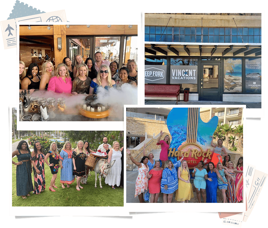
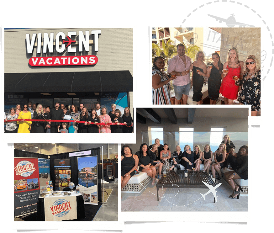
In travel since 2002, and in business since 2013, our travel team serves clients all over the US! Planning a vacation away from home takes a great team. We have taken the time to build a team of dedicated, smart, hard-working personnel who are each committed to excellence and service. We work side-by-side, creating and ensuring INCREDIBLE vacation experiences for you and your group. Our store front in-office team, and our travel consultant independent contractors, work all around the US.


In business since 2013, we are your #1 source for travel!
Free Vacation Package Quote